The Ultimate Mine Pit Slope Stability Monitoring Checklist 2026: A Comprehensive Guide to Pit Wall Safety and Integrity
Veröffentlicht: 28.10.2026 Aktualisiert: 29.10.2026
Inhaltsverzeichnis
- Introduction: The Critical Importance of Slope Stability in 2026
- Phase 1: Pre-Inspection Preparation and Resource Alignment
- Phase 2: Visual Surface Inspection - Detecting Early Warning Signs
- Phase 3: Geotechnical Instrumentation Review and Sensor Calibration
- Phase 4: Hydrological & Pore Pressure Assessment Strategies
- Phase 5: Structural Integrity and Bench Geometry Auditing
- Phase 6: Evaluating Blast Impact and Vibration Dynamics
- Phase 7: Erosion Control and Surface Water Management Systems
- Phase 8: Advanced Data Integration and Digital Twin Reporting
- Phase 9: Implementing Corrective Actions and Risk Mitigation
- Phase 10: Incident Escalation and Emergency Response Protocols
- Conclusion: Building a Culture of Proactive Slope Management
- Resources & Links
TLDR: Ensure operational safety and prevent costly pit failures with our 2026 comprehensive guide to slope stability monitoring. This checklist covers everything from pre-inspection preparation and geotechnical instrumentation reviews to blast impact analysis and emergency escalation protocols, providing a robust framework for maintaining structural integrity and managing geotechnical risks in modern mining operations.
Introduction: The Critical Importance of Slope Stability in 2026
The Evolving Landscape of Pit Wall Safety
As we enter 2026, the mining industry faces an increasingly complex set of challenges. The push for deeper open-pit mines, combined with more volatile global weather patterns and the integration of autonomous mining fleets, has heightened the stakes for geotechnical stability. In this era of high-precision mining, the margin for error regarding pit slope integrity has shrunk to near zero. A single slope failure does not just represent a significant financial loss through unplanned downtime; it poses a direct threat to human life and the structural viability of entire mining operations.
Why Traditional Monitoring is No Longer Enough
The wait and see approach to geotechnical monitoring is a relic of the past. With the advent of real-time IoT sensors, satellite-based InSAR monitoring, and AI-driven predictive analytics, the expectations for pit wall safety have shifted from reactive to predictive. In 2026, a robust monitoring strategy must move beyond simply detecting movement; it must focus on understanding the causal mechanisms-such as pore pressure fluctuations, seismic triggers, and structural fatigue-before they manifest as visible cracks.
The Cost of Inaction
Slope instability is often a silent killer. Subsurface movements and internal pore pressure changes can progress for weeks or even months before any surface deformation is detectable by the naked eye. By the time a failure is visually apparent, the window for safe evacuation or controlled remediation has often closed.
This guide is designed to provide geotechnical engineers, site managers, and safety officers with a rigorous, standardized framework. By following this 2026 checklist, your operation can transition from a state of constant monitoring to a state of proactive management, ensuring that every bench, berm, and highwall remains within its design parameters, safeguarding both your workforce and your bottom line.
Phase 1: Pre-Inspection Preparation and Resource Alignment
Setting the Foundation for a Successful Inspection
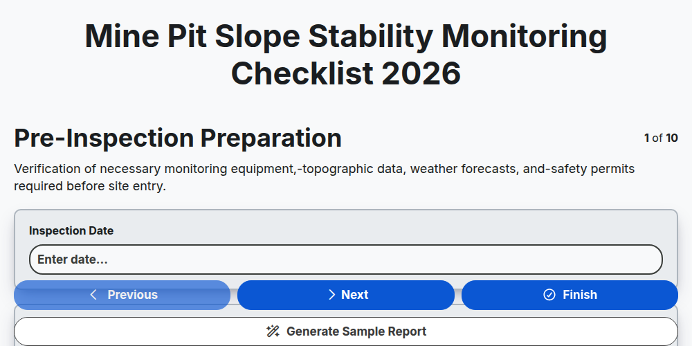
Before any physical inspection or sensor calibration begins, the success of a slope stability audit depends entirely on the quality of the preparation. In 2026, as mining environments become increasingly complex and deeper, winging it is no longer an option. A structured pre-inspection phase ensures that geotechnical engineers and site inspectors are equipped with the right data, tools, and protocols to identify even the most subtle indicators of instability.
Establishing the Inspection Scope and Objectives
The first step is defining exactly what the inspection aims to achieve. Is this a routine monthly check, a post-blasting assessment, or a targeted investigation following a significant rainfall event? Clearly defining the scope prevents inspection fatigue and ensures that high-risk zones (such as active highwalls or areas near critical infrastructure) receive the necessary level of scrutiny.
Resource Allocation and Team Mobilization
A high-level stability audit requires a multidisciplinary approach. Your preparation checklist must include:
- Personnel Assignment: Identifying the lead geotechnical engineer, pit technicians, and drone pilots.
- Equipment Readiness: Ensuring all LiDAR scanners, UAVs (drones), and Total Stations are calibrated and fully charged.
- Safety Briefing: Conducting a specialized Pre-Task Talk (PTT) to review exclusion zones, heavy machinery movement, and pit-specific hazards.
Documentation and Baseline Data Review
You cannot identify an anomaly if you do not know what normal looks like. Prior to heading to the pit, the inspection team must review:
- Historical Monitoring Data: Analyzing recent trends from piezometers, prisms, and InSAR satellite data.
- Recent Site Activity Records: Reviewing recent blast reports, major heavy equipment movement, and changes in the mine plan.
- Geological Model Updates: Ensuring the inspection team is working with the most recent structural and lithological mapping.
Logistical and Communication Planning
In the deep pit environments of 2026, communication dead zones are a significant risk. Pre-inspection preparation must include a robust communication plan-ensuring that radio relays are functional and that there is a clear protocol for real-time data transmission from the pit floor to the geotechnical office.
Phase 2: Visual Surface Inspection - Detecting Early Warning Signs
Scanning the Surface for Structural Anomalies
While sophisticated sensors provide the quantitative data necessary for stability modeling, the human eye remains one of the most critical tools in a geotechnical engineer's arsenal. A systematic visual inspection serves as the first line of defense in identifying surface-level precursors to potential slope failure. In 2026, this phase is no longer just about looking at the wall; it is about a disciplined, pattern-based approach to identifying subtle geological shifts.
Identifying Surface Discontinuities and Tension Cracks
The primary objective during a visual sweep is the detection of tension cracks at the crest of the pit slope. These cracks are often the first indicators of incipient movement.
- Crack Morphology: Document the width, depth, and orientation of any newly formed or widening fissures.
- Pattern Recognition: Look for longitudinal cracks running parallel to the crest, which may indicate a rotational failure mechanism.
- Coalescence Tracking: Observe if smaller, isolated cracks are beginning to merge into larger, continuous fracture networks.
Monitoring Surface Deformation and Slumping
Beyond cracks, the physical displacement of material on the bench faces must be meticulously recorded.
- Bulging at the Toe: Inspect the base of the benches for any signs of heaving or bulging, which can indicate significant deep-seated movement or increased lateral earth pressure.
- Rockfall and Spalling: Note any increase in the frequency of small-scale rockfalls or the sloughing of material from the bench faces, as these often precede larger-scale instabilities.
- Debris Accumulation: Assess the accumulation of loose material at the toe of the slope, which may mask underlying structural issues.
Detecting Vegetation and Soil Disturbance
In areas where benches are exposed to the elements, the biological and superficial indicators can provide vital clues.
- Vegetation Displacement: In non-barren zones, tilted or uprooted vegetation can act as a natural tiltmeter, signaling ground movement.
- Soil Creep: On lower-gradient slopes or waste dumps, look for subtle waves or ripples in the soil surface that suggest slow, continuous downslope movement.
Photographic Documentation and Digital Mapping
In the 2026 inspection workflow, visual inspection is inseparable from digital record-keeping. Every anomaly identified must be georeferenced.
- High-Resolution Imaging: Utilize handheld high-resolution cameras or drone-captured imagery to create a visual baseline for every inspection cycle.
- Feature Tagging: Use AR (Augmented Reality) enabled tablets to tag specific cracks or bulges with GPS coordinates, ensuring that these features can be tracked precisely against previous inspection datasets to measure rate of change.
Phase 3: Geotechnical Instrumentation Review and Sensor Calibration
Ensuring Data Accuracy through Precision Monitoring
The reliability of your slope stability model is only as good as the data feeding it. In 2026, with the increasing integration of AI-driven predictive modeling, the integrity of your geotechnical instrumentation is paramount. This phase of the inspection focuses on verifying that your eyes and ears within the pit wall are functioning correctly and providing high-fidelity data for real-time decision-making.
Sensor Health and Connectivity Audit
Before analyzing the data itself, you must audit the physical state of the hardware. A failure in monitoring is often a failure in communication or power, not just a failure in the sensor.
- Inclinometer & Extensometer Verification: Check for casing deformation or physical damage to the heads. Ensure that manual readings align with automated depth measurements.
- Piezometer Integrity: Inspect standpipes and vibrating wire piezometers for any signs of-clogging or damage to the intake filters.
- Automated Total Station (ATS) & Prisms: Verify prism cleanliness and ensure that line-of-sight is not being obstructed by new dust accumulation or new equipment placement.
- Communication Network Stability: Test the latency and signal strength of LoRaWAN, LTE, or satellite links used to transmit data from remote pit sectors to the central control room.
Calibration and Data Drift Analysis
Sensor drift can lead to false negatives, where a movement is masked by instrument error, or false positives, which lead to unnecessary and costly pit evacuations.
- Zero-Point Calibration: Verify that all digital sensors are calibrated against a known baseline to prevent cumulative error.
- Correlation Checks: Compare readings from overlapping technologies. For example, cross-reference surface deformation detected via Radar (SSR) with subsurface movement recorded by in-place inclinometers. If the surface is moving but the subsurface is static, investigate potential sensor decoupling.
- Battery and Power Lifecycle Management: In an era of autonomous mining, power continuity is critical. Check the health of solar arrays, battery backups, and energy harvesting units powering remote sensor nodes.
Firmware and Software Synchronization
As we move deeper into 2026, the convergence of IoT and geotechnical engineering means your software is as much a part of the instrument as the sensor itself.
- Firmware Update Audit: Ensure all wireless nodes are running the latest manufacturer firmware to mitigate cybersecurity risks and improve data packet delivery.
- Threshold & Trigger Level Validation: Re-verify that the Alarm, Warning, and Critical thresholds in your monitoring software are aligned with the current geotechnical risk assessment and current pit geometry.
- Data Log Integrity: Check for data gaps in your historical database. Frequent gaps often indicate intermittent connectivity or sensor blind spots that require immediate physical intervention.
Phase 4: Hydrological & Pore Pressure Assessment Strategies
Monitoring the Invisible Forces: Water and Pressure Management
While surface cracks and structural deformations are the most visible indicators of instability, the most critical drivers of slope failure often remain hidden beneath the surface. In 2026, as open-pit mines push to greater depths and more aggressive pit geometries, managing groundwater and pore pressure is no longer just a maintenance task-it is a fundamental pillar of geotechnical risk management.
Understanding the Role of Pore Water Pressure
The presence of water within the rock mass or soil matrix reduces the effective stress between particles, significantly decreasing the shear strength of the slope. As pore pressure increases, the resisting force that holds the pit wall in place diminishes, potentially triggering rapid, catastrophic failures.
Your assessment in this phase must focus on two primary objectives: identifying groundwater seepage paths and quantifying the pressure exerted within the slope mass.
Critical Assessment Components
1. Piezometric Level Analysis
- Trend Monitoring: Evaluate real-time data from vibrating wire piezometers (VWPs) to identify sudden rises in water levels following precipitation events or changes in pit dewatering efficiency.
- Pressure Gradients: Analyze the vertical and horizontal gradients of pore pressure. Rapidly changing gradients often serve as precursors to localized instability.
- Correlation with Rainfall: Cross-reference piezometric spikes with local meteorological data to determine the lag time between storm events and pressure increases within the slope.
2. Seepage and Drainage Inspection
- Seepage Point Mapping: Systematically document the location, flow rate, and turbidity of all seepage exiting the pit benches. New or increased seepage points can indicate internal erosion or new failure planes.
- Drainage Infrastructure Integrity: Inspect horizontal drains, weep holes, and pumping systems. Ensure that drain outlets are not clogged with fines (siltation) and that pumping capacities are sufficient for projected seasonal inflows.
- Erosion Indicators: Look for signs of piping-internal erosion where water carries away fine materials, creating underground voids that compromise structural stability.
3. Dewatering System Efficiency
- Depressurization Accuracy: Verify that the depressurization zone (the area where water pressure is actively being lowered) is advancing ahead of the mining face.
- Well Performance Tracking: Monitor the drawdown levels in perimeter dewatering wells to ensure they are maintaining the required cone of depression.
- System Redundancy: Assess the reliability of the power supply and backup systems for all critical dewatering pumps, as a failure in the dewatering circuit can lead to rapid pore pressure buildup.
Advanced 2026 Integration: Predictive Hydrology
By 2026, a robust monitoring strategy must move beyond reactive measurement. Use the data collected in this phase to feed into numerical groundwater models. By integrating real-time pore pressure data with 3D seepage modeling, geotechnical engineers can predict how upcoming seasonal changes or planned pit expansions will impact the stability of the highwall, allowing for proactive dewatering adjustments before instability occurs.
Phase 5: Structural Integrity and Bench Geometry Auditing
Ensuring Geometrical Precision and Structural Stability
As we move into the fifth phase of the monitoring cycle, the focus shifts from surface-level observations to a rigorous audit of the physical architecture of the pit walls. In 2026, with the increasing depth of many active mine pits, maintaining the precision of bench geometry is not just a matter of operational efficiency-it is a critical component of life-safety protocols.
Evaluating Bench Geometry and Face Angles
The integrity of a slope is fundamentally tied to its design parameters. This stage of the checklist requires a formal comparison between the as-built geometry and the design geometry.
- Bench Face Angle (BFA) Verification: Check for any deviations in the face angle that could indicate localized slumping or raveling.
- Catch Bench Width Audit: Ensure that catch benches remain wide enough to intercept falling debris. Any encroachment due to lateral movement or unplanned scaling must be documented immediately.
- Inter-ramp Angle (IRA) Monitoring: Analyze the overall slope angle to ensure that cumulative deformations are not compromising the designed stability of the entire slope sector.
Assessing Structural Discontinuities
Structural stability is dictated by the relationship between the rock mass and the existing geological discontinuities. During this phase, the following must be scrutinized:
- Discontinuity Mapping Update: Re-evaluate the orientation (dip and dip direction) of known joints, faults, and bedding planes. Are new kinematic failures (planar, wedge, or toppling) emerging due to recent excavation?
- Daylighting Analysis: Identify any structural planes that have become daylighted (exposed) on the pit face, creating potential failure pathways.
- Fracture Zone Monitoring: Inspect the width and persistence of fracture zones. An increase in fracture density or width is a primary precursor to large-scale slope instability.
Detection of Planar and Kinematic Risks
Beyond simple visual checks, this phase requires a systematic approach to identifying movement potential:
- Wedge Failure Potential: Evaluate the intersection of joint sets to determine if new, unstable wedges have been created by recent blasting or undercut activities.
- Toppling Susceptibility: Monitor vertical or near-vertical discontinuities that may be prone to flexural or block toppling, especially in areas where the toe of the slope has been heavily excavated.
- Scale and Overhang Inspection: Identify any loose or overhanging blocks that pose an immediate risk to personnel and equipment operating at the pit floor.
Phase 6: Evaluating Blast Impact and Vibration Dynamics
Assessing the Aftermath: Blast Impact and Vibration Dynamics
In modern open-pit mining, blasting is an unavoidable operational necessity, but its impact on the structural stability of pit walls is a critical variable in slope monitoring. As we move into 2026, the precision of blast design and the subsequent monitoring of vibration-induced damage have become central to preventing catastrophic slope failure.
Analyzing Peak Particle Velocity (PPV) and Vibration Attenuation
The primary focus of this phase is evaluating how much energy from recent production blasts has been transferred into the highwall. Using data from seismographs and near-field accelerometers, the inspection must determine if the Peak Particle Velocity (PPV) levels remained within the pre-defined structural limits for each specific rock mass unit.
- Threshold Comparison: Compare recorded PPV levels against the established site-specific scaling laws.
- Attenuation Modeling: Verify if the vibration attenuation curves predicted by your geotechnical models match the real-world decay observed during recent shots.
Inspecting for Blast-Induced Fracturing and Backbreak
Beyond mere vibration measurement, a physical inspection of the bench faces is required to identify the tangible effects of blasting energy.
- Backbreak Assessment: Inspect the crest of the benches for signs of significant backbreak, which can reduce the effective catch-bench width and compromise the safety of the working area.
- Micro-fracture Mapping: Look for new, visible fractures or the widening of existing discontinuities (joints/bedding planes) immediately following large-scale blasts.
- Fragmentation and Muckpile Stability: Ensure that the energy from the blast is not causing unexpected instability in the muckpile that could potentially exert lateral pressure on the toe of the slope.
Evaluating Damage to Geotechnical Instrumentation
Blasting does not only affect the rock mass; it can also compromise the very tools used to monitor it. This step of the checklist ensures your eyes and ears in the pit are still functional.
- Sensor Integrity Check: Inspect prisms, piezometers, and InSAR-monitored zones for any physical displacement or damage caused by flyrock or intense ground movement.
- Continuity Testing: Confirm that vibration-induced movement hasn't caused signal loss or noise in automated monitoring systems (such as robotic total stations or radar units).
Correlating Blast Timing with Slope Movement
The final component of this phase is the integration of blast logs with displacement data. By overlaying blast timestamps onto your displacement-time graphs (from slope stability radar or extensometers), you can differentiate between natural slope creep and event-driven acceleration. Identifying these correlations is vital for refining future blast patterns and ensuring that production requirements never supersede pit wall integrity.
Phase 7: Erosion Control and Surface Water Management Systems
Managing Surface Water: The Silent Driver of Slope Instability
Water is often the most significant catalyst for slope failure in open-pit mining. Even the most structurally sound pit walls can succumb to instability if surface water and pore pressure are not meticulously managed. As we move into 2026, advancements in predictive modeling have made it clear that monitoring surface water is no longer just about preventing erosion-it is about managing the fundamental hydraulic forces acting on the pit perimeter.
Assessing Drainage Infrastructure Integrity
A critical component of your 2026 stability audit must involve a physical and functional audit of all water diversion systems. Do not assume that because a ditch exists, it is functioning.
- Diversion Berm and Ditch Audit: Inspect all perimeter bunds and diversion ditches for sedimentation, debris accumulation, or breaches. Any blockage that allows water to bypass the diversion and flow toward the pit crest is a high-priority risk.
- Catchment Berm Inspection: Evaluate the capacity of catch berms to intercept runoff. Check for signs of overtopping, where water spills from one bench to the level below, potentially creating a cascade effect of erosion.
- Culvert and Pipe Functionality: Verify that all drainage pipes and culverts are clear of silt and are structurally sound. In 202scale operations, even a single clogged culvert can lead to rapid saturation of a bench face.
Monitoring Erosion and Surface Runoff Patterns
Erosion does not just remove material; it creates pathways for water to penetrate deeper into the rock mass, increasing pore pressure.
- Rill and Gully Identification: Inspect the pit faces for the development of rills (small channels) or gullies. The presence of new, active erosion patterns is a leading indicator of localized instability and potential stripping of protective surface layers.
- Sediment Load Observation: Monitor the clarity and sediment content of water collecting in the pit sump. An unexpected increase in turbidity can indicate significant surface erosion or the washing away of fine-grained material from a failing face.
- Surface Cracking Detection: Look for tension cracks at the crest of the slope. These cracks act as highways for surface water to enter the slope mass, directly contributing to the degradation of geotechnical stability.
Integrating Hydrological Data with Slope Stability Models
In 2026, the goal is to move from reactive monitoring to predictive management. This requires integrating your surface water observations with your existing geotechnical datasets.
- Correlation of Rainfall Events to Pore Pressure: Use automated weather stations to correlate heavy precipitation events with real-time readings from your vibrating wire piezometers. Understanding the lag time between a rain event and a rise in pore pressure is vital for setting effective trigger action response plans (TARPs).
- Surface Water Mapping: Utilize drone-based photogrammetry to map new drainage paths following significant storm events. This allows the geotechnical team to visualize how surface runoff is interacting with the bench geometry in real-time.
Phase 8: Advanced Data Integration and Digital Twin Reporting
Bridging the Gap Between Raw Data and Decision-Making
In the 2026 mining landscape, collecting data is no longer enough; the true value lies in how that data is synthesized. Phase 8 focuses on the critical transition from individual sensor readings to a unified, actionable intelligence model. As pit geometries become more complex and operational margins tighten, the ability to integrate disparate data streams into a single source of truth is what separates reactive maintenance from proactive stability management.
The Convergence of Heterogeneous Data Streams
Modern slope monitoring involves a massive influx of multi-modal data. Effective integration requires the seamless merging of:
- Real-time Kinematic (RTK) GNSS outputs and automated total station measurements.
- Interferometric Synthetic Aperture Radar (InSAR) displacement maps.
- Piezometric pressure readings and borehole inclinometer profiles.
- Visual inspection logs digitized via mobile edge computing.
The goal of this phase is to eliminate data silos. When hydrological shifts are overlaid directly onto displacement heatmaps, engineers can identify the exact correlation between pore pressure spikes and accelerating creep, allowing for much more accurate predictive modeling.
Leveraging Digital Twins and 4D Visualization
The centerpiece of 2026 monitoring technology is the Digital Twin. By integrating real-time sensor telemetry into a high-fidelity 3D model of the mine pit, geotechnical engineers can perform 4D analysis-adding the dimension of time to spatial geometry.
- Spatial Contextualization: Instead of viewing a spreadsheet of displacement values, teams can visualize hotspots directly on the pit wall model.
- Predictive Simulation: Using integrated data, engineers can run what-if scenarios, simulating the impact of upcoming production blasts or extreme weather events on the current structural state of the slope.
- Automated Trend Detection: Modern integration platforms utilize machine learning algorithms to scan integrated datasets for subtle patterns that precede macro-instability, often detecting precursors that are invisible to the human eye during manual reviews.
Automated Reporting and Stakeholder Transparency
Data integration concludes with the generation of standardized, high-frequency reports. These reports must be designed for diverse audiences:
- For Geotechnical Engineers: Deep-dive technical summaries containing velocity, acceleration, and vector analysis.
- For Mine Operations: Simplified Traffic Light status reports (Green/Amber/Red) that dictate immediate operational constraints.
- For Executive Management: High-level risk dashboards focusing on long-term stability trends and compliance with safety KPIs.
By mastering this integration phase, mining operations ensure that every sensor deployed on the pit wall contributes directly to a more resilient, predictable, and ultimately safer mining environment.
Phase 9: Implementing Corrective Actions and Risk Mitigation
Proactive Risk Management: Turning Data into Action
Identifying a potential instability is only half the battle; the true value of a monitoring program lies in the ability to respond decisively. Once your inspections and instrumentation reviews have identified a deviation from the baseline, the focus must immediately shift from observation to mitigation.
The goal of this phase is to bridge the gap between detecting a problem and preventing a failure through a structured, repeatable response strategy.
Developing the Mitigation Roadmap
Once a potential risk is identified, the geotechnical team must implement a tiered response based on the severity of the anomaly. This involves several critical sub-steps:
- Immediate Stabilization Measures: If the monitoring data suggests an accelerating creep or increased pore pressure, immediate physical interventions may be required. This includes implementing depressurization programs (such as horizontal drain drilling) or scaling loose material from the pit face.
- Geometric Modification: In cases where structural instability is detected, the mitigation strategy may involve redesigning the bench geometry, such as increasing catch bench width or reducing the overall slope angle to decrease the driving force of the potential slide.
- Reinforcement Strategies: For localized instabilities, mechanical stabilization-such as rock bolting, shotcreting, or the installation of mesh-may be deployed to reinforce the rock mass and prevent further unraveling.
Strengthening the Feedback Loop
Effective risk mitigation is not a one-time event but a continuous loop. Every corrective action taken must be fed back into your monitoring system to evaluate its effectiveness.
Managing the Residual Risk
No mining operation is entirely without risk. The objective of the 2026 monitoring standard is to manage residual risk to an acceptable level. This requires:
- Re-calibration of Thresholds: After implementing a corrective measure, your Trigger Action Response Plans (TARPs) should be reviewed. Does the new stability profile require updated alarm thresholds?
- Continuous Monitoring Verification: You must continue high-frequency monitoring (via Radar, InSAR, or Piezometers) to ensure that the implemented mitigation is actually arresting the movement or reducing the pore pressure as predicted.
- Documentation for Compliance: Every mitigation step must be documented within your Geotechnical Database. This ensures that during safety audits or post-incident investigations, there is a clear paper trail proving that the mine operated with due diligence and followed industry best practices.
Phase 10: Incident Escalation and Emergency Response Protocols
Establishing a Rapid Response Framework
Even with the most advanced predictive analytics and real-time geotechnical instrumentation, the ultimate goal of a stability monitoring program is to ensure that when a failure event is detected, the response is instantaneous, organized, and life-saving. The final phase of your 2026 monitoring checklist focuses on the transition from detection to action.
Defining Trigger Action Response Plans (TARPs)
The cornerstone of effective incident escalation is the implementation of a robust Trigger Action Response Plan (TARP). A monitoring program is only as effective as the predefined actions triggered by specific threshold breaches. Your protocol must clearly define:
- Green Level (Normal): Standard operating procedures; routine monitoring continues.
- Yellow Level (Alert): Increased monitoring frequency; mandatory inspection of high-risk benches; notification of geotechnical engineers.
- Orange Level (Warning): Preliminary restriction of access to the toe of the slope; commencement of stability re-assessment; mobilization of specialized inspection equipment (e.g., UAVs/Drones).
- Red Level (Critical): Immediate evacuation of all personnel and equipment from the pit area; cessation of blasting operations; full-scale emergency mobilization.
Critical Communication Channels
In 2026, real-time data integration means that an alarm in the geotechnical office must be simultaneously communicated to the pit dispatch, the site manager, and the safety department. Your escalation protocol must audit the following:
- Redundancy in Communication: Ensuring that radio, LTE/5G, and satellite-based alerts are operational in the event of pit-wide infrastructure damage.
- Chain of Command: A clear, documented hierarchy of who has the authority to order an immediate evacuation.
- Stakeholder Notification: Pre-defined templates for notifying regulatory bodies and corporate leadership during significant stability events.
Post-Incident Recovery and Investigation
The final component of this phase is the Learning Loop. Once the immediate threat to life and equipment has been mitigated, the checklist requires a formal transition into the investigation stage.
- Root Cause Analysis (RCA): Utilizing the data captured during the event (pore pressure spikes, displacement rates, seismic signatures) to determine the precise failure mechanism.
- Re-entry Protocols: Establishing strict safety criteria that must be met before personnel can return to the affected area to assess damage and begin remediation.
- Protocol Calibration: Updating the 2026 monitoring parameters based on the findings to prevent recurrence.
Conclusion: Building a Culture of Proactive Slope Management
Moving Beyond Compliance to Predictive Safety
As we approach 2026, the landscape of open-pit mining is being reshaped by increasingly complex geological challenges and the integration of real-time, automated monitoring technologies. The transition from reactive monitoring to predictive stability management is no longer an option-it is a necessity for operational continuity and workforce safety.
Implementing this Mine Pit Slope Stability Monitoring Checklist is more than just a technical requirement; it is a commitment to a culture of proactive risk management. By systematically addressing everything from geotechnical instrumentation accuracy to erosion control and blast vibration analysis, you move your site from a state of responding to failures to preventing them before they manifest.
Embracing the Future of Pit Integrity
The complexity of modern mining demands a rigorous, multi-layered approach. As the data points from your sensors become more granular and the integration of AI-driven predictive modeling becomes more prevalent, the foundational principles of the checklist remain the same:
- Consistency is Key: A checklist is only as effective as its frequency of use. Regular, disciplined inspections ensure that subtle changes in bench geometry or pore pressure do not go unnoticed.
- Data-Driven Decision Making: Use the insights gathered from your hydrological assessments and structural reviews to drive your engineering interventions.
- Total Site Awareness: Slope stability does not exist in a vacuum. Integrating surface water management with geotechnical monitoring creates a holistic view of pit health.
Final Thoughts for Site Managers and Engineers
The cost of a slope failure-measured in equipment loss, production downtime, and, most importantly, human lives-is far greater than the cost of a robust monitoring program. By adopting this 2026 framework, you are equipping your team with the tools to identify the weak signals of instability, allowing for controlled mitigation and the preservation of the mine's long-term economic viability.
Stay vigilant, stay integrated, and prioritize the structural integrity of your mine assets. Safety in the pit begins with the rigor of your preparation.
Resources & Links
- Australasian Institute of Mining and Metallurgy (AusIMM): A leading professional body providing industry standards, technical papers, and best practices for global mining engineering and slope stability.
- Skempton: Specialists in geotechnical instrumentation and monitoring, offering deep insights into sensor technology and pore pressure measurement.
- Geosynthetica: Essential resources for erosion control, surface water management, and geosynthetic applications in pit wall reinforcement.
- International Geotechnical Engineering Society: Access to global research on structural integrity, geotechnical stability, and advanced slope monitoring methodologies.
- Rock Mechanics & Geotechnical Engineering Resources: Technical documentation regarding rock mass characterization, blasting impacts, and vibration dynamics in open-pit mines.
- Esri: The industry standard for GIS-based data integration, essential for creating Digital Twins and spatial mapping of pit geometries.
- Siemens Industrial Automation: Resources for integrating IoT sensors and automated monitoring systems into centralized mine-site digital infrastructures.
- SLB (Schlumberger): Advanced technology solutions for subsurface monitoring, hydrological assessment, and high-precision geological data.
- MSHA (Mine Safety and Health Administration): Regulatory guidelines and safety protocols for incident escalation and emergency response in mining environments.
- Bentley Systems: Software solutions for infrastructure engineering, focusing on structural integrity auditing and complex 3D modeling of mine pits.
- GeoscienceWorld: A massive repository of academic journals covering geological processes, seismic monitoring, and slope failure mechanics.
- Autodesk Construction Cloud: Tools for managing construction and mining data, facilitating digital twin reporting and project-wide resource alignment.
- PM International (Geotechnical): Specialized knowledge in geotechnical instrumentation, sensor calibration, and monitoring equipment maintenance.
- SD Mining Safety Resources: Focuses on the implementation of corrective actions and risk mitigation strategies for large-scale mining operations.
- Mining.com: Global mining news and trends, useful for staying updated on the 2026 landscape of automated slope monitoring technologies.
- ITASC (International Technical Advisory Committee): Foundational guidelines for dam and slope stability monitoring and risk management frameworks.
Kommentare
Bisher gibt es keine Kommentare. Seien Sie der Erste, der einen hinzufügt!
Demonstration der Lösung für das Bergbau-Management
Maximieren Sie die Effizienz und Sicherheit im Bergbau! ChecklistGuro optimiert die Aufgabenverwaltung, die Geräteverfolgung und die Compliance-Berichterstattung. Optimieren Sie Arbeitsabläufe, reduzieren Sie Risiken und steigern Sie die Produktivität. Verwalten Sie alles mit unserer Work OS.
Verwandte Artikel
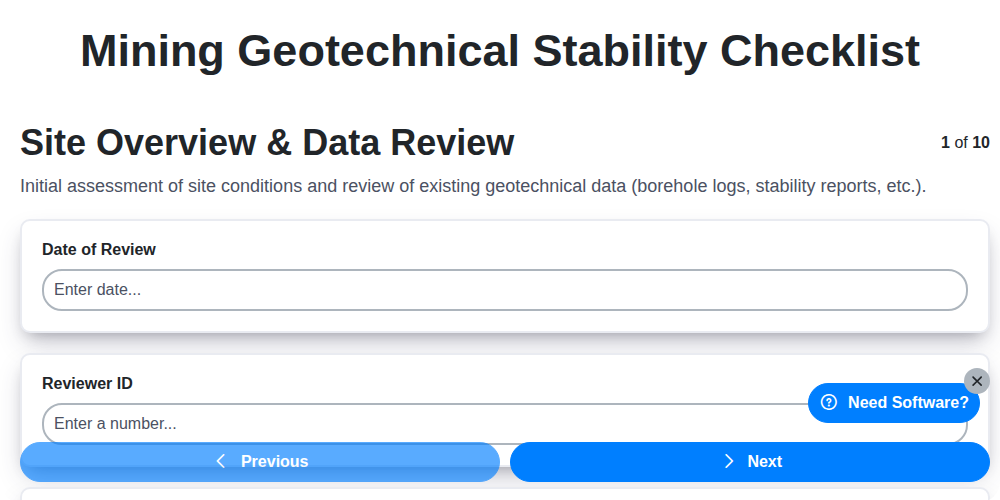
Gewährleistung der Bergwerksicherheit: Ihr Leitfaden zur geotechnischen Stabilitätsprüfung
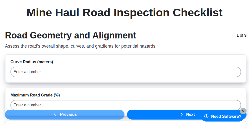
Sicherheit und Effizienz gewährleisten: Ihr Leitfaden für die Überprüfung von Erzförderwegen
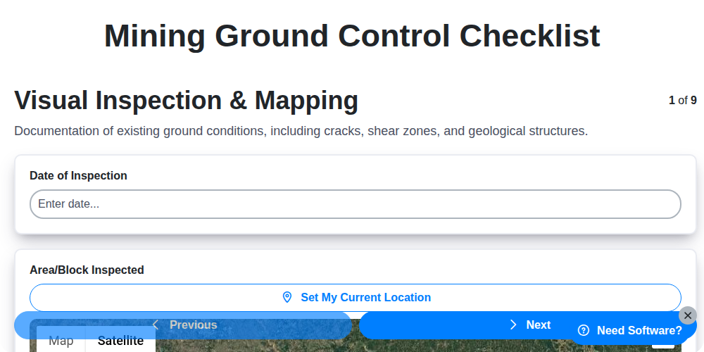
Sicherung des Bergbaus: Ihr Leitfaden zur Checkliste für Standsicherheit
Checkliste für Sicherheitsmaßnahmen im Bergbau: Eine umfassende Vorlage für die Sicherheit
Ensuring Safety: Your Mining Incident Reporting Checklist Guide
Ensuring Safety Underground: Your Mine Traffic Management Checklist Guide
Ensuring Safety: Your Mining Explosives Handling Checklist Template
Ensuring Safety & Compliance: Your Mining Noise Monitoring Checklist Guide
Benötigen Sie Hilfe bei Checklisten?
Haben Sie eine Frage? Wir helfen Ihnen gerne. Bitte senden Sie uns Ihre Anfrage, und wir werden Ihnen umgehend antworten.