The Ultimate Mining Resource Exploration Survey Checklist: A Step-by-Step Guide
Published: 11/25/2025 Updated: 12/14/2025
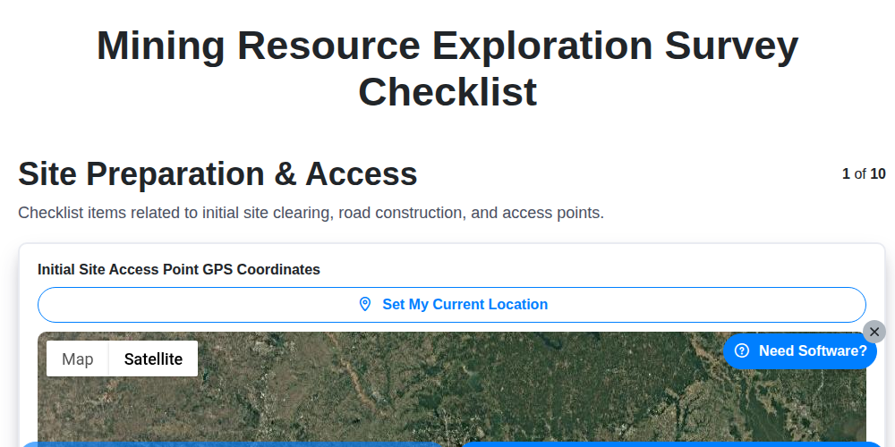
Table of Contents
- Introduction: Laying the Foundation for Successful Exploration
- 1. Site Preparation & Access: Getting On-Site Safely and Efficiently
- 2. Geological Mapping & Sampling: Understanding the Groundwork
- 3. Geophysical Surveys (Ground): Unveiling Subsurface Anomalies
- 4. Geophysical Surveys (Airborne/Satellite): Expanding the Exploration Scope
- 5. Drill Core Logging & Analysis: Deciphering the Drill's Story
- 6. Resource Estimation & Modeling: Quantifying the Potential
- 7. Environmental Compliance: Protecting the Ecosystem
- 8. Safety Procedures: Prioritizing Personnel Wellbeing
- 9. Data Management & Reporting: Maintaining Accuracy and Transparency
- 10. Permitting & Regulatory Compliance: Navigating the Legal Framework
- Resources & Links
TLDR: Planning a mining exploration survey? This checklist is your roadmap! Covering everything from initial site prep and geological mapping to drill core analysis, resource modeling, and regulatory compliance, it ensures a thorough, safe, and compliant exploration process, minimizing risk and maximizing your chances of discovering valuable resources.
Introduction: Laying the Foundation for Successful Exploration
Resource exploration is a complex and capital-intensive endeavor. Success hinges not only on the geological promise of a site but also on meticulous planning and execution. This checklist outlines the essential steps in a mining resource exploration survey, providing a structured approach to ensure efficiency, accuracy, and compliance. Each step builds upon the last, laying the groundwork for a robust assessment of potential mineral deposits. Skipping or overlooking any phase can lead to inaccurate resource estimations, costly rework, environmental damage, and regulatory hurdles. This comprehensive guide aims to provide a framework for professionals and stakeholders to navigate the exploration process with confidence and maximize the chances of a positive outcome.
1. Site Preparation & Access: Getting On-Site Safely and Efficiently
The journey to unlocking a valuable mineral resource begins long before the first drill bit spins. Proper site preparation and secure access are absolutely critical for the safety of your team, the integrity of the exploration project, and minimizing environmental impact. This initial phase lays the groundwork for everything that follows.
Here's a breakdown of key considerations:
- Route Planning & Road Construction: Thoroughly assess existing access routes. If new roads are necessary, carefully plan their construction to minimize deforestation, erosion, and disturbance to wildlife habitats. Consider seasonal accessibility and potential flooding risks.
- Clearance and Vegetation Management: Selective clearing of vegetation is often required, but prioritize minimizing impact. Implement erosion control measures like silt fences and hay bales to prevent runoff.
- Establishment of Base Camp: A well-organized base camp is essential. Plan for water sourcing, waste management (including greywater and solid waste), power generation (consider sustainable options), and communication infrastructure.
- Security Measures: Implement security protocols to protect equipment, data, and personnel. This might involve fencing, security personnel, and access controls.
- Stakeholder Communication: Engage with local communities and landowners early on. Clear communication builds trust and helps avoid misunderstandings.
- Initial Site Surveys: Perform initial surveys to identify potential hazards, such as unstable ground, sinkholes, or presence of protected species.
- Equipment Staging: Carefully plan the delivery and staging of equipment, ensuring it's done in a manner that minimizes disruption and prevents damage.
Proper site preparation and access isn't just about getting vehicles and personnel on-site; it's about establishing a responsible and sustainable foundation for the entire exploration process.
2. Geological Mapping & Sampling: Understanding the Groundwork
Effective resource exploration hinges on a thorough understanding of the geological context. Geological mapping and sampling form the bedrock of this understanding, providing critical data to guide further exploration efforts.
Geological Mapping: This process involves systematically observing and recording the rock types, structures (faults, folds), alteration zones, and mineralization occurrences across the exploration area. Detailed mapping utilizes GPS and geological compasses to accurately document the spatial distribution of geological features. We use established geological symbology and standardized methods to ensure consistency and clarity in the map's interpretation. Identifying rock units, stratigraphy, and structural controls is paramount to understanding the potential for mineralized zones.
Sampling Strategies: The samples collected during mapping are vital for laboratory analysis. Several sampling methods are employed, tailored to the geological setting:
- Rock Chip Samples: Collected from outcrops and surface exposures, these are useful for initial geochemical screening.
- Grab Samples: Selected specifically for their visual characteristics suggesting mineralization (e.g., sulfide content, alteration).
- Channel Samples: Taken from trenches or road cuts, providing a representative cross-section of the rock.
- Soil Samples: Collected at regular intervals across the area, providing a broader geochemical overview.
- Stream Sediment Samples: Analyze sediment carried by streams to identify anomalies up-gradient from mineralization.
Quality Control/Quality Assurance (QA/QC): Rigorous QA/QC protocols are implemented throughout the sampling process. This includes collecting duplicate samples, certified reference materials, and blank samples to ensure the reliability and accuracy of the results. Sample provenance and chain-of-custody are meticulously documented.
Integration with Other Data: Geological mapping and sampling data are integrated with geophysical data and remote sensing imagery to create a comprehensive geological model. This integrated approach allows for a more nuanced interpretation of the exploration area and allows for targeted drilling campaigns.
3. Geophysical Surveys (Ground): Unveiling Subsurface Anomalies
Ground geophysical surveys are a critical step in resource exploration, providing a non-invasive way to image the subsurface and identify potential targets for drilling. These techniques measure physical properties - like magnetic susceptibility, electrical conductivity, gravity, and seismic velocity - to detect variations indicative of mineral deposits or other geological features.
Several ground geophysical methods are commonly employed:
- Magnetics: Measures variations in the Earth's magnetic field caused by magnetic minerals like magnetite. Anomalies can indicate the presence of iron ore deposits, skarn mineralization, or even volcanic intrusions associated with porphyry copper systems.
- Induced Polarization (IP): Measures the chargeability of subsurface materials. High chargeability often signals the presence of sulfide minerals, a key indicator for many ore deposits.
- Electrical Resistivity/Conductivity (ER/EC): Determines how easily electricity flows through the ground. Different rock types and mineralization styles have distinct resistivity/conductivity signatures.
- Gravity: Measures variations in gravitational pull. Density contrasts caused by mineralized zones can be detected.
- Seismic Refraction/Reflection: Uses seismic waves to image subsurface rock layers and structures. Can identify faults, fractures, and changes in lithology.
Survey Execution & Data Quality:
Proper survey design is paramount. This includes accurate station positioning (using GPS or total station), appropriate instrument calibration, and careful attention to noise reduction. Loop orientation (for magnetics and IP), topographic corrections (for gravity), and meticulous data acquisition procedures are all crucial for generating reliable results. Regular quality control checks, such as repeat traverses and instrument comparisons, help ensure data integrity. The density of survey lines is also a key factor - closer spacing provides higher resolution imagery.
4. Geophysical Surveys (Airborne/Satellite): Expanding the Exploration Scope
Geophysical surveys from the air and space offer a crucial advantage: they provide a broad, regional perspective impossible to achieve through ground-based methods alone. Airborne and satellite-based techniques cover vast areas quickly and cost-effectively, identifying potential anomalies that warrant further investigation.
Airborne Geophysics: Common methods include:
- Magnetics: Detecting variations in the Earth's magnetic field, often indicating changes in rock type or the presence of mineralization (e.g., iron ore, massive sulfides).
- Radiometrics: Measuring naturally occurring radioactive elements (like potassium, uranium, and thorium) which can be associated with alteration zones and ore deposits.
- Electromagnetics (EM): Used to map subsurface conductivity, a strong indicator of graphite, conductive mineralization (like nickel and copper sulfides), and groundwater. Different EM frequencies provide varying depths of penetration.
- Gravity: Measures subtle variations in the Earth's gravitational field, useful for identifying density contrasts in the subsurface, potentially highlighting buried geological structures or ore bodies.
Satellite-Based Remote Sensing: While generally offering lower resolution than airborne surveys, satellite data (e.g., Landsat, Sentinel) can be invaluable for:
- Regional Geological Mapping: Analyzing spectral reflectance patterns to identify lithologies and alteration zones across expansive areas.
- Vegetation Analysis: Changes in vegetation health (NDVI) can indicate soil alteration and potential mineralization.
- Structural Interpretation: Identifying lineaments and fractures that may represent pathways for mineralizing fluids.
The data acquired from airborne and satellite surveys are often processed and interpreted in conjunction with geological maps, geochemical data, and ground geophysical results to refine exploration targets and optimize drill planning. They represent a vital reconnaissance stage, significantly reducing the risk and cost of subsequent exploration activities.
5. Drill Core Logging & Analysis: Deciphering the Drill's Story
The drill core is the tangible record of the subsurface, and meticulous logging and analysis are absolutely critical to a successful resource exploration program. This isn't just about noting the color of the rock; it's about capturing a detailed narrative of what the drill encountered.
What is Drill Core Logging?
Drill core logging involves a systematic and continuous description of the recovered drill core. Experienced geologists examine each core run (a length of core typically 1.5 to 3 meters) and record key characteristics, including:
- Lithology: Identifying the rock types (e.g., sandstone, shale, granite).
- Mineralogy: Noting the presence and abundance of key minerals.
- Alteration: Describing any changes to the rock due to hydrothermal or other processes (e.g., sericitization, chloritization).
- Structure: Identifying fractures, faults, and foliation.
- Veining: Documenting the type, abundance, and orientation of veins.
- Texture: Observing the grain size, shape, and arrangement of minerals.
- Weathering/Breakdown: Noting the degree of weathering or alteration visible in the core.
Beyond Description: Analysis & Integration
Logging isn't just about descriptive text. It's also inextricably linked to laboratory analysis. Samples are systematically selected from the core for a variety of tests including:
- Geochemical Analysis: Determining the concentrations of elements and minerals, crucial for identifying mineralization.
- Petrographic Analysis (Thin Sections): Microscopic examination of thin slices of the core to confirm lithology and understand the rock's genesis.
- Structural Analysis: Detailed measurements of fractures, veins, and orientations.
The Importance of Consistency & Detail
Consistent, detailed logging is paramount. It creates a foundational dataset that informs resource modeling, guides further drilling, and ensures the accuracy of resource estimates. Clear, concise descriptions, photographic documentation, and accurate spatial referencing are essential for future interpretation and validation. The story told by the drill core, when properly logged and analyzed, is instrumental in unlocking the potential of the resource.
6. Resource Estimation & Modeling: Quantifying the Potential
Once sufficient geological, geochemical, and geophysical data are collected, the crucial phase of resource estimation and modeling begins. This isn't simply about gathering data; it's about transforming that data into a tangible understanding of the orebody's size, grade, and overall economic viability.
The process typically begins with geostatistical analysis. This involves understanding the spatial distribution of mineralization through techniques like variography, which helps define the range and nugget effect of the data. This information is vital for creating accurate and reliable geological models.
Block modeling is a common technique, where the orebody is divided into a three-dimensional grid of blocks. Each block is assigned a grade estimate based on the surrounding data, including drill hole intercepts, geological interpretations, and geostatistical parameters. Interpolation methods, such as kriging or inverse distance weighting, are employed to estimate grades for unsampled blocks.
Several factors are considered during this stage. Density, porosity, and the potential for metallurgical recovery all play a key role in accurately representing the resource. Furthermore, a robust understanding of geological controls-faults, lithologies, and structural features-is essential to ensure the model reflects the true geological setting.
The resulting resource estimate is typically classified according to internationally recognized guidelines (e.g., JORC, NI 43-101) which categorize resources into Measured, Indicated, and Inferred categories based on the level of geological confidence and data density. This classification is critical for transparency and investor confidence. Finally, sensitivity analysis and scenario planning are vital to assess the impact of varying commodity prices and recovery rates on the project's economic potential.
7. Environmental Compliance: Protecting the Ecosystem
Resource exploration, while vital for meeting global demands, carries significant potential impacts on the environment. A robust environmental compliance program isn't just about ticking boxes; it's about responsible resource stewardship and minimizing harm to ecosystems. This checklist item demands meticulous planning and ongoing monitoring throughout the entire exploration process.
Our Environmental Compliance stage involves a layered approach. This begins with a thorough Baseline Environmental Assessment (BEA) before any fieldwork commences. This crucial step identifies sensitive habitats, endangered species, water sources, and potential impact zones. We then develop an Environmental Management Plan (EMP) outlining mitigation strategies, including erosion control measures, waste management protocols, and wildlife protection measures.
Regular environmental monitoring is essential. This includes water quality testing, soil sampling, noise level assessments, and vegetation surveys. Unexpected findings require immediate corrective action, documented and reported according to regulatory guidelines. We also implement a chain of custody for all samples to ensure data integrity.
Beyond minimizing direct impacts, we actively consider the long-term sustainability of the exploration area. This may involve habitat restoration plans, community engagement regarding environmental concerns, and adherence to stringent pollution prevention measures. Ultimately, environmental compliance isn't a hurdle; it's an integral part of responsible exploration, ensuring that resource extraction benefits society without compromising the health of our planet.
8. Safety Procedures: Prioritizing Personnel Wellbeing
Resource exploration is inherently a high-risk endeavor. Working in remote locations, often involving heavy machinery, potential geological hazards, and challenging weather conditions, demands a meticulous and unwavering commitment to safety. This isn't just about compliance; it's about protecting the wellbeing of every individual involved.
Our safety procedures are built on a foundation of proactive risk assessment and continuous improvement. Before any exploration activity begins, a thorough site hazard analysis is conducted, identifying potential dangers ranging from unstable ground and wildlife encounters to equipment malfunction and extreme temperatures.
Key components of our safety protocols include:
- Comprehensive Training: All personnel receive extensive training, covering topics like first aid, emergency response, hazard identification, and the safe operation of equipment. Refresher training is regularly provided.
- Personal Protective Equipment (PPE): Mandatory use of appropriate PPE, including hard hats, safety glasses, high-visibility clothing, steel-toed boots, and appropriate gloves, is strictly enforced.
- Communication & Monitoring: Clear communication channels are established, with regular check-ins and satellite communication for remote locations. Weather monitoring systems are in place to anticipate and mitigate potential risks.
- Emergency Response Plan: A detailed emergency response plan outlines procedures for various scenarios, including medical emergencies, natural disasters, and equipment failures. This includes designated evacuation routes and contact information for local authorities.
- Equipment Maintenance: Rigorous maintenance schedules are in place for all machinery and vehicles to minimize the risk of breakdowns and accidents.
- Near Miss Reporting: A robust near-miss reporting system encourages personnel to report any incidents or situations that could have led to an accident, allowing for proactive adjustments to safety protocols.
We believe that a culture of safety is paramount to the success of any resource exploration project. Our commitment to prioritizing personnel wellbeing ensures a productive, responsible, and sustainable operation.
9. Data Management & Reporting: Maintaining Accuracy and Transparency
In resource exploration, data is your most valuable asset. A robust data management and reporting system isn't just about storing information; it's about ensuring its accuracy, accessibility, and traceability throughout the entire exploration process. Poor data management can lead to incorrect resource estimations, wasted investments, and even legal complications.
Here's why a strong approach is critical, and key elements to consider:
- Standardized Formats: Implement consistent data entry formats for geological mapping, assay results, geophysical measurements, and drill core logging. This eliminates ambiguity and facilitates seamless integration between different datasets.
- Centralized Database: Utilize a secure, centralized database (often GIS-based) to house all exploration data. This allows for easy access, version control, and collaborative analysis.
- Metadata Management: Meticulously document the metadata associated with each dataset - including acquisition dates, personnel involved, equipment used, and processing techniques. This traceability is crucial for auditing and verification.
- Quality Control (QC) Procedures: Integrate QC checks at every stage - from field data collection to laboratory analysis and data processing. This includes duplicate sampling, independent verification of assays, and rigorous data validation.
- Reporting Standards: Establish clear reporting standards that outline how data will be presented and interpreted. This ensures consistency and transparency in communicating exploration results to stakeholders, including investors, regulatory bodies, and the public.
- Data Security and Backup: Implement robust data security measures to protect against loss or unauthorized access. Regular data backups are essential.
- Version Control: Track changes made to datasets over time, allowing for easy reversion to previous versions if needed.
- Audit Trails: Maintain detailed audit trails that document all data manipulations and decisions made throughout the exploration process.
A proactive and well-documented data management strategy not only enhances the reliability of your exploration findings, but also demonstrates a commitment to responsible and ethical practices.
10. Permitting & Regulatory Compliance: Navigating the Legal Framework
Resource exploration is a heavily regulated industry, and navigating the complex web of permits and regulations is crucial for success - and avoiding costly delays or shutdowns. This stage isn't just about ticking boxes; it's about demonstrating a commitment to responsible resource development.
What's Involved?
The specific permits and regulations vary dramatically depending on the location, the resource being explored for (minerals, oil & gas, etc.), and the exploration techniques being employed. Generally, you'll need to address:
- Land Access Agreements: Securing rights to access and explore land, which can involve agreements with private landowners, indigenous communities, or government agencies.
- Environmental Permits: Covering potential impacts to water quality, air quality, noise pollution, and biodiversity. This often includes Environmental Impact Assessments (EIAs).
- Water Usage Permits: If water is needed for drilling or other processes, securing the appropriate water rights is essential.
- Waste Management Permits: Proper handling and disposal of waste materials generated during exploration activities are mandated.
- Reclamation Bonds: Posting bonds to ensure funds are available for site rehabilitation after exploration concludes.
- Community Engagement & Consultation: Many jurisdictions require consultation with local communities and stakeholders throughout the permitting process.
Best Practices:
- Early Engagement: Begin the permitting process before fieldwork begins. Delays are common if applications are submitted late.
- Expert Assistance: Consider engaging permitting specialists or environmental consultants familiar with local regulations.
- Transparency & Communication: Maintain open communication with regulatory agencies and stakeholders.
- Record Keeping: Diligently document all interactions, applications, and approvals.
- Ongoing Compliance: Permitting doesn't end with approval. Ongoing monitoring and reporting are often required.
Failing to adhere to permitting and regulatory compliance isn't just a legal issue; it damages your reputation and can significantly impact project viability.
Resources & Links
- United States Geological Survey (USGS): A comprehensive resource for geological data, maps, and publications related to mineral resource assessment and exploration. Offers tools and data for understanding geological formations.
- SRM Geophysics: Provides information and expertise on geophysical surveys, including ground and airborne techniques. Good for understanding survey methodologies and equipment.
- Applied Geophysics: Another excellent source of information and services related to geophysical exploration, covering a wide range of survey types and applications.
- MJ Hardrock Consulting: Provides consulting services for mineral exploration, including geological mapping, sampling, and resource estimation. Can offer insights into best practices and potential pitfalls.
- Mineral Resources Management: Provides services and information related to mineral exploration, development, and resource estimation. Includes geological modelling and data management.
- U.S. Energy Information Administration (EIA) - Mining: Provides general information about the mining process, including exploration, development, and extraction, and offers context for the entire lifecycle.
- CIM (Canadian Institute of Mining, Metallurgy and Petroleum): A professional organization offering resources, publications, and training related to mining and mineral processing. Includes technical reports and standards.
- ICMM (International Council on Mining and Metals): Focuses on responsible mining practices and sustainability. Provides resources on environmental management, safety, and community engagement.
- ISO (International Organization for Standardization): Provides information on international standards, including those related to quality management (ISO 9001) and environmental management (ISO 14001), which are relevant for responsible exploration.
- Minerals Discovery: Offers a range of mineral exploration services, including data acquisition, processing, and interpretation. Provides insights into modern exploration techniques.
- Society of Exploration Geophysicists (SEG): Professional organization for geophysicists. Their website contains resources, publications, and educational materials.
- Borehole Loggers: Information about drill core logging techniques, software, and services, important for accurately documenting drill core data.
- BC Geoscience: Provides data and resources for mineral exploration in British Columbia, Canada. Useful for understanding regional geological context and exploration initiatives.
- GoldSource: Provides detailed information about resources, regulations, and exploration data, particularly relevant in Australia, but broadly applicable.
- Australian Department of Environment: Provides environmental regulations and information relevant to mining operations in Australia. Helpful for understanding environmental compliance requirements.
Frequently Asked Questions
What is a Mining Resource Exploration Survey and why is it important?
A Mining Resource Exploration Survey is a systematic assessment of an area to identify potential mineral deposits. It's crucial because it helps determine if a region is worth further, more expensive exploration activities like drilling. It minimizes risk and optimizes resource allocation by providing a clear picture of geological potential.
Who is this checklist for?
This checklist is designed for a wide range of users involved in mining resource exploration, including geologists, exploration managers, project geologists, environmental consultants, and even investors seeking to understand the exploration process.
What kind of resources does this checklist cover?
While the checklist is adaptable, it's primarily focused on exploration for metallic (gold, copper, nickel, etc.), bulk commodity (coal, iron ore), and industrial mineral deposits. It can be tailored for other resource types as well.
What's the difference between reconnaissance, prospecting, and detailed surveys as outlined in the checklist?
Reconnaissance surveys are broad, regional assessments. Prospecting involves more focused ground investigations of promising areas. Detailed surveys are high-resolution studies targeting specific anomalies or potential deposits.
The checklist mentions 'alteration zones'. What are they and why are they important?
Alteration zones are areas where rocks have been chemically changed by hydrothermal fluids related to mineralization. They are often key indicators of underlying mineral deposits, so their identification and characterization are vital.
What is the significance of geological mapping in the exploration survey?
Geological mapping provides a visual representation of the rock types, structures, and geological history of the area. It helps in understanding the potential for mineralization and targeting exploration efforts effectively.
Why is data management crucial throughout the exploration survey process?
Effective data management ensures data integrity, accessibility, and allows for better analysis, interpretation, and decision-making throughout the exploration process. It also facilitates sharing data with stakeholders.
The checklist mentions remote sensing techniques. What are some examples?
Remote sensing includes techniques like aerial photography, satellite imagery (e.g., Landsat, Sentinel), and hyperspectral imaging. These can be used to identify alteration zones, lineaments, and other geological features from a distance, helping prioritize ground investigations.
What kind of environmental considerations should be taken into account during the exploration survey?
Environmental considerations include minimizing disturbance to vegetation and wildlife, managing water resources, preventing erosion, and complying with relevant environmental regulations. Proper permitting and impact assessments are essential.
How should the data collected from the exploration survey be interpreted and reported?
Data interpretation involves integrating all collected data (geological maps, geophysical results, geochemical samples) to build a geological model. The final report should clearly outline the methodology, findings, conclusions, and recommendations for further exploration.
Can this checklist be modified for different geological settings?
Absolutely. The checklist serves as a guideline. It can and should be modified to suit the specific geological context, exploration objectives, and regulatory requirements of each project.
What are some potential risks associated with mining resource exploration surveys?
Risks include unexpected geological conditions, environmental hazards, safety issues for personnel, regulatory challenges, and financial risks related to the exploration investment.
Found this Article helpful?
Survey Management Solution Demo
Gather valuable insights with ease! ChecklistGuro simplifies survey creation, distribution, and analysis. Automate data collection, improve response rates, and make data-driven decisions. Manage it all with our Work OS.
Related Articles

The Ultimate Veterinary Animal Health Checkup Survey Checklist Template
Your Guide to a Green Business: The Environmental Sustainability Audit Checklist

Paper vs ChecklistGuro in Survey Management
Construction Site Safety Survey Checklist Template
A Checklist for Congregant Feedback: Template for Religious Organizations

Excel vs ChecklistGuro in Survey Management

Mastering the Policyholder Journey: Your Insurance Experience Survey Checklist
Real Estate Property Condition Survey Checklist Template
We can do it Together
Need help with
Survey Management?
Have a question? We're here to help. Please submit your inquiry, and we'll respond promptly.