Your Ultimate Guide: The Public Transport Route Planning & Optimization Checklist Template
Published: 09/26/2025 Updated: 12/13/2025
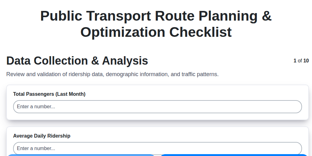
Table of Contents
- Introduction: Why Route Planning Matters
- Phase 1: Data Collection & Analysis - Know Your Riders
- Phase 2: Route Definition & Design - Connecting Communities
- Phase 2.1: Prioritizing Accessibility & Equity
- Phase 3: Service Frequency & Timing - Meeting Demand When It Matters
- Phase 3.1: Integration with Existing Transit Systems
- Phase 3.2: Environmental Considerations & Sustainability
- Phase 4: Modeling & Simulation - Testing Your Plan
- Phase 4.1: Stakeholder Engagement & Feedback
- Phase 5: Implementation & Monitoring - The Ongoing Journey
- Template Download: Your Route Planning Companion
- Resources & Links
TLDR: Overwhelmed by planning public transport routes? Our free checklist template breaks down the entire process - from data collection to monitoring - into 10 manageable steps. It's your shortcut to efficient, accessible, and sustainable public transport planning, saving you time and ensuring you cover all the crucial bases.
Introduction: Why Route Planning Matters
Effective public transport isn't just about getting people from A to B; it's the backbone of thriving communities. Well-planned routes connect neighborhoods, drive economic opportunity, and reduce traffic congestion. Conversely, poorly conceived routes can lead to underutilization, frustration for riders, and a drain on public resources. This isn't just about lines on a map; it's about understanding the nuanced needs of your community, maximizing efficiency, and building a sustainable transportation system for the future. Investing time and careful consideration in the route planning process yields substantial returns - improved accessibility, reduced environmental impact, and a more equitable and connected city for all.
Phase 1: Data Collection & Analysis - Know Your Riders
Understanding who your riders are - their needs, their habits, and their destinations - is the bedrock of effective public transport planning. This isn't just about counting passengers; it's about building a picture of their lives and how your system can serve them better.
Beyond the Numbers: Qualitative Insights
While ridership numbers are important, don't stop there. Qualitative data can reveal motivations and pain points that statistics alone can't capture. Consider:
- On-board Surveys: Short, targeted surveys distributed on buses and trains can quickly gather information about trip purpose, satisfaction, and potential barriers to use.
- Focus Groups: Facilitated discussions with diverse groups of potential riders provide deeper insights into their experiences and preferences.
- Community Events: Engaging with residents at local events allows for informal conversations and feedback.
Leveraging Technology for Deeper Understanding
Modern technology offers powerful tools for data collection:
- Mobile App Data: If you have a transit app, analyze usage patterns - popular routes, peak times, frequently used features.
- Social Media Listening: Monitor social media conversations about your transit system to identify common complaints or suggestions.
- Geographic Information Systems (GIS): Overlay ridership data with demographic information (age, income, employment) to identify underserved areas and target outreach efforts.
- Smart Card Data: Analyzing smart card usage provides detailed information on trip origins, destinations, and transfer patterns.
Phase 2: Route Definition & Design - Connecting Communities
Once you're armed with comprehensive data (as outlined in Phase 1), the real work of route definition begins. This isn't simply about drawing lines on a map - it's about strategically connecting communities and facilitating access to essential services and opportunities. Here's a breakdown of key considerations:
Prioritizing Destinations: Identify the core destinations that your route will serve. These typically include:
- Employment Centers: Business districts, industrial parks, major employers.
- Educational Institutions: Schools, colleges, universities.
- Healthcare Facilities: Hospitals, clinics, medical offices.
- Commercial Hubs: Shopping malls, supermarkets, retail districts.
- Recreational Areas: Parks, community centers, entertainment venues.
Balancing Directness and Coverage: A fundamental design challenge is balancing a direct route - minimizing travel time to major hubs - with wider coverage to serve more dispersed residential areas. A direct route might be efficient for commuters, while broader coverage ensures access for residents further from the core network. Often, a combination approach, utilizing feeder routes to connect outlying areas to the main lines, proves most effective.
Considering Road Network Constraints: Existing road infrastructure significantly influences route design. Evaluate road widths, traffic patterns, and the presence of physical barriers (rivers, railroads, one-way streets) that can restrict route options. Existing bus lanes, if available, should be prioritized.
Understanding Population Density: Route frequency and capacity should be proportional to population density. Densely populated areas warrant higher frequency and larger vehicle sizes, while less populated areas can be served with lower frequency and smaller vehicles.
Minimizing Detours and Circuitous Routes: Route paths should be as direct as possible, avoiding unnecessary detours that waste time and increase travel distances.
Evaluating Alternative Transportation Options: Consider how your route will integrate with other transportation modes, such as walking, cycling, and ride-sharing services. Strategic placement of bus stops near bike racks and pedestrian walkways encourages multi-modal travel.
Addressing Equity Concerns: Route design should proactively address transportation inequities, ensuring that underserved communities have equitable access to opportunities. This may involve extending routes into historically disadvantaged areas or providing discounted fares.
Ultimately, the goal of Phase 2 is to create a route network that is both efficient and equitable, effectively connecting communities and enhancing the overall quality of life for residents.
Phase 2.1: Prioritizing Accessibility & Equity
Accessibility and equity aren't simply checkboxes on a route planning list; they's foundational principles that shape a truly effective and just public transportation system. This phase - deliberately placed between initial planning and full-scale implementation - prioritizes ensuring that everyone, regardless of age, ability, income, or location, can reliably and safely access transit.
This goes beyond simply providing ramps and accessible stops. It demands a deeper understanding of the unique needs of different communities. Consider the following:
- Identifying Underserved Areas: Utilize data (census data, community feedback, ridership patterns) to pinpoint areas with limited access to transit. Are there neighborhoods with disproportionately high populations of seniors, people with disabilities, or low-income households?
- Addressing the First/Last Mile Problem: Many individuals face challenges getting to and from transit stops. Explore options like improved pedestrian infrastructure (sidewalks, crosswalks), bike-sharing programs, microtransit solutions (on-demand shuttles), and partnerships with ride-hailing services to bridge this gap.
- Route Design for Diverse Needs: Evaluate route lengths and frequency to accommodate individuals with mobility limitations or those requiring extended travel times. Consider stop spacing to ensure accessibility for wheelchair users and parents with strollers.
- Affordability Programs: Implement or expand fare subsidy programs for low-income riders and explore options for discounted fares for seniors and students.
- Community Engagement Focused on Equity: Hold targeted outreach events in underserved communities, ensuring that those most impacted by transportation decisions have a voice in the planning process. Use accessible formats for all communications (e.g., large print, translated materials, audio descriptions).
- Safety Considerations for Vulnerable Users: Assess stop locations for pedestrian safety, particularly for women, children, and seniors. Increase lighting and security measures in areas with high crime rates.
Prioritizing accessibility and equity isn't just the right thing to do; it's essential for building a transportation system that strengthens communities, connects people to opportunities, and fosters a more inclusive society.
Phase 3: Service Frequency & Timing - Meeting Demand When It Matters
Getting the timing right is just as important as designing the route itself. A perfectly planned route is useless if it doesn't run when people need it. This phase moves beyond the "where" to the "when," ensuring your service aligns with actual demand.
Understanding Peak and Off-Peak: The most obvious consideration is differentiating between peak hours (typically morning and evening commutes) and off-peak hours (mid-day, weekends). Peak hours demand significantly higher frequencies to accommodate the surge in passengers. Off-peak hours can often function with reduced frequencies to optimize resource allocation.
Beyond the Daily Grind: Weekend and Evening Considerations: Don't forget about weekend travel! Many people rely on public transport for leisure activities, errands, and social engagements. Consider extending service hours and maintaining a reasonable frequency, even on Saturdays and Sundays. Similarly, evening service is crucial for those working late, attending events, or simply needing a reliable way home after dark.
Data-Driven Adjustments: It's not enough to rely on assumptions. Regularly analyze ridership data - both overall and by time of day - to identify patterns and adjust frequencies accordingly. Real-time data from ticketing systems or passenger counters can be invaluable for making informed decisions.
Dynamic Scheduling: Explore dynamic scheduling options, where frequencies are automatically adjusted based on predicted demand. This technology uses historical data, weather forecasts, and even event schedules to optimize service levels in real-time.
Coordination with Other Services: Seamless integration with other transportation options - trains, buses, ferries - is essential. Synchronize schedules to minimize wait times and transfers, ensuring a convenient and efficient travel experience for all passengers.
Remember, optimizing service frequency and timing is an ongoing process. Continuous monitoring and adjustments are key to meeting evolving passenger needs and maximizing the effectiveness of your public transport system.
Phase 3.1: Integration with Existing Transit Systems
Connecting your new or optimized routes to existing transit networks isn't just about physical alignment; it's about creating a truly seamless experience for riders. A disjointed transition between modes leads to confusion, frustration, and ultimately, discourages ridership. Here's how to ensure a smooth integration:
- Data Sharing & Coordination: Regularly exchange ridership data, schedule updates, and service disruptions with all relevant transit agencies. This allows for proactive adjustments and ensures passengers have accurate information.
- Harmonized Schedules: Aim for coordinated schedules at transfer points, minimizing wait times and reducing the likelihood of missed connections. Consider clockface scheduling (e.g., buses arriving and departing every 15 minutes) to simplify transfers.
- Unified Fare Systems: Explore the possibility of integrated fare payment options, such as single tap payment across multiple systems, to avoid the hassle of purchasing multiple tickets.
- Consistent Signage and Information: Ensure consistent branding, signage, and real-time information displays across all transit systems. This creates a familiar and intuitive experience for riders regardless of the mode they're using.
- Physical Accessibility: Prioritize physical accessibility at transfer points. This includes accessible bus stops, ramps, elevators, and clearly marked pathways.
- Joint Marketing and Communication: Collaborate on marketing campaigns to promote integrated services and attract riders to the entire network.
Phase 3.2: Environmental Considerations & Sustainability
Public transport has a critical role to play in creating a more sustainable future. While reducing reliance on private vehicles is a significant benefit, we must also ensure that our public transport operations themselves minimize environmental impact. This means incorporating sustainability considerations throughout the route planning process, not just as an afterthought.
Several key strategies can be implemented:
- Fleet Electrification: Prioritizing electric buses and trains significantly reduces greenhouse gas emissions and improves air quality. This includes evaluating charging infrastructure requirements and exploring renewable energy sources to power the fleet.
- Route Optimization for Fuel Efficiency: Beyond minimizing distance, routes should be designed to avoid congested areas, reduce idling time, and favor flatter terrain where possible. Advanced routing software can assist in identifying the most efficient paths.
- Green Infrastructure Integration: Considering the placement of bus stops and park-and-ride facilities to maximize tree cover and incorporate green spaces can help mitigate the urban heat island effect and improve air quality.
- Material Selection & Lifecycle Assessment: When new infrastructure is needed (bus shelters, park-and-ride lots), prioritize sustainable materials with low embodied carbon and consider the entire lifecycle of these assets, from manufacturing to disposal.
- Noise Reduction Measures: Implementing noise barriers along routes in residential areas and utilizing quieter bus technologies can reduce noise pollution and improve quality of life.
- Promoting Active Transportation Connections: Integrating bike lanes and pedestrian pathways alongside public transport routes encourages a shift towards more sustainable modes of travel for the first mile/last mile of a journey.
Ultimately, a truly sustainable public transport system is one that actively contributes to the health of the environment and the well-being of the communities it serves.
Phase 4: Modeling & Simulation - Testing Your Plan
Before a single bus rolls out or a train begins its journey, rigorous modeling and simulation are essential. This isn't just about creating pretty visuals; it's about identifying potential bottlenecks, predicting rider behavior, and ensuring your planned routes are robust and efficient. Think of it as a dress rehearsal for your transit system.
We utilize a multi-faceted approach to testing our plans. This includes both macroscopic and microscopic simulations, allowing us to analyze performance at different scales.
Macroscopic Simulation: These models focus on the overall flow of traffic and the impact of new routes on the wider transportation network. We use software that simulates the movement of vehicles across the entire city, allowing us to assess how our planned routes affect congestion, travel times for other modes, and even air quality. We can test scenarios like rush hour peaks, unexpected road closures, and major events.
Microscopic Simulation: Moving down to a more granular level, microscopic simulations focus on individual vehicle movements and rider behavior at specific intersections and bus stops. We model factors like driver reaction times, pedestrian crossing patterns, and the dwell time of buses at stops. This allows us to identify potential conflict points and optimize signal timings to improve efficiency and safety.
Ridership Modeling: Understanding how many people will actually use your new routes is critical. We leverage historical ridership data, demographic information, and land use patterns to predict demand. This involves creating detailed ridership models that account for factors like accessibility, frequency of service, and fare structure.
Scenario Planning: The real world is unpredictable. Scenario planning helps us prepare for unexpected events. We create simulations that test how our system performs under various conditions, such as:
- Severe Weather: How do routes adjust during snowstorms or floods?
- Major Events: What's the impact of a large concert or sporting event?
- Infrastructure Failures: How does the system react to a road closure or bridge malfunction?
Through these comprehensive modeling and simulation processes, we can fine-tune our plans, minimize risks, and ultimately deliver a public transportation system that meets the needs of our community. This iterative process ensures we're not just planning routes, but building a truly reliable and responsive transit network.
Phase 4.1: Stakeholder Engagement & Feedback
Public transport planning doesn't happen in a vacuum. Truly successful routes are born from collaboration and a deep understanding of community needs. This phase isn't just about informing people - it's about actively listening and incorporating their feedback into your plan.
Why is Stakeholder Engagement Crucial?
Ignoring the voices of residents, businesses, and advocacy groups can lead to resistance, underutilization, and ultimately, a less effective system. Genuine engagement fosters a sense of ownership and builds trust. It also uncovers valuable insights that a planning team might otherwise miss - local knowledge about traffic patterns, accessibility concerns, or unmet needs.
Who are Your Stakeholders?
This is broader than just the obvious. Consider:
- Local Residents: Their daily experiences are invaluable.
- Businesses: Impact on deliveries, employee commutes, and customer access.
- Community Groups: Representatives of specific demographics or interests (e.g., seniors, disability advocates, environmental organizations).
- Local Authorities: City planners, traffic engineers, and elected officials.
- Transit Agencies: Collaboration is key for integration and coordination.
- Schools & Universities: Student transportation and campus accessibility.
Methods for Meaningful Engagement:
- Public Meetings: Structured forums for presentations and Q&A. Make them accessible (location, time, translation).
- Online Surveys: Reach a wider audience and gather quantitative data. Keep them concise and user-friendly.
- Interactive Maps: Allow stakeholders to provide feedback directly on a visual representation of the proposed routes.
- Focus Groups: Small, facilitated discussions to explore specific issues in more depth.
- Dedicated Email Address & Phone Line: A clear channel for ongoing communication and questions.
- Social Media: Use platforms to announce updates, solicit feedback, and respond to concerns. Actively monitor comments and engage in constructive dialogue.
Remember to document all feedback received and demonstrate how it was considered in the final plan - transparency builds trust and shows stakeholders their voices were heard.
Phase 5: Implementation & Monitoring - The Ongoing Journey
Launching a new public transport route or optimizing an existing one isn't a finish line; it's the start of an ongoing journey. This phase focuses on translating your meticulously crafted plan into reality and, crucially, ensuring it continues to meet the needs of the community.
Phased Rollout for Minimal Disruption: We strongly advocate for a phased implementation approach. Introducing changes incrementally allows for real-world testing and minimizes disruption to existing commuters. Start with a pilot program along a smaller section of the route, observe performance, gather feedback, and make adjustments before expanding to the full extent.
Key Performance Indicators (KPIs) & Data Collection: From day one, you need to be collecting data. Define your Key Performance Indicators before launch. These might include:
- Ridership Numbers: How many people are actually using the route?
- On-Time Performance: Are buses/trams/trains adhering to the schedule?
- Customer Satisfaction: Are passengers happy with the service? (Surveys and social media monitoring are vital here.)
- Operational Costs: Are expenses staying within budget?
- Environmental Impact: Measure changes in emissions or noise pollution.
Utilize GPS tracking, automated passenger counters, and online feedback platforms to streamline data collection.
Regular Reviews & Adaptive Management: Set a cadence for regular reviews - monthly, quarterly, or annually - to analyze performance data. Compare actual results against your initial projections. Be prepared to make adjustments. This might involve:
- Schedule Modifications: Fine-tuning arrival and departure times based on ridership patterns.
- Route Alterations: Shifting stops or adding new ones to better serve changing demographics or development patterns.
- Vehicle Allocation: Adjusting the number or type of vehicles based on demand.
- Marketing & Communication: Tailoring messaging to attract new riders or address concerns.
Embrace Technology for Continuous Improvement: Leverage real-time data analytics to identify bottlenecks, predict demand fluctuations, and optimize resource allocation. Consider implementing dynamic route adjustments based on traffic conditions or special events. Remember, public transport is a living system; ongoing monitoring and adaptation are essential to its long-term success.
Template Download: Your Route Planning Companion
Planning a new public transport route or optimizing an existing one can feel overwhelming. That's why we've created a comprehensive, downloadable template to guide you through every step of the process. Forget scattered notes and guesswork - this template brings structure, clarity, and efficiency to your route planning endeavors.
What's Inside the Template?
- Detailed Checklist: A fully expanded version of the ten-step checklist outlined in this article, with specific prompts and considerations for each stage.
- Data Collection Worksheet: A structured worksheet to organize and analyze data related to demographics, origin-destination patterns, and existing infrastructure.
- Route Alignment Matrix: A matrix to evaluate different route options based on key criteria such as directness, coverage, and feasibility.
- Cost-Benefit Analysis Spreadsheet: A pre-formatted spreadsheet to calculate the financial viability of your route plans.
- Stakeholder Engagement Tracker: A tool to manage communication and feedback from community members and local authorities.
- Performance Monitoring Dashboard: A sample dashboard to track key performance indicators and identify areas for improvement.
Ready to Simplify Your Route Planning?
This template is designed to be your constant companion throughout the entire route planning lifecycle - from initial concept to ongoing optimization. Don't just plan - plan effectively.
Resources & Links
- Montana Department of Transportation - Transit Division : Offers resources, best practices, and guidelines for public transportation planning and route optimization. Contains useful information on data collection, route design, and performance measurement.
- Federal Transit Administration (FTA) : The primary federal agency for transit funding and oversight. Contains reports, guidance documents, and funding information relevant to route planning and service optimization. Look for their Circulars and Planning Guidance.
- American Public Transportation Association (APTA) : A leading organization representing public transportation agencies. Provides industry best practices, research, and conferences related to route planning and transit system improvement. Their Transit-Oriented Development (TOD) resources are particularly valuable.
- CityLab : A website dedicated to urban planning and city design. Articles often discuss innovative transit solutions, route optimization strategies, and the social impact of transit systems. Search for 'public transit' or 'route planning' to find relevant content.
- Esri - Geographic Information System (GIS) : GIS software is essential for route planning and analysis. Esri is a leading provider of GIS technology. Explore their transit solutions and resources for visualizing and optimizing routes. Many transit agencies use ArcGIS.
- Open Transportation Society : Focuses on open data and accessibility in transportation. May provide useful datasets and tools for analyzing ridership patterns and identifying service gaps.
- U.S. Department of Transportation - Intelligent Transportation Systems (ITS) : Focuses on technology and data applications in transportation. Provides information on smart transit solutions and real-time passenger information systems, which are crucial for effective route management.
- Trimble Transportation : Offers specialized software and solutions for route optimization, fleet management, and passenger information in public transportation. Explore their offerings to understand how technology can improve efficiency.
- Pollywolly : Offers a platform that allows users to create and share transit route planning tools. It showcases how community-driven route planning can contribute to a better transit system.
- Rethink Urban : A consultancy specializing in transit-oriented development and sustainable transportation planning. Their website contains articles and insights into creating effective and equitable transit systems.
- Metropolitan Planning Commission (MPC) - Nashville : MPC's site offers some case studies of local transit route planning initiatives which can provide real-world examples of different approaches.
Frequently Asked Questions
What is this checklist template for?
This checklist template is designed to guide you through planning and optimizing public transport routes, whether you're a traveler, urban planner, or researcher. It covers everything from initial data gathering to evaluating different routing options.
Who is this checklist template for?
It's for anyone involved in public transport route planning, including travelers, urban planners, transit agencies, researchers, and even app developers. It's adaptable for various levels of expertise.
What kind of data do I need to use this checklist?
You'll need data such as public transport schedules (bus, train, subway, etc.), geographical information (maps, locations of points of interest), travel time estimates, cost information, and potential constraints (e.g., accessibility needs, time limitations).
Can I adapt the checklist for different cities or regions?
Absolutely! The checklist is designed to be flexible. You can modify it to incorporate local transit systems, regulations, and specific priorities.
What are some key steps in route planning that the checklist addresses?
The checklist covers steps like defining objectives, gathering data, generating potential routes, evaluating routes based on metrics (time, cost, accessibility), and documenting your findings.
What metrics are typically used to evaluate route options?
Common metrics include travel time, cost, distance, number of transfers, accessibility for people with disabilities, environmental impact, and passenger satisfaction.
How can I use this checklist to optimize existing routes?
Use the checklist to analyze current performance, identify bottlenecks, assess passenger needs, and test alternative routes or service adjustments. The 'Evaluation' section is particularly useful here.
Is there a specific software or tool I need to use with this checklist?
No, the checklist itself is a document. However, it's often used *in conjunction with* route planning software (e.g., Google Maps API, OpenTripPlanner, ArcGIS) or spreadsheet software for data analysis.
What does 'Accessibility' refer to in the checklist?
Accessibility refers to ensuring routes are usable by people with diverse needs, including wheelchair users, people with visual or auditory impairments, and those with mobility limitations. It considers factors like ramps, elevators, audible announcements, and accessible vehicle design.
Where can I find additional resources related to public transport route planning?
Look for resources from transit agencies, urban planning organizations, academic research papers on transportation, and online forums dedicated to urban mobility.
Found this Article helpful?
Public Transport Management Solution Demo
Optimize public transport operations & enhance passenger experience! ChecklistGuro streamlines route planning, vehicle maintenance, and incident reporting. Improve efficiency, safety, and reliability. Manage it all with our Work OS.
Related Articles
Train Depot Emergency Audit: Your Checklist Template for Safety
Mastering the Crush: Your Public Transport Crowded Conditions Audit Checklist
Keeping Our Buses Clean: A Checklist for Air Quality Audits
The Ultimate Bus Route Audit Checklist: A Template for Public Transit Success
Keeping City Transit Rolling: Your Tram Maintenance Checklist Template
Keeping Wheels Turning Safely: Your Bus Depot Safety Checklist Template
Mastering ATP Safety: Your Train Inspection Checklist Template
Train Depot Safety Inspection Checklist Template: Your Guide to a Safer Facility
We can do it Together
Need help with
Public Transport Management?
Have a question? We're here to help. Please submit your inquiry, and we'll respond promptly.