Water Runoff Analysis Checklist Template
Published: 08/23/2025 Updated: 03/25/2026
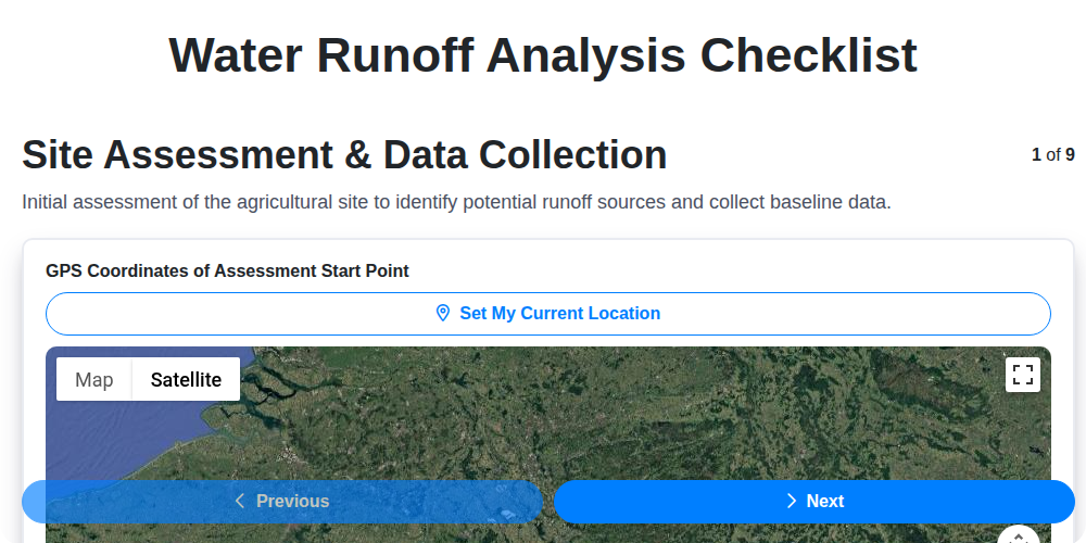
Table of Contents
- Introduction: Understanding Water Runoff
- Why a Water Runoff Analysis is Essential
- Template Overview: Steps and Key Data
- Step 1: Initial Site Assessment & Data Collection
- Step 2: Rainfall and Hydrologic Data Analysis
- Step 3: Soil Characteristics and Infiltration Assessment
- Step 4: Topography and Slope Evaluation
- Step 5: Agricultural/Land Use Practices Review
- Step 6: Runoff Modeling & Volume Estimation
- Step 7: Water Quality Considerations
- Step 7.5: Mitigation Strategy Planning
- Step 8: Reporting & Documentation
- Conclusion: Implementing Your Water Runoff Management Plan
- Resources & Links
TLDR: Need to understand and manage water runoff on your property? This checklist template breaks down the process into 9 easy-to-follow steps, from site assessment and soil analysis to modeling, mitigation, and reporting. Download it to identify risks, develop solutions, and protect your land!
Introduction: Understanding Water Runoff
Water runoff is more than just rainwater flowing downhill. It's a complex process shaped by soil, topography, vegetation, and human activities. While a certain amount of runoff is natural and essential for ecosystems, excessive runoff can lead to serious problems-erosion, flooding, pollution of waterways, and damage to infrastructure. Understanding the factors that influence water runoff is the first step toward effectively managing it. This article provides a practical checklist to assess runoff risk on your property, empowering you to implement sustainable solutions and protect valuable resources.
Why a Water Runoff Analysis is Essential
Ignoring water runoff isn't a viable strategy - it's a ticking time bomb for your land and the environment. A comprehensive runoff analysis isn't just a "nice-to-have"; it's an essential safeguard against a range of costly and damaging consequences.
Think beyond immediate flooding. Unmanaged runoff contributes significantly to soil erosion, degrading valuable topsoil and reducing agricultural productivity. It carries pollutants - fertilizers, pesticides, sediment - into waterways, harming aquatic life and potentially contaminating drinking water sources. Property damage from flooding and erosion is a very real and often expensive outcome of neglecting water management.
Furthermore, responsible land stewardship is increasingly regulated. Many jurisdictions now require runoff assessments for new developments or agricultural operations. Proactive analysis demonstrates a commitment to environmental protection and helps ensure compliance, avoiding potential fines and legal issues.
Ultimately, a water runoff analysis empowers you with knowledge - the knowledge to protect your investment, preserve natural resources, and build a more resilient and sustainable landscape. It's an investment that pays dividends in the long run.
Template Overview: Steps and Key Data
Here's a breakdown of the Water Runoff Analysis template, outlining the key steps and the essential data you'll need to gather at each stage. Think of this as your roadmap for a successful assessment.
1. Site Characterization & Reconnaissance: Start with a thorough on-site inspection. Capture high-resolution photos and videos, noting existing drainage patterns, vegetation cover, and any signs of erosion or ponding. Key Data: GPS coordinates, aerial imagery (historical and current), site map, photographs.
2. Precipitation Data Acquisition: Compile historical rainfall data, including intensity, duration, and frequency values. Look for trends and peak storm events. Key Data: Local weather station records, NOAA data, rainfall intensity-duration-frequency (IDF) curves.
3. Soil Profile Analysis & Testing: Determine soil type, texture, and structure. Conduct infiltration tests to measure how quickly water penetrates the soil. Key Data: Soil survey data, laboratory soil analysis reports (particle size distribution, organic matter content), infiltration rates (e.g., double ring test results).
4. Topographic Mapping & Analysis: Create detailed topographic maps using survey data or digital elevation models (DEMs). Calculate slope gradients and identify areas of concentrated flow. Key Data: Contour maps, digital elevation models (DEMs), slope calculations (degrees), aspect (direction of slope).
5. Land Cover and Use Assessment: Document the existing land cover types (e.g., forest, grassland, agricultural fields) and land use practices. Key Data: Land cover maps, vegetation indices (e.g., NDVI), agricultural management practices (e.g., tillage, fertilizer application rates).
6. Hydrologic Connectivity Evaluation: Assess how surface water and groundwater interact within the site. Key Data: Stream flow measurements, groundwater well data, wetland delineations.
7. Runoff Calculation and Modeling (Optional): Utilize appropriate hydrologic models (e.g., Rational Method, SCS Curve Number Method) to estimate runoff volumes and peak flow rates. This step often requires specialized software and expertise. Key Data: Model input parameters (rainfall data, soil data, topographic data, land cover data, Manning's roughness coefficient).
8. Water Quality Sampling (If applicable): Collect water samples from discharge points and analyze for sediment, nutrients, and other pollutants. Key Data: Water sample analysis reports, turbidity measurements, pollutant concentration data.
Step 1: Initial Site Assessment & Data Collection
Before diving into complex modeling or detailed analysis, a thorough initial site assessment is absolutely critical. This isn't just a casual walkthrough; it's a systematic examination of the land to establish a baseline understanding of existing conditions. Start by documenting the boundaries of the area in question using GPS coordinates-this is essential for accurate mapping and future reference.
Capture a detailed visual record. Take numerous photographs and videos from various angles, paying close attention to topography, vegetation cover (types and density), and any existing infrastructure like roads, buildings, and drainage systems (ditches, pipes, culverts). Aerial imagery, whether from readily available satellite sources or drone-based surveys, provides invaluable context, allowing you to view the site in its broader landscape.
Pay close attention to obvious signs of existing runoff issues: eroded gullies, sediment deposits in waterways, standing water, and areas of stressed vegetation. Note any natural features like wetlands, streams, or steep slopes that may contribute to runoff. Finally, gather any existing maps - topographic maps, aerial photographs, or previous site plans - as these can provide valuable historical context and help identify changes over time. This meticulous data collection forms the foundation for all subsequent analysis and mitigation efforts.
Step 2: Rainfall and Hydrologic Data Analysis
Understanding the rainfall patterns impacting your site is fundamental to any runoff analysis. It's not just about how much rain falls, but also when and how intensely. This step involves digging into historical rainfall data to build a picture of potential storm events.
We start by gathering rainfall data from local weather stations, regional climate centers (like NOAA in the US), and any available historical flood records. This data provides insights into average rainfall amounts, frequency of storms, and the intensity of precipitation over time.
A crucial part of this analysis is generating Intensity-Duration-Frequency (IDF) curves. These curves graphically represent the rainfall intensity for a specified duration and return period (e.g., a 10-year, 1-hour rainfall event). The return period essentially describes how often an event of that magnitude is expected to occur - a 100-year storm, for instance, is expected to occur on average once every 100 years. IDF curves are essential for sizing stormwater management infrastructure.
Beyond total rainfall, consider the timing and distribution of precipitation. Is the area prone to prolonged, moderate rainfall, or intense, short-duration storms? This impacts runoff rates and potential for flooding. Analyzing these patterns helps us predict potential runoff volumes and peak flow rates for various storm scenarios, forming the foundation for modeling and mitigation planning.
Step 3: Soil Characteristics and Infiltration Assessment
Understanding how your soil behaves is absolutely critical to predicting runoff. Soil isn't just dirt; it's a complex mix of minerals, organic matter, water, and air, and its composition directly influences how much rainfall infiltrates and how much flows away.
Why Soil Matters for Runoff:
- Texture & Structure: Sandy soils drain quickly but hold little nutrients. Clay soils hold water well but can become compacted and impede drainage. Loamy soils (a mix of sand, silt, and clay) generally offer the best balance. The way soil particles are arranged (structure) also affects permeability.
- Organic Matter: Organic matter improves soil structure, increases water-holding capacity, and enhances infiltration rates.
- Compaction: Compacted soil has reduced pore space, drastically limiting infiltration and increasing runoff. Heavy machinery, foot traffic, and over-tillage can contribute to compaction.
How to Assess Soil Characteristics:
- Visual and Tactile Examination: Get your hands dirty! Observe the soil's color, texture, and structure. Does it feel gritty (sandy), smooth (silty), or sticky (clay)?
- Jar Test: A simple "jar test" can give you a rough estimate of the soil's sand, silt, and clay content. Layer soil in a clear jar with water, shake well, and let it settle. The layers will separate, allowing you to visually estimate the proportions.
- Infiltration Test (Double Ring Test): A more accurate assessment involves using a double ring infiltrometer. This method measures the rate at which water infiltrates into the soil within a defined area. It provides valuable data for runoff models and helps identify areas with poor infiltration.
- Professional Soil Testing: For detailed soil analysis (including nutrient levels, pH, and organic matter content), consider sending a sample to a certified soil testing laboratory. The results will inform your mitigation strategies.
Step 4: Topography and Slope Evaluation
The lay of the land is critical when assessing water runoff. Steep slopes accelerate water flow, increasing erosion risk and the potential for concentrated runoff. We need to understand how the land rises and falls.
What we look for:
- Contour Maps: These lines connect points of equal elevation, revealing the overall shape of the land. Closely spaced contour lines indicate steep slopes; widely spaced lines suggest a gentler gradient.
- Digital Elevation Models (DEMs): DEMs provide a 3D representation of the topography, allowing us to visualize slopes and identify areas where water is likely to accumulate or flow rapidly.
- Slope Calculations: We quantify the steepness of slopes using degrees or percentages. Higher slope values correlate with increased runoff potential.
- Identifying Natural Channels: Observing existing drainage paths, gullies, and swales helps predict how water will move across the site.
- Analyzing Ridgelines and Valleys: Ridges act as divides, directing water flow, while valleys channel it. Understanding these features is essential for predicting runoff patterns.
By carefully analyzing the topography, we can pinpoint areas that are particularly vulnerable to erosion and prioritize mitigation efforts to slow water flow and protect the land.
Step 5: Agricultural/Land Use Practices Review
Agricultural lands and other areas with significant land use activities (like grazing, forestry, or construction) are often primary contributors to runoff. A crucial part of the analysis involves a detailed review of these practices.
This isn't just about what crops are grown or livestock are raised; it's about how those activities are managed. Consider these factors:
- Tillage Practices: Conventional tillage (plowing) leaves soil vulnerable to erosion. No-till or reduced-tillage methods significantly improve infiltration and reduce runoff.
- Crop Cover: Leaving crop residue on the soil surface, planting cover crops during fallow periods, and utilizing crop rotation strategies help protect the soil from raindrop impact and increase water absorption.
- Fertilizer Management: Excessive fertilizer application leads to nutrient runoff, polluting waterways. Evaluate fertilizer rates, timing, and placement to minimize losses.
- Grazing Management: Overgrazing degrades vegetation cover and compacts soil, increasing runoff. Proper grazing rotations and stocking rates are essential.
- Forestry Practices: Logging and forest management activities can disturb soil and increase runoff. Sustainable forestry practices minimize these impacts.
- Construction Site Management: During and after construction, erosion control measures (silt fences, sediment basins) are vital to prevent runoff contamination.
Document current practices, identify potential areas for improvement, and consider the economic and environmental trade-offs associated with different management approaches. Understanding the link between land use and runoff is key to developing effective mitigation strategies.
Step 6: Runoff Modeling & Volume Estimation
Quantifying runoff isn't just about observing; it's about predicting. Runoff modeling allows us to estimate the volume and peak flow rates of water leaving a site under various rainfall scenarios. This is crucial for designing effective mitigation strategies and ensuring compliance with regulations.
Several methods exist, ranging from relatively simple calculations to complex computer simulations. The Rational Method, for instance, is a commonly used, albeit simplified, approach that estimates peak discharge based on rainfall intensity, drainage area, and a runoff coefficient (which reflects the land's ability to infiltrate water). The Natural Resources Conservation Service (NRCS) Curve Number Method is another frequently employed technique, factoring in soil type, land cover, and antecedent moisture conditions to determine runoff potential.
For more detailed and accurate predictions, particularly in complex terrains or for large areas, sophisticated software like HEC-RAS or SWMM (Storm Water Management Model) is utilized. These tools account for topography, channel characteristics, and infrastructure to simulate runoff processes.
While performing these calculations yourself is possible, a strong understanding of hydrology and hydraulic principles is essential. Due to the complexity and potential for error, engaging a qualified hydrologist or engineer to conduct runoff modeling is often recommended. Accurate modeling provides the foundation for informed decisions about managing stormwater and protecting your land.
Step 7: Water Quality Considerations
Runoff isn't just about soil and landscape; it's also about water quality. As water flows across the land, it picks up various pollutants that can impact downstream water bodies and ecosystems. This is why assessing water quality is a crucial part of a comprehensive runoff analysis.
The types of pollutants carried by runoff vary depending on the land use and activities present. In agricultural areas, fertilizers, pesticides, and sediment are common contaminants. Urban runoff often contains oil, grease, heavy metals, and litter. Even seemingly benign materials like leaves and organic matter can contribute to water quality issues by depleting oxygen levels when they decompose.
During a water quality assessment, you're looking for indicators of pollution, such as:
- Sediment Load: High sediment levels cloud the water, reduce light penetration, and smother aquatic habitats.
- Nutrient Levels (Nitrogen & Phosphorus): Excess nutrients can lead to algal blooms, which deplete oxygen and harm aquatic life.
- pH: Significant deviations from a neutral pH can be detrimental to aquatic organisms.
- Heavy Metals & Pollutants: These can accumulate in the food chain and pose risks to human health.
- Biological Oxygen Demand (BOD): High BOD indicates a large amount of organic matter decomposing in the water, which consumes oxygen.
Collecting water samples and sending them to a certified laboratory for analysis is the most reliable way to determine the presence and concentration of these pollutants. Visual inspection (looking for unusual color, odor, or debris) can also provide initial clues about water quality issues. The results of this assessment will directly inform your mitigation strategies, ensuring that your efforts address not only the volume of runoff but also its potential to harm the environment.
Step 7.5: Mitigation Strategy Planning
So, you're armed with data and a clear understanding of your runoff risks. Now comes the crucial part: crafting a plan to manage them. Mitigation strategy planning isn't just about picking a few quick fixes; it's about developing a long-term, sustainable approach tailored to your specific site conditions and goals.
Here's how to approach it:
- Prioritize Based on Risk: Focus on the areas with the highest runoff risk and potential for negative impact. Addressing the biggest problems first yields the greatest benefit.
- Consider a Range of Options: Explore various mitigation techniques - from simple landscaping changes (like installing rain gardens or swales) to more complex engineering solutions (like terracing or detention basins).
- Evaluate Feasibility: Assess the practicality of each option, considering factors like cost, available space, regulatory constraints, and potential environmental impacts. A beautiful solution that's impossible to implement is useless.
- Think Long-Term: Choose strategies that provide lasting benefits and minimize maintenance requirements. Consider how your mitigation plan will adapt to future climate changes and land use changes.
- Integrate with Existing Practices: Aim for solutions that complement existing land management practices rather than disrupting them.
- Incorporate Green Infrastructure: Whenever possible, prioritize nature-based solutions that provide multiple benefits, like stormwater management, habitat creation, and aesthetic improvement.
- Phased Implementation: Break down the mitigation plan into manageable phases, allowing for adjustments and improvements along the way.
- Monitor & Adapt: Regularly monitor the effectiveness of your mitigation measures and be prepared to make changes as needed. Runoff patterns can change, and your plan should be adaptable.
Step 8: Reporting & Documentation
Compiling a clear and comprehensive report is the culmination of your runoff analysis. This isn't just about ticking a box; it's about creating a valuable resource for informed decision-making and demonstrating due diligence. Your report should synthesize all collected data, analysis findings, and proposed mitigation strategies.
Here's what a robust report should include:
- Executive Summary: A concise overview of the entire assessment, including key findings and recommendations. This is crucial for stakeholders who may not have time to read the full report.
- Site Description: A detailed description of the site, including its location, topography, land use, and any existing drainage infrastructure.
- Methodology: A clear explanation of the methods and models used in the analysis. This ensures transparency and allows others to evaluate the reliability of the findings.
- Data & Analysis: Present all collected data in a well-organized manner, using tables, graphs, and maps to illustrate key trends and patterns. Explain the assumptions and limitations of the analysis.
- Findings & Recommendations: Clearly articulate the identified runoff risks and provide specific, actionable recommendations for mitigation. Include cost estimates and potential performance metrics for each proposed measure.
- Appendices: Include supporting documentation such as raw data, soil analysis reports, model inputs and outputs, and relevant permits or regulatory requirements.
Maintaining meticulous records throughout the entire process is just as important. These records should include field notes, photographs, calibration data, and any communications with stakeholders. This documentation provides a valuable audit trail and can be used to track the effectiveness of mitigation efforts over time. Properly documenting your assessment not only demonstrates responsible land stewardship but also provides a crucial foundation for future planning and management.
Conclusion: Implementing Your Water Runoff Management Plan
Your water runoff analysis isn't just about identifying problems; it's about building a sustainable future for your land. The insights gained from this process - understanding rainfall patterns, soil characteristics, and topographic influences - empower you to make informed decisions about land management. Implementing your runoff management plan requires commitment and a phased approach. Start with the most critical areas identified in your analysis, prioritizing those facing the highest risk of erosion or flooding. Consider a pilot program to test mitigation strategies before widespread adoption. Remember that ongoing monitoring is crucial; regularly assess the effectiveness of your measures and adapt your plan as needed. Collaboration is also key-engage with local authorities, agricultural extension services, or community groups to share knowledge and leverage resources. Ultimately, a proactive and adaptive approach to water runoff management protects your investment, enhances environmental quality, and contributes to a more resilient landscape for generations to come.
Resources & Links
- United States Environmental Protection Agency (EPA) : The EPA provides comprehensive information on stormwater management, runoff pollution, and best management practices. A great source for regulations, guidelines, and research related to water runoff. Specifically look for their resources on Nonpoint Source Pollution.
- United States Geological Survey (USGS) : The USGS provides valuable data on rainfall, streamflow, and water quality. Their water resources website has maps, data, and tools useful for understanding hydrologic cycles and runoff patterns. Look for their National Water Information System (NWIS) for real-time data.
- National Oceanic and Atmospheric Administration (NOAA) : NOAA provides historical rainfall data, weather forecasts, and climate information. This is essential for Step 2: Rainfall and Hydrologic Data Analysis. Their National Weather Service is particularly useful.
- ScienceDirect : A subscription-based database with peer-reviewed research on hydrology, soil science, and environmental engineering. Useful for deeper dives into infiltration rates, runoff modeling techniques, and water quality impacts (may require institutional access).
- Soil Science Society of America (SSSA) : Provides information and resources about soil properties, soil health, and soil's role in water infiltration and runoff. Crucial for Step 3: Soil Characteristics and Infiltration Assessment.
- American Society of Civil Engineers (ASCE) : ASCE is a professional organization offering resources, standards, and publications related to civil engineering, including stormwater management and runoff control. Look for publications on hydrologic design and best practices.
- United States Department of Agriculture - Farm Service Agency (FSA) : Relevant for Step 1 and Step 5, the FSA provides information about agricultural practices and land use, which heavily influence runoff. Look for data and programs related to conservation practices.
- Esri ArcGIS : A widely used Geographic Information System (GIS) platform. Useful for visualizing topography (Step 4), land use (Step 1 & 5), and runoff patterns. Can be used to create custom maps and analyze spatial data, and also to support Runoff Modeling (Step 6).
- Stormwater Management Model (SWMM) : SWMM is a widely-used, free stormwater modeling software. Crucial for Step 6: Runoff Modeling & Volume Estimation. Requires some training and technical skill to use effectively.
- Hydrologic Engineering Center (HEC) : HEC offers various software packages and resources for hydraulic and hydrologic modeling. Their software is used for advanced runoff calculations and is an alternative to SWMM (often requires purchase).
- American Public Health Association (APHA) : While focused on public health, APHA offers resources on water quality and the impacts of runoff on human health. Important for Step 2 and Step 7: Water Quality Considerations.
- World Resources Institute (WRI) : WRI provides data, research, and analysis on water resources, including runoff patterns and sustainable water management practices. Offers a global perspective on water challenges and solutions.
- National Institute of Standards and Technology (NIST) : NIST develops standards and provides guidance on measurement and testing techniques, which can be relevant for quantifying runoff volume and water quality. May be useful in developing calibration methods for runoff models.
Frequently Asked Questions
What is a Water Runoff Analysis Checklist Template?
A Water Runoff Analysis Checklist Template is a structured document used to systematically assess and document factors contributing to water runoff in a specific area. It helps identify potential problems, estimate runoff volume, and determine appropriate mitigation strategies.
Who is this checklist template for?
This template is designed for a wide range of users including civil engineers, environmental consultants, landscape architects, developers, urban planners, and property managers who need to assess water runoff risks.
What information does the checklist typically include?
Typically, it includes sections covering topography, soil type, vegetation cover, impervious surfaces, drainage infrastructure, rainfall data, and potential impact areas. It often includes space for observations, calculations, and recommendations.
How can I use this checklist template?
Download the template, fill in the fields based on site observations and data collection, use the checklist to identify potential issues and prioritize areas for improvement, and use the findings to develop runoff mitigation plans.
Can I customize the checklist template?
Yes, absolutely! The template is designed to be flexible. You can add or remove sections, modify questions, and adjust the criteria to align with the specific requirements of your project or location.
What is the purpose of assessing water runoff?
Assessing water runoff helps prevent erosion, flooding, pollution, and damage to property. It also helps ensure compliance with environmental regulations and promotes sustainable land management.
Are there any specific regulations or standards the checklist can help me comply with?
The checklist can help with compliance to local stormwater management ordinances, EPA guidelines (like the National Pollutant Discharge Elimination System - NPDES), and other relevant environmental regulations. However, always refer to the specific regulations applicable to your location and project.
What is the difference between runoff and stormwater?
'Stormwater' specifically refers to water that originates from precipitation. 'Runoff' is a broader term encompassing water flowing over land, which can include stormwater, snowmelt, and irrigation water.
What kind of data do I need to collect to effectively use this checklist?
You'll need topographic maps, soil surveys, vegetation assessments, impervious surface data (like rooftops and pavement), rainfall data, and potentially data on existing drainage infrastructure. Photos and videos documenting site conditions are also highly recommended.
Where can I find more information about water runoff management?
You can consult your local government's environmental protection agency, the Environmental Protection Agency (EPA) website, professional engineering organizations, and academic resources on stormwater management.
Found this Article helpful?
Agriculture Management Solution Demo
Running a farm or agricultural business is complex. ChecklistGuro's Work OS platform simplifies your operations, from crop planning and irrigation management to livestock tracking and harvest scheduling. Increase efficiency, reduce waste, and boost yields! See how ChecklistGuro can revolutionize your agriculture business.
Related Articles
Fish Farm Success: Your Aquaculture System Checklist Template

Mastering the Daily Crop Scouting Report: Your [Specific Crop] Checklist Template
Irrigation System Checklist: Farm Water Management & Crop Yield Optimization
Unlock Your Garden's Potential: A Soil pH Verification Checklist
PPE Usage Checklist Template: Your Guide to Safety
Water Discharge Permit Compliance Checklist Template

The Ultimate GPS & Precision Farming Calibration Checklist Template

10 Simple Steps to a Healthy Drainage System: Your Checklist Template
We can do it Together
Need help with
Agriculture?
Have a question? We're here to help. Please submit your inquiry, and we'll respond promptly.