Drone Crop Inspection Checklist: Your Guide to Precision Agriculture
Published: 09/02/2025 Updated: 12/13/2025
Table of Contents
- Getting Started with Drone Crop Inspections
- Pre-Flight Preparations: Setting the Stage for Success
- Flight Planning and Permissions: Navigating Regulations
- Data Acquisition Settings: Optimizing for Crop Health
- Visual Inspection & Data Capture: Identifying Key Indicators
- Data Logging & GPS Accuracy: Ensuring Reliable Geolocation
- Post-Flight Data Management: Organization and Backup
- Equipment Maintenance & Battery Care: Prolonging Drone Lifespan
- Environmental Factors & Observations: Contextualizing Your Data
- Analyzing Your Findings & Taking Action
- Resources & Links
TLDR: Want better crop data from your drone? This checklist ensures you cover all bases - from pre-flight checks and legal permissions to camera settings, data logging, and equipment maintenance. Follow it to collect accurate, reliable data for informed decisions about irrigation, fertilization, and pest control, boosting your farm's efficiency and yield!
Getting Started with Drone Crop Inspections
Embarking on your drone crop inspection journey can feel overwhelming, but breaking it down into manageable steps makes it accessible. First, choose the right drone. Consider your acreage, budget, and required data resolution. Entry-level drones with basic cameras are great for smaller farms, while larger operations may benefit from drones equipped with multispectral or thermal sensors. Research different models, read reviews, and compare specifications to find the best fit.
Next, familiarize yourself with the software. Many drone manufacturers offer proprietary software for flight planning and data processing. Alternatively, explore third-party platforms like DroneDeploy, Pix4D, or AgEagle. These platforms often provide advanced features like orthomosaic generation, NDVI mapping, and automated reporting.
Training and Certification are highly recommended. While not always legally required, proper training ensures safe operation and optimizes data quality. Consider online courses or hands-on workshops to learn the fundamentals of drone flight, airspace regulations, and data processing techniques. Some areas require a Part 107 certification - research your local requirements.
Start small. Don't attempt to map your entire farm on your first flight. Begin with a small test area to practice your flight planning, data acquisition, and processing techniques. This allows you to refine your workflow and identify any potential issues before tackling larger areas. Finally, remember that continuous learning is key - drone technology and agricultural practices are constantly evolving!
Pre-Flight Preparations: Setting the Stage for Success
A successful drone crop inspection starts long before you take off. Thorough pre-flight preparations are the bedrock of reliable data and a safe operation. Think of it as building a solid foundation; skipping steps here can lead to wasted time, inaccurate results, and potential hazards.
First, a meticulous physical inspection of your drone is paramount. Propellers should be free of cracks or damage, the gimbal should move smoothly, and all connections (battery, camera, remote controller) must be secure. Don't underestimate the importance of software checks, too. Ensure your drone's firmware, the flight controller software, and any processing software you're using are all up-to-date. Outdated software can lead to instability, inaccurate data, or even complete failure.
Next, compass and IMU calibration are crucial. Magnetic interference can wreak havoc on a drone's navigation, so a recent compass calibration ensures accurate flight paths. Similarly, calibrating the Inertial Measurement Unit (IMU) helps maintain flight stability, particularly important in challenging wind conditions. Finally, before anything else, verify you have a strong and stable GPS signal - a weak signal can lead to navigation errors and unsafe landings. Taking these seemingly small steps upfront significantly reduces the risk of encountering issues in the field and helps guarantee a smooth and productive flight.
Flight Planning and Permissions: Navigating Regulations
Before you even think about taking off, a solid flight plan and the right permissions are absolutely essential. Operating a drone without proper authorization can lead to hefty fines, legal repercussions, and potentially endanger lives. Let's break down what you need to consider.
Understanding Airspace and Restrictions:
The first step is determining if the area you plan to fly over is restricted. Many areas, including airports, prisons, national parks, and military bases, are designated as No-Fly Zones. Utilize tools like Aloft (formerly Kittyhawk), DroneZone (in the US), or similar platforms relevant to your region. These apps provide real-time airspace information and allow you to submit flight requests when necessary. Always verify the latest restrictions - they can change frequently.
FAA Authorization (or Equivalent in Your Region):
In the United States, Part 107 certification is typically required for commercial drone operations. This involves passing a knowledge test and adhering to FAA regulations. Even with Part 107, you may need to apply for waivers or authorizations for specific operations, such as flying at night or beyond visual line of sight (BVLOS). Outside the US, be sure to investigate the equivalent regulations and licensing requirements for your jurisdiction.
Privacy Considerations:
Beyond airspace restrictions, think about privacy. Inform landowners if you plan to fly over their property. Respect people's privacy and avoid recording them without their knowledge or consent. Familiarize yourself with local privacy laws and best practices.
Community Engagement:
Building positive relationships with your local community can go a long way. Let neighbors or local authorities know about your planned flights, especially if you're operating near populated areas. Communication can prevent misunderstandings and build trust.
Remember: Planning is Paramount. A few minutes spent planning your flight and securing necessary permissions can save you a lot of headaches (and potential fines) later on.
Data Acquisition Settings: Optimizing for Crop Health
Getting the right data starts with meticulous camera settings. It's not enough to simply point and shoot; thoughtful configuration ensures you capture information usable for actionable insights. Here's a breakdown of key settings and considerations:
Resolution & Frame Rate: Higher resolution (e.g., 12MP or greater) provides more detail, critical for identifying subtle plant stress. Frame rate is less crucial for general crop health assessment but may be relevant for capturing dynamic events like pest movement.
Exposure & White Balance: Proper exposure ensures images aren't too dark or overexposed, which can obscure detail. Auto settings often work, but manual control allows for consistent results across multiple flights. White balance adjusts colors to accurately represent plant appearance. Set it to a consistent setting (like "daylight" or "custom") to avoid color variations impacting analysis.
NDVI/Multispectral Specifics: If utilizing a multispectral camera, the band acquisition settings are paramount. Ensure the correct wavelengths are being captured and that the camera is properly calibrated. Consider incorporating a calibration target within the field for improved accuracy. Check the NDVI calculation formulas within your processing software and ensure they align with your camera's band designations.
Flight Parameters Impacting Data: Think beyond the camera itself. Shutter speed can affect image sharpness, especially in windy conditions. Ensure your gimbal is properly calibrated to minimize vibration. Overlap between flight lines (typically 70-80% forward and 60-70% side) is crucial for generating accurate orthomosaics and 3D models.
A Simple Checklist:
- Resolution: At least 12MP
- Exposure: Manual or consistent Auto settings
- White Balance: Fixed setting (e.g., Daylight)
- NDVI/Multispectral: Calibrated and appropriately configured.
- Flight Overlap: Forward 70-80%, Side 60-70%
Visual Inspection & Data Capture: Identifying Key Indicators
Beyond the technical settings and planning, keen visual observation during the flight is paramount. Don't just fly the route; actively look. While the drone captures data, you're the first line of defense in identifying potential problems. Here's what to be looking for:
1. Color & Uniformity: Healthy crops exhibit a consistent color. Variations in green hue can indicate nutrient deficiencies (yellowing for nitrogen, purpling for phosphorus), disease onset, or water stress. Look for streaking or patchy discoloration.
2. Plant Structure & Density: Assess the overall structure of the plants. Are they stunted? Are leaves wilting or curling? Is there uneven growth across the field? Unusual gaps or reduced plant density can signal pest infestations or disease.
3. Foliage Damage: Look for signs of physical damage - insect feeding, leaf spots, lesions, or areas of necrosis (dead tissue). Close examination can sometimes reveal early signs of fungal or bacterial infections that aren't yet visible from ground level.
4. Weed Presence: Drone imagery can be surprisingly effective for identifying weed infestations, particularly in areas with dense crop cover. Observe for unusual vegetation patterns or color contrasts.
5. Edge Effects & Field Boundaries: Pay special attention to field edges and boundaries. These areas often experience different environmental conditions (e.g., proximity to roads, shade) that can affect crop health and may reveal early signs of stress before they become widespread.
6. Leverage Zoom: Don't hesitate to use the drone's zoom function to get a closer look at specific areas of interest. A brief pause and a closer inspection can be far more valuable than simply following the programmed flight path.
Documenting Observations: It's crucial to document any unusual observations during the flight. Many drone flight planning apps allow you to mark points of interest (POIs) directly on the map. Use these to flag areas that require further investigation after the data has been processed. A few quick notes in a digital notebook are also valuable for context.
Data Logging & GPS Accuracy: Ensuring Reliable Geolocation
Reliable geolocation is the backbone of any successful drone crop inspection program. Without accurate GPS data, your maps, analyses, and targeted interventions become significantly less valuable. Here's how to ensure your data logging and GPS accuracy are up to par:
Understanding Your Drone's GPS System:
Most modern drones utilize a combination of GPS, GLONASS, and sometimes Galileo satellites for positioning. While this typically provides good accuracy (within a few meters), environmental factors and drone settings can impact performance. Understanding your drone's capabilities and limitations is the first step.
Data Logging Essentials:
Your drone's flight controller and app should be logging critical data points during the flight. Verify that these logs include:
- Latitude and Longitude: Essential for georeferencing your imagery and creating accurate maps.
- Altitude: Records the drone's height above sea level, crucial for orthorectification.
- Timestamp: Ensures chronological ordering of data and facilitates synchronization with ground-based observations.
- Flight Parameters: Speed, battery voltage, GPS signal strength - these provide context for data analysis and troubleshooting.
Improving GPS Accuracy: Techniques & Considerations
- Clear View of the Sky: Obstructions like buildings, trees, and even dense foliage can interfere with GPS signals. Launch your drone from an open area with a clear view of the sky.
- GPS Averaging: Many drones offer a "GPS Averaging" or "Satellite Lock" feature. Allow the drone to stabilize and acquire a strong GPS signal before starting the flight.
- Ground Control Points (GCPs): For the highest levels of accuracy (sub-meter or even centimeter-level), consider using GCPs. These are precisely surveyed points on the ground that you can use to correct for GPS drift and improve georeferencing accuracy. This is particularly valuable for creating highly detailed orthomosaics and digital elevation models.
- Real-Time Kinematic (RTK) & Post-Processed Kinematic (PPK): These advanced GPS technologies offer significantly improved accuracy (down to centimeter-level) by utilizing a base station or correction data. RTK provides real-time corrections, while PPK processes data after the flight. This often requires specialized hardware and software.
- Check Your Drone's Firmware: Manufacturers often release firmware updates that improve GPS performance. Ensure your drone's firmware is up to date.
- Regular Calibration: Some drones benefit from periodic GPS calibration. Consult your drone's manual for instructions.
Post-Flight Data Management: Organization and Backup
The quality of your insights hinges not only on the data collected but also on how well you manage it. A disorganized data archive can lead to wasted time, missed opportunities, and even inaccurate conclusions. Here's a breakdown of best practices for post-flight data management:
1. Immediate Transfer & Verification: As soon as possible after each flight, transfer the raw data (photos, videos, flight logs) from your drone's SD card to a secure storage location-ideally, both an external hard drive and a cloud-based storage solution. Before deleting the SD card's contents, quickly verify that the transfer was successful by checking file counts and sizes.
2. Consistent File Naming Conventions: Establish a clear and consistent file naming system before you start flying. Include relevant details in the filenames to make them easily searchable and sortable. A suggested format could be: [Field Name]_[Date]_[Flight Type]_[Camera Settings]. For example: EastField_20240726_NDVI_RGB. This simplifies searching and allows for easy tracking of data from different locations and dates.
3. Folder Structure & Metadata: Organize your data within a well-defined folder structure. Create folders for each field, date, and type of data collected (e.g., RGB Imagery, NDVI Maps, Flight Logs). Consider adding metadata files (e.g., CSV files) containing detailed information about each flight - date, time, GPS coordinates, weather conditions, camera settings, pilot, and any observations made during the flight.
4. Redundancy is Key: Backup, Backup, Backup: Data loss is a serious risk. Implement a robust backup strategy. The 3-2-1 rule is a good guideline: * 3 copies of your data: One primary copy, and two backups. * 2 different media: Store backups on different types of media (e.g., external hard drive and cloud storage). * 1 offsite copy: Keep one backup copy in a geographically separate location to protect against physical disasters like fire or flood.
5. Version Control (for Processed Data): If you're using specialized software to process your drone data (creating orthomosaics, NDVI maps, etc.), implement a version control system. This allows you to track changes made to your processed data and revert to earlier versions if necessary. Many cloud storage services offer version history functionality.
6. Data Retention Policy: Define a clear data retention policy. How long will you store your drone data? This will depend on your needs and legal requirements. Regularly review and purge older data to manage storage space effectively.
Equipment Maintenance & Battery Care: Prolonging Drone Lifespan
Your drone is an investment, and consistent maintenance is key to maximizing its operational life and ensuring reliable data collection. Neglecting regular checks can lead to costly repairs or even premature failure. Here's a breakdown of essential maintenance and battery care practices:
Drone Body & Components:
- Post-Flight Inspection: After each flight, visually inspect the drone frame, arms, and landing gear for any cracks, scratches, or signs of damage. Small issues can escalate quickly if left unattended.
- Propeller Health: Propellers are vulnerable. Check for nicks, bends, or cracks. Replace damaged propellers immediately, as even slight imperfections can significantly affect flight stability and safety. Always balance new propellers if required by the manufacturer.
- Gimbal & Camera Lens: Protect the gimbal and camera lens. Clean the lens regularly with a microfiber cloth to remove dust and debris. Avoid exposing the gimbal to extreme temperatures or impacts.
- Motor Checks: Listen for unusual noises coming from the motors during pre-flight and post-flight checks. Unusual sounds could indicate a problem requiring attention.
- Secure Connections: Regularly inspect and tighten all screws, connectors, and wiring to ensure secure connections.
Battery Care - The Heart of Your Drone:
- Proper Charging: Always use the manufacturer-supplied charger and follow the recommended charging procedures. Don't overcharge or leave batteries connected to the charger unnecessarily.
- Storage: When not in use for extended periods, store batteries at a cool, dry place with a 40-60% charge level. Avoid extreme temperatures.
- Cycle Management: Follow the manufacturer's recommendations for battery cycling (charging and discharging). Excessive cycling can shorten battery lifespan.
- Avoid Deep Discharges: While occasional deep discharges (draining the battery close to empty) can help calibrate the battery management system, avoid doing this frequently.
- Temperature Considerations: Extreme temperatures (both hot and cold) can negatively impact battery performance and longevity. Avoid flying or storing batteries in these conditions.
- Regular Checks: Periodically check the battery's health using the drone's software or a dedicated battery analyzer. This can provide valuable insights into its overall condition and remaining capacity.
- Safe Disposal: Dispose of old batteries responsibly, following local regulations for electronic waste recycling.
Environmental Factors & Observations: Contextualizing Your Data
Understanding the broader environmental context surrounding your crop inspection is paramount to interpreting your drone data accurately. It's not enough to simply collect imagery; you need to correlate it with the conditions present at the time of the flight. This contextual information provides crucial insights into potential causes of observed stress or health variations within your fields.
Here's a breakdown of key environmental factors to document:
- Weather Conditions: Record precise details including air temperature, humidity, wind speed and direction, cloud cover (percentage and type), and any recent precipitation events (date, amount, and intensity). Sudden temperature shifts or periods of drought, for example, can significantly impact plant health and should be noted.
- Soil Moisture: Observe and document general soil moisture levels. Is the soil saturated, moist, or dry? Consider recent irrigation practices and rainfall events.
- Crop Stage & Phenology: Precisely note the crop's growth stage (e.g., vegetative, flowering, grain fill) at the time of the flight. Different growth stages exhibit varying sensitivities to environmental stressors.
- Field History: Record any relevant field history, such as recent fertilizer applications, pesticide treatments, or tillage practices.
- Topography & Drainage: Note any significant topographical features that may influence drainage patterns and moisture distribution within the field.
- Unusual Events: Document any unusual occurrences that may have impacted the crops, such as pest infestations, disease outbreaks, or animal damage.
By meticulously recording these environmental factors alongside your drone imagery, you create a more complete picture of the conditions impacting your crops. This holistic approach allows for more accurate diagnoses, targeted interventions, and ultimately, improved decision-making for optimized crop management.
Analyzing Your Findings & Taking Action
Collecting high-quality drone imagery is just the first step. The true power lies in transforming that data into actionable insights that drive better farm management practices. Here's how to move beyond raw data and translate your findings into tangible improvements.
Visualizing the Landscape: Mapping Problem Areas
Most drone data processing software (like Pix4D, DroneDeploy, AgEagle, and others) generates a variety of valuable outputs. Orthomosaic maps provide a high-resolution aerial view of your field, allowing you to visually identify areas exhibiting stress. NDVI (Normalized Difference Vegetation Index) and NDRE (Normalized Difference Red Edge) maps are particularly useful for highlighting variations in vegetation health. These maps use color gradients - typically red indicating stress and green indicating healthy vegetation - to pinpoint areas requiring attention. Don't just look at the overall map; zoom in and analyze the patterns and severity of the variations.
Identifying Root Causes - It's More Than Just a Color
A patch of red on an NDVI map isn't a diagnosis - it's a symptom. Further investigation is crucial to understand the underlying cause. Consider these possibilities:
- Nutrient Deficiencies: Specific nutrient deficiencies can manifest as distinct patterns in vegetation health.
- Water Stress: Uneven irrigation or drought conditions will be readily apparent in your imagery.
- Pest or Disease Infestation: Early detection of pest infestations or disease outbreaks is key to preventing widespread damage.
- Soil Compaction: Areas with soil compaction often exhibit stunted growth and reduced chlorophyll content.
- Variations in Planting Density: Uneven planting can create variations in vegetation cover and health.
Targeted Interventions - Precision is Key
Once you've identified the potential causes, you can develop targeted interventions. Here are a few examples:
- Variable Rate Fertilization: Apply fertilizer at different rates across the field, based on the NDVI or NDRE data.
- Precision Irrigation: Adjust irrigation schedules and water application rates to address areas experiencing water stress.
- Targeted Pest Control: Apply pesticides or other pest control measures only to areas exhibiting signs of infestation.
- Soil Remediation: Address soil compaction or other soil health issues with targeted remediation techniques.
Continuous Improvement - Monitoring and Adapting
Drone imagery should be integrated into a continuous improvement cycle. Conduct regular flights throughout the growing season to monitor changes in vegetation health. Compare new data with historical data to track progress and identify any emerging issues. Adjust your management practices as needed, and refine your drone imagery program to optimize its effectiveness. Remember that the best insights come from combining aerial data with ground-based observations and expert knowledge.
Resources & Links
- Federal Aviation Administration (FAA) : The primary regulatory body for drone operations in the United States. Essential for understanding airspace restrictions and drone regulations.
- United States Department of Agriculture (USDA) : Provides information on agricultural technology, research, and resources related to precision agriculture.
- PrecisionAg.org : A leading online resource for precision agriculture news, technology, and best practices. Covers drone applications extensively.
- AgPro : Provides industry news and insights on agricultural technologies, including drone applications and precision farming techniques.
- Crop Drone Lab : Focuses specifically on drone-based crop monitoring and analytics, providing valuable insights and resources.
- senseFly (Parrot Drone Solutions) : Offers professional drone solutions often used in agriculture. Provides educational materials and technical specifications.
- DJI : A major drone manufacturer. Provides product information, training resources, and documentation.
- XAG : Manufacturer of agricultural drone solutions, with a strong focus on spraying and precision applications. Contains information about drone technology for agriculture.
- Trimble : Provides geospatial solutions, including drone-based mapping and analytics tools relevant to precision agriculture.
- Esri : A leader in Geographic Information System (GIS) software. Important for processing and analyzing drone-derived data for agricultural applications.
- Texas A&M AgriLife Extension - Agritech : Provides research, resources, and training related to agricultural technology, including drone applications for crop inspection.
- University of Nebraska-Lincoln Extension : Offers resources and publications on precision agriculture practices, including drone-based crop monitoring.
- Purdue University Agriculture Extension : Provides practical guidance on agricultural technology use, including drone applications for crop health assessment.
- DroneDeploy : Provides drone mapping and analytics software platforms often used to process agricultural drone data.
- Pix4D : Another popular software for creating 3D models and maps from drone imagery, useful for analyzing crop health over time.
Frequently Asked Questions
What is drone crop inspection and why is it important?
Drone crop inspection uses unmanned aerial vehicles (UAVs) equipped with cameras and sensors to assess crop health and identify potential problems like disease, pest infestations, nutrient deficiencies, and irrigation issues. It's important because it allows for faster, more efficient, and more detailed assessments than traditional methods, leading to improved yield, reduced input costs, and more sustainable farming practices.
What equipment do I need for drone crop inspection?
You'll need a drone equipped with a suitable camera (multispectral, RGB, thermal), a flight controller, a battery, a ground control station (GCS) with a tablet or laptop, and potentially a specialized software platform for data processing and analysis. You' also need appropriate safety gear and potentially a drone pilot license, depending on your location's regulations.
What is a multispectral camera and why is it beneficial for crop inspection?
A multispectral camera captures images in specific wavelengths of light, beyond what the human eye can see (e.g., near-infrared). This data reveals information about plant health, such as chlorophyll content and moisture levels, that isn't visible in regular RGB images, allowing for early detection of stress indicators.
What should be included in a pre-flight checklist for drone crop inspection?
A comprehensive pre-flight checklist should include: checking drone battery levels, camera functionality, GPS signal strength, weather conditions (wind, rain, visibility), airspace restrictions, flight plan accuracy, software updates, and ensuring all equipment is properly calibrated and secured.
What data should I collect during a drone flight for crop inspection?
Collect high-resolution RGB imagery for visual assessment, multispectral data for NDVI and other vegetation indices, and potentially thermal imagery for irrigation assessment. Ensure sufficient image overlap for orthomosaic creation and accurate data analysis.
How do I process and analyze the data collected from drone flights?
Data processing typically involves orthorectification, georeferencing, and the creation of vegetation indices like NDVI. Analysis can be done through specialized software platforms, which often provide tools for identifying areas of stress, quantifying crop health, and generating reports.
What are some common vegetation indices used in drone crop inspection and what do they indicate?
NDVI (Normalized Difference Vegetation Index) is the most common, indicating plant health and biomass. NDRE (Normalized Difference Red Edge) is more sensitive to chlorophyll content. Other indices like EVI (Enhanced Vegetation Index) and SAVI (Soil Adjusted Vegetation Index) offer alternative perspectives depending on the specific application and environmental conditions.
How can drone crop inspection help with precision irrigation?
Thermal imagery can identify areas of drought stress and uneven water distribution, allowing farmers to optimize irrigation schedules and reduce water waste. This allows for targeted irrigation, improving water use efficiency and promoting healthier crop growth.
What are the legal and regulatory considerations for using drones for crop inspection?
Regulations vary by location. You may need a drone pilot license, be aware of airspace restrictions, comply with privacy laws, and adhere to FAA guidelines or equivalent governing bodies. Always check local rules and regulations before operating a drone.
How often should I conduct drone crop inspections?
The frequency of inspections depends on crop type, growth stage, and potential risks. Generally, weekly or bi-weekly flights during critical growth stages are recommended. More frequent inspections may be needed in areas with known pest or disease pressures.
Found this Article helpful?
Agriculture Management Solution Demo
Running a farm or agricultural business is complex. ChecklistGuro's Work OS platform simplifies your operations, from crop planning and irrigation management to livestock tracking and harvest scheduling. Increase efficiency, reduce waste, and boost yields! See how ChecklistGuro can revolutionize your agriculture business.
Related Articles

10 Simple Steps to a Healthy Drainage System: Your Checklist Template

Mastering the Daily Crop Scouting Report: Your [Specific Crop] Checklist Template
Irrigation System Checklist: Farm Water Management & Crop Yield Optimization
Unlock Your Garden's Potential: A Soil pH Verification Checklist
PPE Usage Checklist Template: Your Guide to Safety
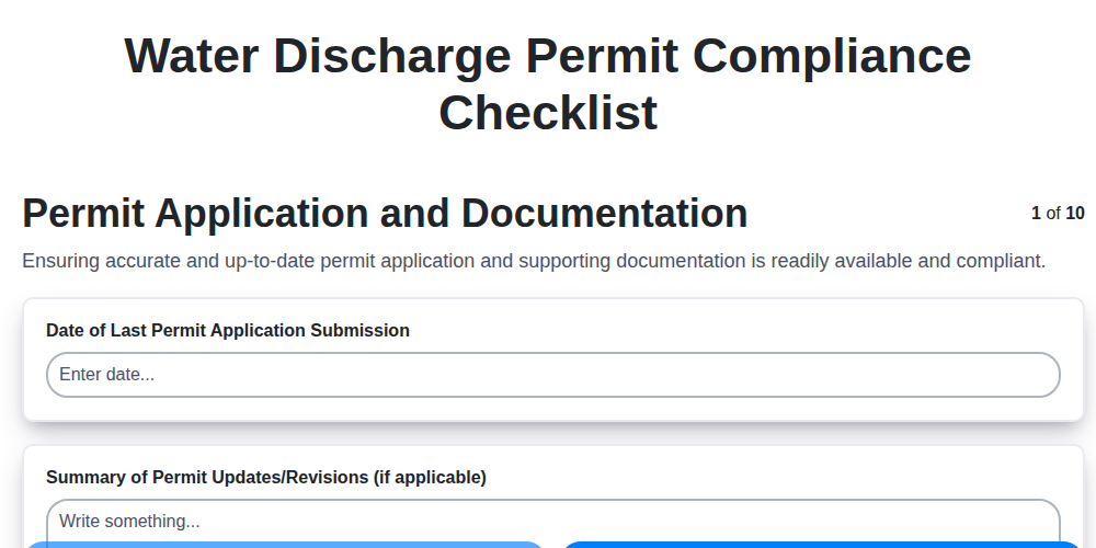
Water Discharge Permit Compliance Checklist Template

The Ultimate GPS & Precision Farming Calibration Checklist Template
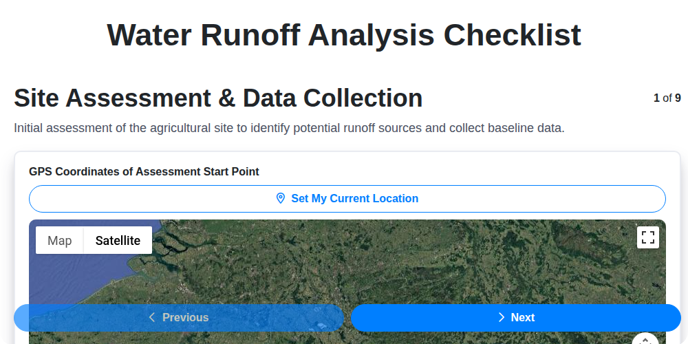
Water Runoff Analysis Checklist Template
We can do it Together
Need help with
Agriculture?
Have a question? We're here to help. Please submit your inquiry, and we'll respond promptly.