Drone Flight Operations Checklist: Streamlining Farm Management with Drones
Published: 11/22/2025 Updated: 12/13/2025
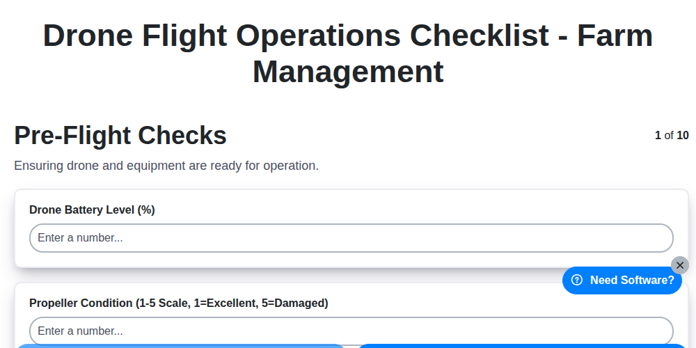
Table of Contents
- Introduction: Drones and the Future of Farm Management
- Why a Drone Flight Operations Checklist is Essential
- 1. Pre-Flight Checks: Setting the Foundation for Success
- 2. Weather Assessment: Flying Safe in Any Conditions
- 3. Flight Planning & Area Survey: Maximizing Efficiency
- 4. Regulatory Compliance & Permissions: Staying on the Right Side of the Law
- 5. Drone & Payload Inspection: Ensuring Optimal Performance
- 6. Battery & Power Management: Avoiding Mid-Flight Disruptions
- 7. Geofence & Safety Settings: Defining Boundaries and Preventing Accidents
- 8. Flight Execution: Best Practices for Smooth Operations
- 9. Post-Flight Procedures: Securing Your Assets
- 10. Data Management & Analysis: Turning Data into Actionable Insights
- 11. Checklist Customization: Adapting to Your Farm's Needs
- Conclusion: Elevating Farm Management with a Robust Drone Program
- Resources & Links
TLDR: Flying drones for farm management? This checklist ensures safe, compliant, and efficient operations! It covers everything from pre-flight checks and weather assessment to data analysis, minimizing risk and maximizing the value of your drone data for better crop monitoring and decision-making.
Introduction: Drones and the Future of Farm Management
The agricultural landscape is rapidly evolving, and technology is at the forefront of this transformation. Drones, or Unmanned Aerial Vehicles (UAVs), have emerged as a powerful tool for farm management, offering a bird's-eye view and data-driven insights previously unattainable. No longer a futuristic fantasy, drone technology is now a practical and cost-effective solution for a wide range of farming operations, from crop health monitoring and irrigation management to livestock tracking and yield optimization. This isn't just about taking pretty pictures; it's about leveraging aerial data to make informed decisions, improve efficiency, reduce input costs, and ultimately, increase profitability. This blog post will guide you through a comprehensive checklist to ensure safe, compliant, and effective drone flight operations on your farm. Let's explore how drones are shaping the future of agriculture and how you can harness their potential.
Why a Drone Flight Operations Checklist is Essential
Flying a drone for farm management offers incredible benefits - from crop health assessments to precision irrigation planning. However, those benefits are only realized safely and effectively with a meticulous approach. A drone flight operations checklist isn't just a formality; it's the cornerstone of responsible and successful agricultural drone usage.
Think of it as your pilot's manual for every mission. Skipping steps can have serious consequences, including drone damage, injury, legal penalties, and wasted time. A checklist ensures consistency, reduces errors, and minimizes risk. It provides a systematic way to cover all critical aspects of a flight, from initial planning to data processing. Furthermore, it demonstrates due diligence - a vital factor if any incident occurs. Ultimately, a checklist transforms a potentially complex and risky operation into a predictable and productive workflow, maximizing your return on investment and ensuring the long-term viability of your drone program.
1. Pre-Flight Checks: Setting the Foundation for Success
Before even thinking about takeoff, a thorough pre-flight check is absolutely crucial for safe and successful drone operations on your farm. Skipping steps here can lead to equipment damage, injury, or even legal repercussions. This isn't just about ticking boxes; it's about ensuring everything is functioning optimally and identifying potential issues before they become problems in the air.
Here's what should be included in your pre-flight checklist:
- Visual Inspection of the Drone: Look for any cracks, dents, or signs of wear on the frame, propellers, and motors. Pay close attention to the gimbal - ensure it moves freely and is properly aligned.
- Propeller Integrity: Examine each propeller for chips, cracks, or bends. Replace any damaged propellers immediately. Even a small imperfection can significantly impact flight stability.
- Secure Components: Verify that all components - battery, camera, gimbal, and any specialized sensors - are securely attached to the drone.
- Firmware Updates: Check for and install any available firmware updates for the drone and controller. Manufacturers often release updates to improve performance and address potential issues.
- Controller Functionality: Test the controller's buttons, joysticks, and display to ensure they're functioning correctly. Confirm adequate signal strength and range.
- GPS Signal Acquisition: Ensure the drone has acquired a strong GPS signal before takeoff. A weak signal can affect flight stability and make landing more challenging.
- Calibrate Sensors: Calibrate the drone's compass and IMU (Inertial Measurement Unit) as required, following the manufacturer's instructions. This is especially important if you're flying in a new location or have moved the drone significantly.
2. Weather Assessment: Flying Safe in Any Conditions
Before even thinking about powering up your drone for farm management tasks, a thorough weather assessment is absolutely crucial. Even seemingly benign conditions can quickly turn a routine flight into a hazardous situation.
Here's what to consider:
- Wind Speed & Direction: Wind is the biggest enemy of drone stability. Check forecasts for sustained wind speeds and gusts. Most drones have maximum wind speed limitations - exceeding these can lead to loss of control. Pay close attention to crosswinds, which are particularly challenging.
- Precipitation: Rain, snow, or even heavy fog significantly impact drone performance and visibility. Most manufacturers advise against flying in precipitation due to potential damage to the drone's electronics and reduced control.
- Temperature: Extreme temperatures can affect battery performance and drone components. Consult your drone's specifications for acceptable operating temperature ranges.
- Visibility: Ensure clear visibility throughout your planned flight path. Haze, fog, or smoke can severely limit your ability to see and avoid obstacles.
- Cloud Cover: Be aware of cloud base height, especially if flying near airports or controlled airspace. Low-hanging clouds can pose a collision risk.
- Lightning: Never fly in the presence of lightning. Drones are not safe to operate during thunderstorms.
- Utilize Reliable Weather Sources: Don't rely on a single source. Cross-reference weather forecasts from multiple reputable sources (e.g., aviation weather websites, local weather apps) and consider on-site observations.
Remember, safety is paramount. If there's any doubt about weather conditions, postpone the flight. It's always better to be safe than sorry.
3. Flight Planning & Area Survey: Maximizing Efficiency
Before you even think about taking off, meticulous flight planning is crucial for efficient and insightful farm management using drones. Simply flying around haphazardly won's yield valuable data; a strategic approach will significantly enhance your results.
Define Your Objectives: What specific information are you seeking? Are you assessing crop health, identifying irrigation issues, monitoring livestock, or mapping field boundaries? Clearly defining your goals dictates the necessary flight parameters and sensor choices.
Area Survey & Route Planning: Utilize readily available tools like Google Earth, aerial imagery, or farm mapping software to thoroughly survey the area. Identify potential hazards - power lines, trees, buildings - and plan your flight path to avoid them. Consider overlapping flight lines for optimal orthomosaic and 3D model creation. Higher overlap generally means better data quality.
Altitude & Ground Sampling Distance (GSD): Determine the optimal flight altitude based on your objectives and sensor capabilities. Lower altitudes (e.g., 50-100 feet) provide higher resolution imagery (smaller GSD) for detailed inspections, while higher altitudes (e.g., 150-300 feet) cover larger areas quickly. Remember, a smaller GSD requires more flight time and battery power.
Flight Path Optimization: Plan efficient flight patterns, like grid patterns or parallel sweeps, to ensure complete coverage. Consider using automated flight planning software to streamline the process and minimize manual adjustments. Account for wind direction and speed to maintain consistent flight lines and avoid drift.
Multiple Flight Missions: For larger farms or complex areas, break down your flight plan into smaller, manageable missions. This simplifies the process, allows for adjustments based on initial data, and helps manage battery life.
Ultimately, a well-planned flight translates to valuable insights and efficient use of your drone's capabilities.
4. Regulatory Compliance & Permissions: Staying on the Right Side of the Law
Flying a drone for farm management isn't as simple as just taking off. You absolutely must understand and adhere to all applicable regulations. Failure to do so can result in hefty fines, legal action, and even suspension of your drone operating privileges.
Understanding the Landscape:
Regulations vary significantly based on your location. In the US, the FAA (Federal Aviation Administration) is the primary governing body. Internationally, you'll need to research the specific aviation authority in your country. Key areas to consider include:
- Part 107 Certification (US): If you're operating commercially (which farm management typically is), you'll likely need to obtain a Part 107 Remote Pilot Certificate. This requires passing an FAA knowledge test and meeting certain eligibility requirements.
- Visual Line of Sight (VLOS): Most regulations require maintaining visual line of sight with your drone at all times.
- Night Operations: Night flights generally require additional FAA waivers and specific equipment.
- Beyond Visual Line of Sight (BVLOS): Flying beyond your line of sight is restricted and generally requires waivers, which are difficult to obtain.
- Altitude Restrictions: There are maximum altitude limits you must adhere to.
- No-Fly Zones: Be acutely aware of restricted airspace, including airports, national parks, and other sensitive areas. Utilize FAA-approved airspace awareness apps (like B4UFLY) to confirm flight legality.
- State and Local Laws: Beyond federal regulations, state and local governments may have additional restrictions, such as privacy laws or limitations on drone use near certain structures. Research these carefully.
- Landowner Permission: Always obtain permission from the landowner before flying over their property, even if it's your own farm.
Staying Compliant:
- Consult Official Sources: Refer directly to the FAA website (https://www.faa.gov/) or your local aviation authority for the most up-to-date regulations.
- Stay Updated: Regulations can change frequently. Subscribe to aviation authority updates and regularly review changes.
- Document Everything: Keep records of permissions, waivers, and pilot certifications.
- Privacy Considerations: Be mindful of privacy concerns when collecting data, particularly near neighboring properties.
Taking the time to understand and comply with regulations is crucial for safe, legal, and successful drone operations in farm management.
5. Drone & Payload Inspection: Ensuring Optimal Performance
Before every flight, a thorough inspection of your drone and any attached payload (like a multispectral camera or NDVI sensor) is absolutely critical. This isn't just about identifying obvious damage; it's about preventative maintenance and ensuring accurate data capture.
Drone Inspection:
- Frame & Body: Look for cracks, breaks, or any signs of impact damage. Even small imperfections can weaken the structure and affect flight stability.
- Propellers: Examine each propeller for chips, bends, or discoloration. Replace any damaged propellers immediately. Ensure they are securely fastened.
- Motors: Listen for unusual noises when spinning the motors (without the propellers attached - safety first!). Look for signs of overheating or damage to the motor windings.
- Gimbal: Test the gimbal's movement to ensure it operates smoothly and doesn't exhibit any binding or erratic behavior.
- Landing Gear: Check for damage or wear on the landing gear, especially if operating in rough terrain.
Payload Inspection (e.g., Camera, Sensor):
- Lens/Sensor Cover: Ensure the lens or sensor cover is clean and free from debris.
- Connections: Verify all connections between the drone and the payload are secure and undamaged.
- Calibration: If applicable, check the payload's calibration status. Recalibrate if necessary, following the manufacturer's instructions. (NDVI sensors often require regular calibration.)
- Functionality: Briefly test the payload's functionality. For cameras, take a test photo. For sensors, check for initial readings.
Documentation: Record any findings during the inspection in a maintenance log. Consistent, detailed records will help identify recurring issues and schedule proactive maintenance.
6. Battery & Power Management: Avoiding Mid-Flight Disruptions
Battery life is the single biggest factor determining flight duration. For farm management applications, a sudden power loss mid-flight can be disastrous, potentially losing valuable data and risking the drone itself. Here's a breakdown of battery and power management best practices:
Before Every Flight:
- Charge Status: Always start with fully charged batteries. Don't rely on estimations - verify the battery percentage displayed on your drone and charging system.
- Battery Health: Regularly monitor battery health through your drone's software. Batteries degrade over time and usage. Replace batteries exhibiting signs of reduced capacity or unusual behavior.
- Temperature Considerations: Cold temperatures significantly reduce battery performance. Allow batteries to warm up to room temperature before flying in colder conditions.
- Calculate Flight Time: Don't just look at the advertised maximum flight time. Factor in payload weight (sensors, cameras), wind conditions, and flight maneuvers. Always plan for a generous safety margin (at least 20-30%). Utilize your drone's flight planning software, which often provides estimated flight times based on the planned route and conditions.
During Flight:
- Monitor Battery Levels: Continuously monitor the battery percentage and remaining flight time displayed on your drone's screen and within the flight app.
- Avoid Excessive Power Draw: Aggressive maneuvers and flying against strong winds consume more power. Fly efficiently and anticipate wind conditions.
- Return to Home (RTH) Altitude: Familiarize yourself with your drone's Return to Home altitude setting and ensure there are no obstructions (trees, power lines) within that altitude that could impede a safe return.
Post-Flight:
- Proper Storage: Store batteries at a cool, dry place, ideally around 50% charge. Avoid leaving them fully charged or completely discharged for extended periods.
- Cycle Batteries: Follow the manufacturer's recommendations for battery cycling. This helps maintain battery health and prolong its lifespan.
By prioritizing battery and power management, you'll significantly reduce the risk of unexpected power loss and ensure consistent, reliable data acquisition for your farm management operations.
7. Geofence & Safety Settings: Defining Boundaries and Preventing Accidents
Before even thinking about takeoff, meticulously configuring your drone's geofence and safety settings is paramount for responsible and safe farm management operations. These digital boundaries aren's just about following rules; they're your first line of defense against unintentional airspace violations and potential accidents.
Understanding Geofences: A geofence is a virtual perimeter you define around an area using your drone's flight planning software. Think of it as an invisible fence. You can establish multiple geofences - a large perimeter around your farm, smaller ones around sensitive areas like livestock pens or grain silos, and even specific no-fly zones.
Why are They Crucial?
- Airspace Protection: Prevents your drone from accidentally flying into restricted airspace, airports, or populated areas.
- Property Boundaries: Keeps your drone within your designated farmland, preventing it from straying onto neighboring properties and causing disputes.
- Sensitive Area Avoidance: Protects livestock, equipment, or other vulnerable areas from drone proximity.
- Return-to-Home (RTH) Confidence: Properly configured RTH settings, often tied to geofences, ensure the drone automatically returns to a designated location if signal is lost or battery levels are low.
- Pilot Error Mitigation: Acts as a safety net in case of pilot distraction or miscalculation during flight.
Beyond Basic Geofences: Advanced Safety Settings:
- Altitude Limits: Set maximum flight altitude to avoid obstacles and ensure compliance with regulations.
- No-Fly Zones: Program specific locations as completely off-limits.
- Automatic Hover & Pause: Configure the drone to automatically pause or hover if it detects obstacles.
- Emergency Procedures: Familiarize yourself with and test your drone's emergency landing protocols.
Always double-check your geofence and safety settings before every flight. A few minutes of proactive configuration can save you significant headaches - and potential legal repercussions - down the line.
8. Flight Execution: Best Practices for Smooth Operations
This is where your planning truly comes to life. But don't let excitement override safety and precision. Here's how to execute your drone flight with best practices:
1. Pilot Focus & Communication: Ensure the pilot is fully focused and free from distractions. Establish clear communication channels with any spotters or ground personnel. Use pre-defined terminology to avoid misunderstandings.
2. Visual Line of Sight (VLOS): Maintain constant visual contact with the drone throughout the entire flight. If using a spotter, ensure they are actively participating and communicating observations.
3. Controlled Ascent & Altitude: Begin with a controlled, vertical ascent to a safe altitude. Don't rush to the working altitude; allow the drone to stabilize and confirm GPS lock.
4. Consistent Flight Patterns: Adhere to your pre-planned flight path as closely as possible. Consistent flight patterns improve data consistency and repeatability. Consider automated flight modes (like grid patterns) to enhance accuracy, but always be prepared to take manual control.
5. Monitor Drone Performance: Continuously monitor the drone's telemetry data, including battery level, signal strength, and GPS accuracy. Be prepared to adjust the flight plan or initiate a landing if conditions change.
6. Dynamic Obstacle Avoidance: While the drone likely has obstacle avoidance systems, don't solely rely on them. Actively scan the area for potential hazards, including livestock, people, and infrastructure.
7. Gradual Maneuvers: Avoid abrupt changes in direction or speed. Smooth, controlled maneuvers are safer and improve data quality.
8. Contingency Planning: Be prepared for unexpected events - a sudden wind gust, a system error, or a change in ground conditions. Have a clear plan for aborting the flight and returning safely.
9. Post-Flight Procedures: Securing Your Assets
The flight itself is only half the battle. Proper post-flight procedures are crucial for data integrity, drone longevity, and ensuring a smooth workflow. Don't skip these steps!
Immediate Actions Upon Landing:
- Secure the Drone: Park the drone in a safe, level area, away from livestock, people, and potential hazards. Engage the parking brake (if equipped) or otherwise stabilize it.
- Initial System Check: Briefly review the drone's onboard system messages for any error codes or warnings that may have occurred during the flight. Note these down for later review.
- Battery Removal & Storage: Immediately remove the drone batteries and payload batteries (if applicable). Store them according to manufacturer guidelines - typically in a cool, dry place away from direct sunlight. Don't leave batteries charging unattended.
- Propeller Inspection: Quickly inspect the propellers for any damage (nicks, cracks, bends). Even minor damage can affect flight performance and safety. Replace damaged propellers immediately.
Data Transfer & Storage:
- Data Download: Transfer all recorded data (photos, videos, sensor data) from the drone's internal storage to a secure location on your computer or cloud storage. Verify the data transfer was successful.
- Data Backup: Create a backup of the downloaded data to a separate storage medium (external hard drive, cloud service). Redundancy is key to preventing data loss.
- Metadata Tagging (Optional but Recommended): Add metadata to your files, including date, time, location, drone ID, flight purpose, and any relevant field notes. This streamlines data analysis and organization.
Drone Maintenance & Preparation for Next Flight:
- Clean the Drone: Remove any debris (dirt, dust, pollen, moisture) from the drone's body, sensors, and propellers. Use appropriate cleaning solutions as recommended by the manufacturer.
- Visual Inspection: Conduct a thorough visual inspection of the drone, including the frame, motors, gimbal, and landing gear. Look for any signs of wear and tear.
- Logbook Entry: Document the flight in a dedicated flight log. Include date, time, location, flight duration, pilot name, flight purpose, any issues encountered, and maintenance performed.
- Charging & Readiness: Begin charging batteries and prepare the drone for its next flight. Ensure all systems are functional and ready to go.
10. Data Management & Analysis: Turning Data into Actionable Insights
The beauty of drone imagery isn't just in the stunning visuals; it's in the valuable data it provides. But capturing the data is only half the battle. Effective data management and analysis are crucial for translating those images into actionable insights for your farm management decisions.
Here's a breakdown of key considerations:
- Data Storage & Organization: Implement a clear and consistent system for storing your drone imagery. Cloud storage solutions are highly recommended for accessibility and backup. Use descriptive file naming conventions and folder structures to easily locate specific flights and data sets. Metadata (date, time, drone model, flight parameters) is essential and should be meticulously recorded.
- Data Processing Software: Familiarize yourself with appropriate software for processing your data. Options range from free, open-source solutions (like QGIS) to subscription-based platforms specializing in agricultural drone imagery (e.g., DroneDeploy, Pix4D, AgEagle). These tools often automate tasks like orthomosaic generation, NDVI calculation, and 3D modeling.
- Key Metrics & Indices: Understand the agricultural indices and metrics relevant to your crops and farm goals. NDVI (Normalized Difference Vegetation Index) is a common starting point for assessing crop health. Other useful metrics include:
- NDRE (Normalized Difference Red Edge): More sensitive to subtle changes in vegetation health than NDVI.
- ReLI (Ratio of Late and Early Infrared): Helps identify stress issues before they are visible to the naked eye.
- Plant Count: Automated plant counting can provide crucial insights into seeding density and growth.
- Biomass Estimation: Drone imagery can be used to estimate crop biomass, aiding in yield predictions.
- Change Detection & Historical Analysis: Compare current imagery with historical data to identify trends in crop health, identify areas of concern, and evaluate the effectiveness of management practices.
- Integration with Farm Management Systems (FMS): Integrate your drone data with existing FMS to create a holistic view of your farm's performance and inform decisions related to irrigation, fertilization, and pest control.
- Data Security: Implement robust security measures to protect sensitive data from unauthorized access and ensure compliance with privacy regulations.
Remember, the data you collect is an investment. Proper data management and analysis unlock its full potential, empowering you to make smarter, data-driven decisions and optimize your farm's productivity and profitability.
11. Checklist Customization: Adapting to Your Farm's Needs
No two farms are exactly alike. Your soil types, crop varieties, field layouts, and operational priorities will all influence how you utilize drone technology. That's why a generic checklist, while a good starting point, shouldn't be your final document. Customization is key to maximizing safety and efficiency.
Consider these areas for tailoring your checklist:
- Specific Crop Needs: Does your checklist account for specific requirements related to the crops you're monitoring (e.g., nitrogen stress detection in corn, irrigation assessment in orchards)?
- Field Topography: Steep slopes or uneven terrain require adjustments to flight paths and altitude considerations. Add specific notes for these conditions.
- Equipment Variations: If you're using specialized payloads (multispectral cameras, thermal sensors, LiDAR), add checks specific to their calibration and functionality.
- Team Roles & Responsibilities: Clearly define who is responsible for each checklist item. Is it the pilot, a spotter, or a data analyst?
- Recurring Issues: If you consistently encounter certain challenges (e.g., interference from power lines, bird activity), add specific preventative measures to the checklist.
- Regular Review: Make a habit of reviewing and updating your checklist after each flight season or whenever you make changes to your drone setup or farming practices.
Ultimately, a well-customized checklist reflects a deeper understanding of your farm's unique needs and reinforces a commitment to safe and effective drone operations.
Conclusion: Elevating Farm Management with a Robust Drone Program
Implementing a well-defined drone flight operations checklist isn't just about ticking boxes; it's about building a foundation for safe, compliant, and truly valuable aerial data collection for your farm. By consistently following a comprehensive checklist-from pre-flight assessments to meticulous post-flight data management-you move beyond simple imagery to unlock actionable insights. This proactive approach minimizes risk, ensures regulatory adherence, and ultimately maximizes the return on your drone investment. As drone technology continues to evolve, so too should your operational procedures. Regularly review and update your checklist, incorporating new features and best practices. A robust drone program, guided by a solid checklist, isn't just a modern tool for farm management-it's a strategic advantage.
Resources & Links
- Federal Aviation Administration (FAA) - UAS (Drone) Resources: The official FAA website for drone regulations, safety information, and airspace authorizations. Essential for understanding legal requirements for commercial drone operations.
- Drone Pilot Ground School: Provides comprehensive drone pilot training and resources, including information on regulations, airspace, and best practices for safe and legal drone operations. Offers courses for Part 107 certification.
- Texas A&M AgriLife Extension Service: A comprehensive resource for agricultural information and technology, often including articles and guides on drone applications in farming and precision agriculture. Search their site for specific drone-related content.
- PrecisionAg: A leading publication covering precision agriculture technologies, including drones. Features articles, case studies, and industry news related to drone applications in farming.
- Crop Technology: Focused on agricultural technology, including drone applications. They frequently cover case studies and reviews of drone hardware and software solutions used in farming.
- DJI: A leading manufacturer of drone technology. Their website offers detailed product specifications, user manuals, and safety guidelines for DJI drones (a commonly used platform in agriculture).
- SenseFly: Provides mapping drones and software for various industries, including agriculture. Their website offers technical resources and case studies demonstrating drone applications in farming.
- Skyward (Part of Honeywell): Provides drone flight planning, airspace authorization, and regulatory compliance tools. Can be helpful for streamlining the pre-flight authorization process. (Note: Honeywell has acquired Skyward)
- Geomapping Solutions: Offers drone mapping and data processing services and software. Provides resources related to orthomosaic creation and point cloud generation - important for deriving insights from drone imagery.
- USDA Natural Resources Conservation Service (NRCS): The NRCS may have resources related to drone use for environmental monitoring and agricultural conservation practices. Search their website for relevant information.
- Pymetrics: While not directly drone-related, their data analysis and insights platform highlights the importance of data interpretation - a critical element of turning drone data into actionable insights. Provides a useful perspective on analytical processes.
Frequently Asked Questions
What is the purpose of a drone flight operations checklist for farm management?
A checklist ensures a systematic and safe approach to drone flights, minimizing risks, ensuring data quality, and maintaining compliance with regulations. It helps streamline operations, prevents errors, and helps with consistency across different flights and operators.
Who should use this checklist?
Anyone involved in operating drones for farm management - from experienced pilots to those just starting out. It's beneficial for all levels of skill and experience.
What are the key sections included in this checklist?
The checklist typically covers pre-flight checks (drone & battery status, weather conditions, airspace clearance), in-flight procedures (flight path, camera settings), and post-flight activities (data download, drone maintenance).
Why is pre-flight weather assessment so important?
Weather conditions significantly impact flight safety and data quality. Wind, rain, visibility, and temperature all affect drone performance and image clarity. Ignoring weather can lead to accidents or unusable data.
What airspace regulations should I be aware of when flying a drone over farmland?
You must be aware of and adhere to all applicable airspace regulations. This includes understanding controlled airspace, restricted areas, and any temporary flight restrictions (TFRs). Resources like the FAA's B4UFLY app are invaluable.
How often should I perform maintenance on my drone and batteries?
Regular maintenance is crucial. Follow the manufacturer's recommendations for drone and battery maintenance. Batteries typically require cyclical charging and occasional inspection. Drones should be inspected for physical damage and functionality after each flight.
What is meant by 'geofencing' and why is it important?
Geofencing is a virtual boundary set around an area. It prevents your drone from flying outside of a defined zone. It's a safety feature that helps prevent accidental incursions into restricted areas and helps enforce operational boundaries.
What documentation should I keep regarding drone flights?
Maintain records of flight logs, maintenance records, pilot certifications, and any incidents or accidents. This documentation is important for compliance and troubleshooting purposes.
How can I ensure the data collected by the drone is accurate and usable?
Proper camera settings, flight path planning, and ground reference points (GCPs) are essential. Calibrating sensors and ensuring accurate GPS data contribute to high-quality, usable data for farm management decisions.
What should I do if I encounter an unexpected situation during a flight?
Immediately assess the situation, prioritize safety, and follow your pre-planned emergency procedures. Be prepared to land the drone if necessary and report any incidents promptly.
Found this Article helpful?
Farm Management Solution Demo
Grow your farm smarter & more efficiently! ChecklistGuro streamlines crop planning, task management, & resource tracking. Maximize yields, reduce waste, & improve profitability. Manage it all with our Work OS.
Related Articles
Unlock Higher Yields: Your Precision Agriculture Checklist Template
The Ultimate Farm Safety Inspection Report Checklist Template
Irrigation System Checklist: Farm Water Management & Crop Yield Optimization

Livestock Health & Welfare Checklist: Your Farm Animal Care & Biosecurity Template
Crop Insurance Policy Review Checklist: A Farmer's Guide
Water Discharge Permit Compliance Checklist Template

The Ultimate GPS & Precision Farming Calibration Checklist Template
Mapping the Threat: A Checklist for Proactive Pest & Disease Pressure Management
We can do it Together
Need help with
Farm Management?
Have a question? We're here to help. Please submit your inquiry, and we'll respond promptly.