Unlock Higher Yields: Your Precision Agriculture Checklist Template
Published: 09/01/2025 Updated: 12/13/2025
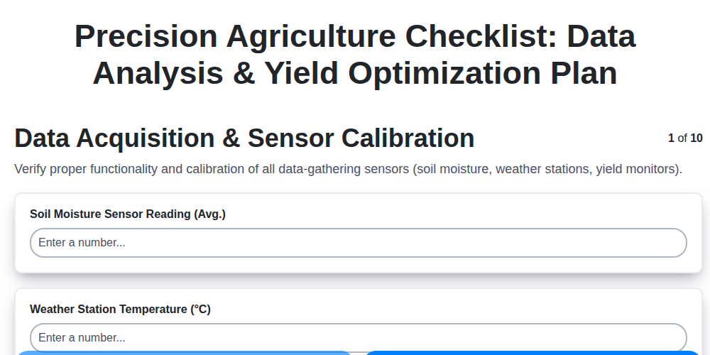
Table of Contents
- Embrace Precision: Why a Checklist is Your Key
- Data Foundation - Sensors & Storage
- Data Cleaning & Processing: Refining Your Insights
- Spatial Analysis: Mapping Yield Potential
- Variable Rate Application: Targeted Interventions
- Precision Irrigation: Water Management Strategies
- Nutrient Optimization: Feeding Your Crops Right
- Performance Evaluation: Measuring Your Success
- Resources & Links
TLDR: Struggling to manage all aspects of precision ag? This free checklist template breaks down data analysis, application planning, and ongoing optimization (yield maps, variable rates, irrigation, pest control) into manageable steps. Download it now to streamline your workflow, maximize efficiency, and boost your farm's performance!
Embrace Precision: Why a Checklist is Your Key
Let's be honest: diving into precision agriculture can feel overwhelming. There's a lot of data to collect, analyze, and act upon. It's easy to get lost in the details, miss crucial steps, or simply feel unsure where to start. That's precisely why a detailed checklist isn't just helpful - it's absolutely essential.
Think of it this way: a checklist transforms a complex, intimidating process into a series of manageable tasks. It provides structure, ensures consistency, and reduces the risk of costly errors. It's your roadmap to precision, guiding you through each step, from initial data collection to ongoing performance evaluation.
Beyond simply remembering tasks, a robust checklist fosters accountability. It provides a tangible record of actions taken, allowing you to track progress, identify areas for improvement, and demonstrate the value of your precision agriculture investments. It's not about just doing - it's about doing it right, every time. Ultimately, embracing this structured approach isn't just about optimizing yields; it's about building a more efficient, sustainable, and profitable farm for the future.
Data Foundation - Sensors & Storage
Before you can analyze and optimize, you need a reliable foundation of data. This initial phase focuses on acquiring, calibrating, and securely storing the raw information that fuels your precision agriculture efforts. Think of it as building the bedrock for your entire operation - a shaky foundation will undermine everything else.
Sensor Selection & Placement: Choosing the Right Tools
The first step is selecting the right sensors for your specific needs. Common sensors include yield monitors (critical for understanding historical performance), soil sensors (monitoring moisture, temperature, and nutrient levels), weather stations (providing localized climate data), drones (offering aerial imagery and multispectral analysis), and satellite imagery (for broad-scale assessments). Consider factors like cost, accuracy, ease of use, and compatibility with your data management system.
Proper placement is equally important. Yield monitors need to be calibrated regularly to ensure accuracy. Soil sensors should be strategically placed to represent different areas within fields. Weather stations should be located in open areas, away from obstructions. Drones need appropriate flight planning and camera angles to capture relevant data.
Calibration is Key: Don't underestimate the importance of sensor calibration. Incorrectly calibrated sensors will generate inaccurate data, leading to flawed decisions. Follow manufacturer recommendations for calibration procedures and frequencies. Document all calibration activities meticulously.
Secure & Accessible Data Storage: Once you're collecting data, you need a robust system for storing and managing it. Options range from basic spreadsheets to sophisticated cloud-based platforms. Consider these factors when choosing a storage solution:
- Scalability: Can the system handle increasing volumes of data?
- Accessibility: Can you and your team easily access the data from various devices?
- Security: Is the data protected from unauthorized access and loss?
- Integration: Can the system integrate with other agricultural software and platforms?
- Data Backup: Implement a regular backup schedule to safeguard against data loss due to hardware failures or other unforeseen events.
A well-planned data foundation provides the crucial raw material for informed decision-making, setting the stage for a more efficient and productive farming operation.
Data Cleaning & Processing: Refining Your Insights
Raw data, fresh from the field, rarely presents itself in a perfectly usable form. It's often riddled with errors, inconsistencies, and missing values - the digital equivalent of weeds in a crop. This is where data cleaning and processing come in. Think of it as preparing the soil before planting; a solid foundation leads to a bountiful harvest of insights.
But what does "cleaning" actually entail? It's a multifaceted process that depends heavily on the types of data you're working with and the questions you're trying to answer. Here are some common tasks:
- Identifying and Removing Outliers: These are data points that fall far outside the expected range. They could be caused by equipment malfunctions, human error during data entry, or unusual environmental conditions. While not all outliers are errors, it's crucial to investigate them to ensure they aren't skewing your analysis.
- Handling Missing Values: Missing data is a common problem. You can address this by either removing rows with missing values (use sparingly to avoid losing valuable information), imputing missing values using statistical methods (e.g., mean, median, or more sophisticated techniques), or simply flagging them for further investigation.
- Correcting Inconsistent Formatting: Data from different sources (e.g., soil sensors, weather stations, yield monitors) may use different units or formats. Standardizing these ensures accurate comparisons and calculations. For example, converting all rainfall data to millimeters or ensuring all dates are in a consistent format.
- Data Transformation: Sometimes, simply cleaning isn't enough. Transformations, like converting categorical data into numerical representations or standardizing variables, can improve the performance of certain analytical models.
- Geospatial Correction: If your data has a location component (latitude, longitude, field boundaries), you may need to correct for errors in GPS coordinates or ensure accurate alignment with aerial imagery.
While these tasks can seem tedious, remember that "garbage in, garbage out" applies directly to data analysis. Investing time in data cleaning and processing upfront will significantly improve the reliability and accuracy of your insights, ultimately leading to more informed decision-making and a healthier, more profitable farm. Several software packages, from simple spreadsheet programs to specialized GIS software, offer tools to streamline these processes. Don't be afraid to explore and find what works best for your workflow.
Spatial Analysis: Mapping Yield Potential
Spatial analysis is where the magic happens - transforming raw data into actionable insights about your farm's performance. At its core, it's about visualizing and interpreting patterns within your fields. Let's break down the key techniques and what they reveal.
Yield Mapping: A Bird's-Eye View of Productivity
A yield map is the cornerstone of spatial analysis. Generated from your combine's yield monitor data, these maps display the amount of grain produced across your field, using color gradients to represent different yield levels. A quick glance can highlight areas of consistently high or low productivity, often revealing underlying issues.
Beyond the Surface: Interpreting Yield Map Patterns
Don's just look at the colors! Consider the context. A low-yielding area might be due to:
- Soil Variability: Differences in soil type, nutrient levels, or water-holding capacity.
- Topography: Slopes or depressions can impact drainage and sunlight exposure.
- Compaction: Heavily trafficked areas often experience reduced yields.
- Pest or Disease Pressure: Uneven distribution of pests or diseases can create localized yield gaps.
- Management Practices: Variations in planting density, fertilizer application, or irrigation.
Zoning for Targeted Management
Once you've analyzed your yield maps, the next step is zoning. This involves dividing your field into smaller, manageable areas - zones - based on observed patterns. Zones can be defined by color ranges on your yield map, or by combining yield data with other factors like soil maps, elevation data, or historical data.
Benefits of Zoning:
- Variable Rate Applications: Apply fertilizers, pesticides, or seeds at rates tailored to the specific needs of each zone.
- Targeted Soil Amendments: Address localized soil deficiencies or compaction issues.
- Improved Resource Allocation: Optimize your use of inputs and labor.
- Refined Management Decisions: Make informed decisions about crop selection, planting techniques, and irrigation strategies.
By understanding the "why" behind the patterns you see on your spatial analysis maps, you can move beyond simply observing the data and start implementing truly effective, site-specific management practices.
Variable Rate Application: Targeted Interventions
The real power of precision agriculture isn't just in gathering data; it's in using that data to take targeted action. Variable Rate Application (VRA) allows us to move beyond blanket treatments and deliver inputs - fertilizers, pesticides, herbicides, seeds - exactly where they's needed, and in the right amount. This minimizes waste, maximizes efficiency, and protects both your bottom line and the environment.
So, how does it work? Once we've analyzed spatial data - think yield maps, soil nutrient levels, or even drone imagery highlighting weed infestations - we create prescription maps. These maps act as digital recipes, instructing our variable rate applicators to adjust the application rate based on the specific needs of each zone within the field.
Let's break down a few common examples:
- Variable Rate Fertilization: Instead of applying the same amount of nitrogen across the entire field, we might prescribe higher rates in areas showing lower historical yields (perhaps due to soil deficiencies) and lower rates in areas with abundant fertility. This prevents over-fertilization in already productive zones, reducing nutrient runoff and environmental impact.
- Variable Rate Seeding: Adjust seeding rates based on soil type and historical yield patterns. For example, areas with poorer soil or a history of low yields might receive a higher seeding rate to compensate.
- Variable Rate Spraying: Imagine identifying patches of heavy weed infestation through drone imagery. VRA allows us to precisely target those areas with herbicide, reducing overall chemical usage and minimizing exposure to non-target plants.
Implementing VRA requires careful planning and calibration. Accurate prescription maps are crucial, and your equipment needs to be properly configured and maintained. However, the potential return on investment - through increased yields, reduced input costs, and enhanced sustainability - makes it a vital component of a modern, data-driven farming operation.
Precision Irrigation: Water Management Strategies
Traditional irrigation often relies on broad, generalized schedules, frequently leading to either overwatering or underwatering. Precision irrigation, however, moves beyond this guesswork, utilizing data to optimize water delivery and maximize crop yields while minimizing waste. Several key strategies contribute to this data-driven approach:
1. Soil Moisture Monitoring: The foundation of precision irrigation is understanding the actual moisture content within the root zone. Soil moisture sensors, ranging from simple capacitance probes to sophisticated network systems, provide real-time data on water availability. These sensors can be strategically placed throughout the field to account for variability in soil type and topography. Regular monitoring allows for timely adjustments to irrigation schedules, ensuring crops receive the precise amount of water they need, when they need it.
2. Evapotranspiration (ET) Modeling: ET represents the combined loss of water from the soil through evaporation and from the plants through transpiration. By integrating weather data - including temperature, humidity, wind speed, and solar radiation - ET models can estimate crop water needs. These estimations can be further refined by considering crop coefficients, which vary based on crop type and growth stage. Comparing ET estimates with soil moisture readings provides a complete picture of water balance.
3. Variable Rate Irrigation (VRI): VRI technology allows for the application of different amounts of water to different areas of a field. This is particularly valuable in fields with significant soil variability, uneven topography, or differences in crop water requirements. VRI systems, often integrated with GPS technology, allow applicators to precisely deliver water based on pre-defined maps generated from soil moisture data, yield maps, or remote sensing imagery. This targeted approach minimizes water waste and maximizes efficiency.
4. Remote Sensing and Drone Imagery: Aerial imagery, including multispectral and thermal imagery captured by drones or satellites, provides valuable insights into crop health and water stress. Areas exhibiting signs of water deficit, such as wilting or discoloration, can be identified and prioritized for irrigation. This proactive approach allows for early intervention and prevents yield losses.
5. Integration with Weather Forecasting: Incorporating short-term and long-term weather forecasts into irrigation decisions can further optimize water management. Anticipating rainfall events allows for reducing or pausing irrigation, preventing overwatering and conserving water resources. Similarly, predicting heat waves or drought conditions allows for proactive adjustments to irrigation schedules to mitigate stress on crops.
Nutrient Optimization: Feeding Your Crops Right
Effective nutrient management isn't about blindly applying fertilizer; it's about understanding your soil's unique needs and delivering the right nutrients at the right time and place. Soil testing remains the cornerstone of this process. Regular testing, ideally conducted every 2-3 years, provides invaluable data on macro- and micronutrient levels, pH, and organic matter content - all critical factors influencing nutrient availability and plant uptake.
But soil tests alone aren't enough. Integrating this data with yield maps, remote sensing data (NDVI imagery from drones or satellites), and crop growth stage information allows for a truly tailored nutrient management plan. For example, a yield map might reveal consistently lower yields in a particular field section, suggesting a nutrient deficiency. Coupled with a soil test showing low phosphorus levels, this triggers a targeted phosphorus application to that specific area, rather than a blanket application across the entire field.
Furthermore, consider the concept of nutrient use efficiency (NUE). Excessive fertilizer applications not only increase costs but also contribute to environmental pollution through runoff and leaching. Variable rate fertilization technology allows you to precisely apply nutrients based on spatial variability, maximizing plant uptake and minimizing waste. This precision approach often involves a combination of soil testing, yield mapping, and NDVI data to create prescription maps that guide fertilizer application rates. Finally, don't overlook the importance of organic matter. Increasing soil organic matter improves nutrient holding capacity, water infiltration, and overall soil health, contributing to a more resilient and productive cropping system.
Performance Evaluation: Measuring Your Success
It's not enough to simply do precision agriculture; you need to rigorously measure its impact. Performance evaluation isn's just a formality; it's your roadmap for continuous improvement. Start by identifying your Key Performance Indicators (KPIs). These are the metrics that truly reflect the success of your precision agriculture efforts.
Common KPIs to Track:
- Yield: The most obvious, but break it down by zone and treatment. Are your variable rate applications translating into measurable yield increases?
- Input Costs: Monitor fertilizer, pesticide, seed, and water usage. Has your precision approach reduced overall input costs per acre?
- Water Usage: Especially crucial for regions facing water scarcity. Are you optimizing irrigation and minimizing water waste?
- Return on Investment (ROI): Calculate the financial return on your precision agriculture investments. This helps justify ongoing expenses and identify areas where adjustments are needed.
- Soil Health Indicators: (e.g., organic matter content, bulk density) While not always directly tied to yield, these metrics provide valuable insights into long-term sustainability.
- Labor Efficiency: Has precision technology reduced the time and effort required for field operations?
Beyond the Numbers: Qualitative Observations
Don't solely rely on quantitative data. Qualitative observations - noting crop health, stand uniformity, or pest pressure - can provide valuable context and insights that numbers alone may miss. Maintain detailed field notes and photos throughout the growing season.
Regular Reporting and Analysis
Establish a regular reporting schedule (e.g., monthly, quarterly) to track your KPIs and identify trends. Compare your results to baseline data (yield maps, soil tests from previous years) to assess progress. Share your findings with your team, advisors, and stakeholders. This transparent communication fosters collaboration and encourages data-driven decision-making.
Tools for Performance Evaluation:
- Farm Management Software: Many platforms integrate data collection, analysis, and reporting capabilities.
- GIS Software: Geographic Information Systems (GIS) allow you to visualize and analyze spatial data.
- Spreadsheets: A simple spreadsheet can be surprisingly effective for tracking KPIs.
Resources & Links
- PrecisionAg : A leading industry resource for precision agriculture news, insights, and technology advancements. Covers all aspects of precision farming.
- Agri-Globe : A global platform connecting farmers, researchers, and technology providers in the precision agriculture space. Excellent for exploring international perspectives and emerging technologies.
- Trimble Agriculture : Trimble is a major provider of precision farming technology, including guidance systems, displays, and data management solutions. Provides in-depth product information and application examples.
- John Deere Agriculture : John Deere offers a comprehensive suite of precision agriculture technologies, from machinery to data platforms. Explore their solutions and learn about best practices.
- CLAAS Precision Farming : CLAAS offers precision farming solutions integrated into their agricultural machinery. Discover how data integration and automated processes can improve efficiency.
- Topcon Agriculture : Topcon provides guidance and control systems, variable rate application technology, and other precision agriculture tools. Focuses on advanced sensor technology and automation.
- YieldSense : Specializes in drone-based crop health monitoring and analytics. Provides high-resolution imagery and actionable insights for precision agriculture.
- Granular : Provides a farm management platform focused on data-driven decision making, planning, and financial insights for agricultural operations.
- Climate FieldView : A data analytics platform from Bayer, designed to help farmers make informed decisions by integrating field data with weather and agronomic information.
- Esri Agriculture : Esri is a leading provider of GIS (Geographic Information System) software used extensively in precision agriculture for spatial analysis and mapping. Useful for understanding spatial data and mapping yield potential.
- Sensor Gens : Focuses on advanced sensors and data solutions tailored for agricultural monitoring, environmental control and yield optimization.
- Pyne-Tec : Provides weather stations and soil monitoring systems for agriculture. Offers granular, real-time data to improve irrigation and nutrient management decisions.
- Agri Advanced : Offers soil sensing technology for precision nutrient management. Provides data on soil composition and provides actionable insights to optimize fertilizer usage.
Frequently Asked Questions
What is precision agriculture and why is it important?
Precision agriculture (PA) uses technology to optimize farming practices. It involves using data (soil conditions, weather patterns, crop health) to make informed decisions about irrigation, fertilization, pest control, and more, ultimately leading to higher yields, reduced costs, and environmental sustainability.
What is a precision agriculture checklist template and how will it help me?
A precision agriculture checklist template is a structured guide outlining the steps and tasks needed to implement and maintain a precision agriculture system. It helps organize your efforts, ensures you don't miss crucial steps, and provides a framework for continuous improvement.
Who is this checklist template for?
This template is designed for farmers of all sizes and experience levels, from those just starting to explore precision agriculture to those already using some technology who want to refine their processes. It can be adapted for various crops and farming systems.
What types of technology does this checklist cover?
The checklist covers a range of technologies, including GPS, soil sensors, drone imagery, variable rate applicators, yield monitors, and data management platforms. It's designed to be flexible and applicable regardless of the specific technologies you utilize.
How do I customize the checklist template?
The template is provided as a starting point. You can add, remove, or modify tasks to align with your specific farm's needs, crop types, and available technology. We encourage you to personalize it to make it most effective for your operation.
What are the key areas addressed in the checklist?
The checklist covers areas such as planning, data collection, data analysis, variable rate application, maintenance of equipment, record-keeping, and continuous improvement. It aims to provide a comprehensive overview of PA implementation.
Do I need expensive equipment to use this checklist?
Not necessarily. While some tasks require specific equipment, the checklist also includes steps that can be performed with basic tools and observations. You can gradually adopt more advanced technologies as your budget allows.
What kind of data record-keeping is mentioned in the checklist?
The checklist emphasizes the importance of tracking data related to soil conditions, weather, input applications, yield, and equipment performance. This data is crucial for analyzing trends, identifying areas for improvement, and demonstrating the effectiveness of your PA practices.
Where can I find additional resources to help me implement precision agriculture?
The article provides some initial resources. You can also find valuable information from university extension programs, agricultural consultants, industry associations, and online forums dedicated to precision agriculture.
Is this checklist a one-time use or something I should use consistently?
This checklist is designed for consistent use. It should be reviewed and updated regularly to reflect changes in your farm practices, technology adoption, and changing environmental conditions.
Found this Article helpful?
Agriculture Management Solution Demo
Running a farm or agricultural business is complex. ChecklistGuro's Work OS platform simplifies your operations, from crop planning and irrigation management to livestock tracking and harvest scheduling. Increase efficiency, reduce waste, and boost yields! See how ChecklistGuro can revolutionize your agriculture business.
Related Articles

10 Simple Steps to a Healthy Drainage System: Your Checklist Template

Mastering the Daily Crop Scouting Report: Your [Specific Crop] Checklist Template
Irrigation System Checklist: Farm Water Management & Crop Yield Optimization
Unlock Your Garden's Potential: A Soil pH Verification Checklist
PPE Usage Checklist Template: Your Guide to Safety
Water Discharge Permit Compliance Checklist Template

The Ultimate GPS & Precision Farming Calibration Checklist Template
Water Runoff Analysis Checklist Template
We can do it Together
Need help with
Agriculture?
Have a question? We're here to help. Please submit your inquiry, and we'll respond promptly.