Ensuring Mine Safety: Your Geotechnical Stability Checklist Guide
Published: 11/20/2025 Updated: 04/10/2026
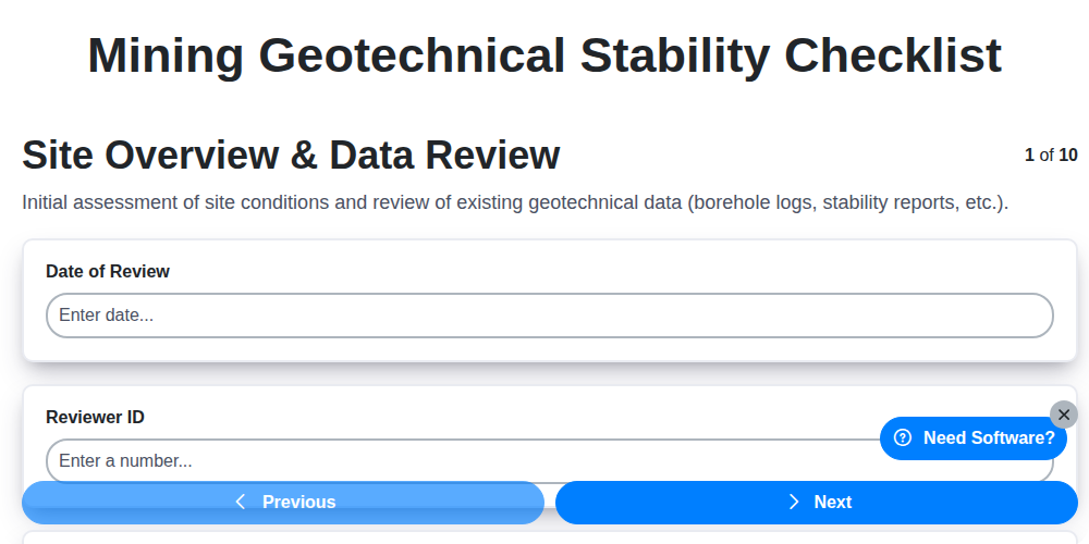
Table of Contents
- Introduction: Why Geotechnical Stability Matters in Mining
- 1. Site Overview & Data Review: Laying the Foundation
- 2. Slope Monitoring Equipment: Your Early Warning System
- 3. Visual Inspection - Ground Movement: Identifying Subtle Shifts
- 4. Visual Inspection - Support Systems: Assessing Structural Integrity
- 5. Water Management & Seepage: Controlling a Major Threat
- 6. Weather Condition Impacts: Predicting and Preparing
- 7. Equipment & Traffic Routes: Minimizing Induced Instability
- 8. Unstable Ground Identification: Recognizing the Signs
- 9. Mitigation Actions & Recommendations: Immediate and Long-Term Solutions
- 10. Prioritizing Mitigation Efforts: Risk Assessment
- 11. Follow-up & Reporting: Documentation and Continuous Improvement
- Conclusion: Proactive Stability Management for Mine Safety
- Resources & Links
TLDR: This checklist helps you proactively manage geotechnical risks in your mine! It's a step-by-step guide covering everything from initial data review to ongoing monitoring and reporting, ensuring ground stability, protecting personnel, and minimizing disruptions. Use it regularly to identify potential hazards, implement fixes, and keep your mine operating safely.
Introduction: Why Geotechnical Stability Matters in Mining
Mining operations inherently disrupt the earth, and ensuring geotechnical stability - the ability of rock and soil to remain in place - is paramount for safety, productivity, and environmental responsibility. Unstable ground can lead to catastrophic failures, impacting not only the mine itself but also surrounding communities and ecosystems. This isn't just about preventing collapses; it's about proactively managing risk and optimizing mine planning. A robust geotechnical stability program, incorporating regular assessments and proactive mitigation, minimizes downtime, protects personnel, and ensures the long-term viability of the mining operation. Ignoring these factors can result in costly delays, environmental damage, and, most importantly, endanger lives. This blog post will outline a practical checklist to guide your geotechnical stability assessments, ensuring a safer and more efficient mining process.
1. Site Overview & Data Review: Laying the Foundation
Before boots even hit the ground, a thorough site overview and data review is paramount. This isn't just about knowing the location; it's about understanding the historical context and potential vulnerabilities. Begin by compiling all existing geotechnical reports, geological maps, and previous stability assessments. Critically examine these documents for information regarding soil types, bedrock characteristics, past failures, and any prior mitigation efforts.
Beyond the formal reports, gather any available historical data - aerial photographs, local knowledge from long-term residents, even anecdotal evidence of past landslides or ground movement can be valuable. This paints a picture of the site's behavior over time. Carefully review topographic maps to understand the existing slope angles and potential runout zones in case of a failure. Finally, cross-reference all gathered data with current regulations and permit requirements. A solid foundation of knowledge at this stage significantly informs all subsequent checklist steps and contributes to a proactive approach to geotechnical stability.
2. Slope Monitoring Equipment: Your Early Warning System
Effective geotechnical stability isn't just about periodic inspections; it's about having a proactive, early warning system in place. That's where slope monitoring equipment comes in. These tools provide continuous or regularly scheduled data that can identify subtle changes indicative of potential instability before they become critical failures.
The specific equipment deployed will depend on the site's geology, slope geometry, and potential hazards, but common choices include:
- Inclinometers: These measure horizontal ground movement, crucial for detecting creep or slow deformation within the slope. They're often placed strategically along potential failure surfaces.
- Piezometers: Monitoring groundwater pressure is essential. Piezometers provide real-time data, allowing you to understand the influence of water on slope stability.
- Extensometers: Similar to inclinometers but specifically measure changes in distance between two points, useful for monitoring crack propagation or settlement.
- Strain Gauges: These detect deformation in structural elements like retaining walls or rock bolts.
- GPS/GNSS Monitoring: Provides data on surface movement and settlement over larger areas, particularly useful for tailings dams or expansive soils.
- Automated Weather Stations: Integrated weather data (rainfall, temperature, wind) helps correlate environmental factors with observed slope behavior.
Crucially, data from these instruments needs to be regularly reviewed and analyzed. Establish clear thresholds and trigger levels for alerts. Automated systems that send notifications upon exceeding these thresholds are highly recommended, ensuring prompt action and minimizing risk. Don't just install the equipment; use the data it provides.
3. Visual Inspection - Ground Movement: Identifying Subtle Shifts
Visual inspection for ground movement is a critical, ongoing process. It's not enough to just look; you need to observe and document. Look for subtle signs that might indicate instability before they escalate into major issues. Here's what to be vigilant about:
- Cracks: Note the location, width, length, and orientation of any cracks in the ground, pavement, or structures. Are they new? Have they widened or lengthened since the last inspection? Pay particular attention to cracks that appear to be consistently opening or closing.
- Bulging or Swelling: Look for areas where the ground appears to be pushing outward, creating a bulge or swelling. This can be a sign of subsurface movement.
- Settlement: Identify any visible sinking or lowering of the ground surface. This can be gradual and difficult to detect, so comparison with previous survey data or reference points is valuable.
- Deformation: Watch for unusual warping or distortion of the ground or any structures built upon it.
- Vegetation Stress: Stressed or dying vegetation can be an early indicator of ground movement, as roots are affected by changing soil conditions.
- Soil Heaving: Look for areas where the ground is pushing upward, often associated with moisture or gas pressure.
- Rockfalls/Debris Accumulation: At slopes, note any new rockfalls or accumulation of debris at the base, which can indicate slope instability.
Consistent, detailed documentation - photos, measurements, and notes - is essential. Create a log to track observations and compare them over time. Deviations from the baseline conditions should immediately trigger further investigation.
4. Visual Inspection - Support Systems: Assessing Structural Integrity
Support systems, whether they be rock bolts, soil nails, retaining walls, shoring, or other engineered solutions, are crucial for maintaining stability. A thorough visual inspection of these systems is paramount. This isn't just about looking; it's about critically assessing their condition and functionality.
Here's what to look for:
- Rock Bolts/Soil Nails: Check for corrosion, bending, or signs of pull-out. Examine the surrounding ground for bulging or cracking indicative of bolt failure or excessive stress. Note any signs of settlement around the plate.
- Retaining Walls: Inspect for cracking, tilting, bulging, or any movement relative to the surrounding ground. Pay close attention to drainage features - are they clear and functioning correctly? Look for vegetation growth near the wall, as this can indicate moisture issues and potential degradation.
- Shoring (e.g., Sheet Piling, Soldier Piles): Assess for corrosion, bending, and settlement. Check the connections between sections for looseness or failure. Ensure bracing is intact and effective.
- Concrete Structures: Look for cracks, spalling, and efflorescence (a white, powdery deposit indicating moisture migration). Assess for any signs of reinforcement corrosion.
- General Condition: Note any discrepancies between the as-built design and the actual installation. Document any unauthorized modifications or repairs.
Record the type, location, and condition of each support system element. Any signs of distress warrant further investigation and potential remedial action. Remember, preventative maintenance and timely repairs are far more cost-effective than dealing with a catastrophic failure.
5. Water Management & Seepage: Controlling a Major Threat
Water is a constant enemy in geotechnical stability. Whether it's rainfall infiltration, groundwater seepage, or surface runoff, excess water significantly reduces soil strength, increases pore pressure, and accelerates erosion - all contributing to instability and potential failure. A robust water management plan is therefore paramount.
This section of the checklist focuses on identifying and mitigating these water-related risks. It begins with examining existing drainage systems - are they functioning correctly? Are outlets clear and free from debris? Look for signs of ponding water, saturation, and areas where water is visibly seeping from the slope face or ground.
Pay close attention to the effectiveness of any installed water management infrastructure:
- Surface Water Diversion: Are ditches, swales, and culverts adequately diverting surface runoff away from the slope?
- Subsurface Drainage: Are weep holes and subsurface drains preventing groundwater buildup? Inspect for clogging and reduced flow.
- Impermeable Barriers: If present, assess the integrity of any impermeable membranes or liners. Look for cracks, tears, or signs of water penetration.
Documentation of observed water flow paths, ponding areas, and any evidence of seepage is critical. Record the type of vegetation present, as this can also impact water infiltration rates. Finally, this section prompts consideration of potential sources of water, like nearby water bodies or underground springs, which might necessitate further investigation and proactive management strategies.
6. Weather Condition Impacts: Predicting and Preparing
Weather plays a critical, and often unpredictable, role in geotechnical stability. Rainfall, freeze-thaw cycles, extreme temperatures, and even wind can significantly impact slope integrity and trigger instability. Ignoring these factors is a recipe for disaster.
Understanding the Risks:
- Rainfall: Increased pore water pressure reduces soil strength, saturates slopes, and can lead to landslides and debris flows. Intense, short-duration rainfall events are particularly dangerous.
- Freeze-Thaw Cycles: Water expands when it freezes, exerting pressure on soil and rock, weakening their structure and potentially leading to cracking and displacement. Thawing then creates pathways for further erosion and instability.
- Extreme Temperatures: High temperatures can cause thermal expansion and contraction of rock masses, potentially leading to cracking and loosening. Low temperatures exacerbate freeze-thaw effects.
- Wind: While less direct, strong winds can contribute to debris flow by mobilizing loose soil and vegetation.
Proactive Measures - Prediction & Preparation:
- Weather Forecasting: Regularly monitor short-term and long-term weather forecasts, paying close attention to precipitation intensity, duration, and temperature predictions. Utilize reliable weather services and consider incorporating specialized meteorological data relevant to your site.
- Rainfall Thresholds: Establish rainfall intensity-duration thresholds that trigger heightened monitoring or temporary operational adjustments. These thresholds should be site-specific and based on historical data and geotechnical assessments.
- Early Warning Systems: Consider implementing automated rainfall monitoring and early warning systems that alert personnel to potentially hazardous conditions.
- Vegetation Management: Maintain vegetation cover to intercept rainfall and reduce surface runoff. However, be aware that dense, mature vegetation can increase the load on slopes.
- Surface Water Diversion: Ensure adequate surface water drainage systems are in place to quickly remove excess water from the slope area.
- Contingency Plans: Develop and regularly review contingency plans for various weather scenarios, including temporary work stoppages, evacuation procedures, and emergency stabilization measures.
7. Equipment & Traffic Routes: Minimizing Induced Instability
Heavy equipment and frequent traffic can significantly contribute to slope instability, particularly in already vulnerable areas. The vibrations from machinery, the compaction of soil from repeated loading, and even the concentrated stresses from parked vehicles can trigger movement or exacerbate existing weaknesses.
A crucial step in geotechnical stability assessment is careful consideration of equipment and traffic routes. This includes:
- Route Planning: Prioritize routes that avoid steep slopes, known unstable areas, and areas with shallow overburden. Plan alternative routes in case primary routes become problematic.
- Load Restrictions: Implement and enforce load restrictions on vehicles traversing slopes. Consider reducing axle loads and tire pressure to minimize compaction.
- Vibration Mitigation: Limit the use of vibrating equipment near slopes. If unavoidable, schedule vibration-intensive operations during periods of reduced rainfall and when slopes are most stable. Explore using low-vibration alternatives where possible.
- Vehicle Staging Areas: Designate safe and stable areas for equipment parking and staging. Avoid locating these areas on or near slopes. Level ground is preferable.
- Traffic Management: Control traffic flow, especially during critical periods (e.g., after heavy rainfall). Consider temporary closures or reduced speeds.
- Regular Route Inspections: Conduct periodic inspections of traffic routes to identify any signs of rutting, ground deformation, or increased instability.
By proactively managing equipment and traffic, you can significantly reduce the risk of induced instability and protect the integrity of your slope.
8. Unstable Ground Identification: Recognizing the Signs
Identifying unstable ground is the critical step in ensuring geotechnical stability. It's not enough to just monitor; you need to be actively looking for tell-tale signs. These can range from subtle indicators to obvious, potentially dangerous, warnings. Here's what to look for:
Subtle Signs (Early Warning):
- Cracks: These are the most common indicator. Pay attention to their size, pattern, and direction. Hairline cracks can be a precursor to larger failures. Look for cracks in the ground surface, pavement, retaining walls, and building foundations.
- Settlement: Uneven ground settlement can be a sign of subsurface instability. This might manifest as tilted structures, sagging pavement, or changes in drainage patterns.
- Vegetation Stress: Unusual wilting, discoloration, or premature die-off of vegetation can indicate changes in soil moisture or ground movement.
- Changes in Drainage: Noticeable shifts in surface water flow or the appearance of new springs or seeps can be indicative of subsurface instability.
- Soil Creep: Slow, gradual movement of soil downslope, often visible as tilted trees or fences.
More Obvious Signs (Immediate Concern):
- Ground Movement: Visible slumping, bulging, or spreading of the ground surface.
- Rockfalls: Obvious displacement of rocks, especially on slopes.
- Deformation of Structures: Cracking, tilting, or shifting of retaining walls, buildings, or other structures.
- Sudden Ground Subsidence: A rapid sinking of the ground, which can be extremely dangerous.
- Audible Sounds: Rumbling, cracking, or popping sounds originating from the slope - a potential indicator of movement.
Important Note: Any of these signs, even seemingly minor ones, should trigger a more thorough investigation and potentially adjustments to your monitoring plan. Never ignore any potential indicators of instability.
9. Mitigation Actions & Recommendations: Immediate and Long-Term Solutions
Identifying unstable ground is only half the battle; implementing effective mitigation actions is crucial to ensuring safety and preventing further issues. These actions should be tiered, addressing immediate risks and establishing longer-term stability solutions.
Immediate Actions (Within 1-24 hours):
- Area Isolation & Evacuation: Immediately restrict access to the affected area and evacuate all non-essential personnel. Establish a secure perimeter.
- Emergency Stabilization: Implement short-term stabilization measures, such as shoring with timber, installing temporary retaining walls (e.g., sandbags, Jersey barriers), or diverting surface water flows. These are temporary fixes intended to reduce immediate risk.
- Slope Flattening (if feasible and safe): If conditions allow, carefully consider and implement shallow slope flattening to reduce the slope angle and decrease driving forces. This must be performed by experienced personnel and with constant monitoring.
- Increased Monitoring Frequency: Dramatically increase the frequency of slope monitoring using all available equipment to observe for any further movement or deterioration.
Long-Term Solutions (Weeks to Months):
- Detailed Geotechnical Investigation: Commission a thorough geotechnical investigation, including subsurface exploration (boreholes, geophysical surveys) and laboratory testing, to understand the root causes of instability.
- Permanent Support Systems: Design and install permanent support systems based on the findings of the geotechnical investigation. Options include:
- Retaining Walls: Gravity walls, cantilever walls, sheet pile walls, soil nail walls, anchored walls.
- Soil Nailing/Rock Anchoring: Strengthening the slope through ground reinforcement.
- Drainage Improvements: Implementing comprehensive drainage systems to reduce pore water pressure.
- Terracing/Benching: Creating a series of flat or gently sloping platforms.
- Slope Regrading: Altering the slope angle to a safer geometry.
- Vegetation Stabilization: Planting vegetation with strong root systems to bind the soil and reduce erosion.
- Improved Water Management: Implementing a sustainable water management plan, including surface drainage, subsurface drainage, and potentially groundwater control measures.
- Regular Inspections & Maintenance: Establish a preventative maintenance program to regularly inspect and maintain all mitigation measures and ensure their continued effectiveness.
Crucially, all mitigation actions must be designed and supervised by qualified geotechnical engineers.
10. Prioritizing Mitigation Efforts: Risk Assessment
Not all unstable ground conditions present equal risk. Mitigation efforts should be prioritized based on a thorough risk assessment, considering both the likelihood of failure and the potential consequences. This goes beyond simply identifying instability; it involves quantifying the threat.
Here's a breakdown of key factors to consider when prioritizing mitigation:
- Probability of Failure: How likely is the ground movement to occur? This is influenced by factors like the severity of observed movement, the type of ground conditions, and ongoing environmental factors (e.g., rainfall). Historical data and expert judgement are critical here.
- Consequence Severity: What are the potential impacts if failure does occur? Consider potential damage to infrastructure, injury to personnel, environmental impact, and disruption to operations. A small, localized instability posing minimal risk requires less urgent attention than a large slope threatening a critical roadway.
- Exposure: How many people or assets are exposed to the potential hazard? Increased exposure elevates the overall risk.
- Risk Matrix: Utilizing a risk matrix (e.g., plotting likelihood vs. severity) is a visual and effective way to categorize risks and prioritize response. High-likelihood, high-severity risks demand immediate and robust mitigation.
Prioritization isn't static. Re-evaluate the risk assessment after each round of mitigation and with any significant change in site conditions or weather patterns. This iterative process ensures resources are allocated effectively and allows for a proactive approach to geotechnical stability.
11. Follow-up & Reporting: Documentation and Continuous Improvement
The geotechnical stability checklist isn't a one-and-done exercise. Consistent follow-up and diligent reporting are crucial for maintaining long-term safety and proactively addressing potential issues. This final stage focuses on ensuring that actions taken are effective and that the process itself is continuously refined.
Key elements of this stage include:
- Detailed Record Keeping: Every observation, action taken, and recommendation should be meticulously documented. This includes dates, times, personnel involved, specific locations, photographic evidence, and a clear description of the findings. Digital platforms are highly recommended for ease of access, organization, and version control.
- Verification of Mitigation Actions: After implementing mitigation strategies, a follow-up inspection should be conducted to confirm their effectiveness. Did the actions achieve the desired outcome? Are there any unexpected consequences? Document these findings clearly.
- Trend Analysis: Regular review of historical checklist data allows for identification of trends. Are certain areas consistently showing signs of instability? Are particular support systems requiring more frequent maintenance? This information is invaluable for anticipating future problems.
- Feedback Loop: Share checklist findings and recommendations with relevant stakeholders - engineers, site managers, operators. Encourage open communication and solicit feedback on the checklist's usability and effectiveness.
- Checklist Refinement: The geotechnical stability checklist isn't static. Based on experience, observations, and feedback, the checklist should be reviewed and updated periodically to ensure it remains relevant and comprehensive. New potential hazards or changing site conditions may necessitate revisions.
- Reporting Structure: Establish a clear reporting structure to ensure findings are communicated to decision-makers in a timely and understandable manner. Reporting frequency should be determined by the assessed risk level of the site.
Ultimately, robust follow-up and reporting transforms the geotechnical stability checklist from a reactive tool into a proactive mechanism for continuous improvement and enhanced site safety.
Conclusion: Proactive Stability Management for Mine Safety
The geotechnical stability checklist outlined provides a framework for a proactive and systematic approach to managing ground stability risks in mining operations. It's not simply a box-ticking exercise; it's a living document that demands continuous assessment, adaptation, and commitment from all levels of personnel.
By consistently implementing these steps - from the initial data review and visual inspections to the diligent monitoring and follow-up reporting - we move beyond reactive responses to potential ground failures. This shift empowers us to identify vulnerabilities early, implement appropriate mitigation measures, and ultimately, safeguard the safety of our workforce, infrastructure, and the long-term viability of the mine.
Remember, geotechnical stability isn't a one-time problem to solve, but an ongoing responsibility. Embracing this checklist as a cornerstone of your safety protocols, coupled with continuous improvement and learning, is paramount to maintaining a stable and secure mining environment. The cost of preventative measures is always significantly less than the potential consequences of inaction.
Resources & Links
- Mine Safety and Health Administration (MSHA): The primary federal agency responsible for mine safety and health. Provides regulations, guidance, training materials, and accident reports. Essential for understanding legal requirements and best practices.
- Society for Mining, Minerals, and Exploration (SME): A professional society offering technical publications, conferences, and training courses on all aspects of mining, including geotechnical engineering. A valuable source for specialized knowledge and industry standards.
- International Council on Mining and Metals (ICMM): ICMM promotes sustainable development practices in the mining sector, and often addresses geotechnical stability as a key aspect. Provides guidance and reports related to responsible mining.
- GeoSyntec Consultants: A geotechnical consulting firm specializing in mining. Their website features case studies, technical papers, and insights into real-world geotechnical challenges in mining operations. Useful for seeing how principles are applied.
- Terra Model: Terra Model provides software and services for slope stability analysis and geotechnical design. Their site offers insights into slope monitoring technologies and modeling techniques. Focuses on digital solutions.
- Rock Science: Rock Science provides software and consulting services related to rock mechanics, slope stability, and ground support. Offers tools and expertise for assessing and mitigating geotechnical risks.
- Itasca Consulting Group: Itasca develops FLAC3D, a widely used software for geotechnical modeling. Their website has resources and tutorials on numerical modeling techniques relevant to slope stability analysis.
- Banner Engineering: Banner offers various sensing and monitoring technologies, including those relevant for geotechnical stability, such as tilt sensors, vibration monitoring, and automated data logging systems. Useful for understanding technical options.
- Dalton Controls: Dalton Controls supplies instrumentation and control systems that are vital for monitoring ground movement, water levels, and weather conditions in mining operations. Provides a view of equipment suppliers.
- Geotechnical Data: Provides access to geophysical data and geotechnical reports. While often commercial, it illustrates the importance of baseline data and ongoing data collection for informed decision-making.
- Roper Geotechnical: Roper Geotechnical specializes in geotechnical instrumentation and monitoring systems. Provides practical insights into equipment selection and data interpretation for slope stability management.
- Wermac: Wermac provides automated monitoring systems, including piezometers and extensometers, essential for accurately measuring ground deformation and water pressure in mining environments. Provides equipment options.
Frequently Asked Questions
Where can I find more detailed information about specific geotechnical techniques?
This checklist provides a general overview. For more detailed information on specific geotechnical techniques (e.g., ground support installation, rock bolting, shotcrete), consult relevant industry standards, engineering textbooks, and specialized training courses. Contacting a qualified geotechnical engineer is highly recommended for complex situations.
Found this Article helpful?
Mining Management Solution Demo
Maximize efficiency & safety in mining operations! ChecklistGuro streamlines task management, equipment tracking, and compliance reporting. Optimize workflows, reduce risk, & boost productivity. Manage it all with our Work OS.
Related Articles
Ensuring a Sustainable Future: Your Mine Rehabilitation & Closure Checklist Guide
Ensuring Safety & Efficiency: Your Mine Haul Road Inspection Checklist Guide
Mastering Mine Safety: Your Guide to the Ground Control Checklist
Mining Security Procedures Checklist: A Comprehensive Template for Safety
Ensuring Safety: Your Mining Incident Reporting Checklist Guide
Ensuring Safety Underground: Your Mine Traffic Management Checklist Guide
Ensuring Safety: Your Mining Explosives Handling Checklist Template
Ensuring Safety & Compliance: Your Mining Noise Monitoring Checklist Guide
We can do it Together
Need help with
Mining Management?
Have a question? We're here to help. Please submit your inquiry, and we'll respond promptly.