Mining Survey & Mapping Checklist: Ensuring Accuracy & Compliance
Published: 11/20/2025 Updated: 12/13/2025
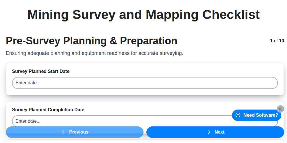
Table of Contents
- Introduction: The Importance of a Mining Survey & Mapping Checklist
- 1. Pre-Survey Planning & Preparation: Laying the Foundation
- 2. Control Point Verification: Establishing Accuracy
- 3. Data Acquisition - Ground Surveys: Precise Measurements
- 4. Data Acquisition - Aerial/Drone Surveys: Efficiency and Coverage
- 5. Data Processing & Adjustment: Refining the Data
- 6. Surface Mapping and Modeling: Visualizing the Landscape
- 7. Underground Mapping & Volumetric Calculations: Optimizing Resource Extraction
- 8. Datum and Coordinate System Consistency: Maintaining Spatial Integrity
- 9. Reporting & Documentation, Data Security & Storage: Ensuring Traceability and Safety
- Resources & Links
TLDR: This checklist is your guide to accurate and compliant mining survey and mapping. It covers everything from initial planning and control point checks to data processing, surface/underground mapping, and final reporting - ensuring your project adheres to standards, minimizes errors, and protects your valuable data.
Introduction: The Importance of a Mining Survey & Mapping Checklist
Mining operations, whether surface or underground, are inherently complex and risky endeavors. Accurate and reliable survey and mapping data are absolutely critical for everything from resource estimation and mine planning to safety, stability monitoring, and ultimately, profitability. Without a robust and consistently applied surveying process, companies risk costly errors, safety hazards, and inaccurate decision-making.
A comprehensive Mining Survey and Mapping Checklist isn't just a formality; it's a cornerstone of operational excellence. It serves as a standardized guide, ensuring each stage of the surveying process-from initial planning to final documentation-is diligently executed and adheres to best practices and regulatory requirements. This checklist mitigates risks, improves data quality, and fosters a culture of precision within the mining team. Investing in a well-defined and meticulously followed checklist is a proactive measure that safeguards your operation and maximizes your return.
1. Pre-Survey Planning & Preparation: Laying the Foundation
A successful mining survey and mapping project hinges on meticulous pre-planning. Rushing into data acquisition without a solid foundation is a recipe for inaccurate results, wasted resources, and potential safety hazards. This initial phase goes beyond simply defining the survey area; it's about understanding the project's objectives, anticipating challenges, and assembling the right team and equipment.
Here's what a robust pre-survey plan should include:
- Define Project Objectives: Clearly outline the purpose of the survey. Is it for resource estimation, slope stability assessment, mine planning, or environmental monitoring? The objective dictates the level of accuracy and the data required.
- Site Reconnaissance: Conduct a preliminary site visit to assess accessibility, terrain, potential hazards (e.g., unstable ground, water ingress, existing infrastructure), and prevailing environmental conditions.
- Regulatory Compliance: Identify and adhere to all relevant local, state, and federal regulations pertaining to surveying, mining operations, and environmental impact.
- Risk Assessment: Identify potential risks associated with the survey, including safety hazards, equipment failure, and weather-related disruptions. Develop mitigation strategies for each identified risk.
- Team Assembly & Roles: Define roles and responsibilities for each team member, ensuring appropriate skillsets and experience levels are assigned.
- Equipment Selection & Calibration: Choose surveying equipment appropriate for the project's scope and terrain. Ensure all equipment is calibrated and functional before deployment. This includes total stations, GPS/GNSS receivers, drones, and software.
- Develop a Survey Plan: Create a detailed survey plan outlining methodologies, control point locations, data acquisition schedules, and quality control procedures. This should be documented and readily available to the survey team.
- Budget and Timeline: Establish a realistic budget and timeline, factoring in potential delays and unexpected costs.
2. Control Point Verification: Establishing Accuracy
Before a single measurement is taken, rigorous control point verification is paramount for any successful mining survey and mapping project. These control points-precisely located and accurately known coordinates-form the bedrock of all subsequent data, ensuring the final deliverables are reliable and usable for engineering design, resource estimation, and mine planning.
Verification isn't just about confirming the existence of control points; it's about validating their accuracy. This process typically involves several key steps:
- Re-observation and Comparison: Independently re-observe the coordinates of existing control points using modern survey equipment (GNSS, total station). Compare these new observations with the original published coordinates. Significant discrepancies warrant investigation and potentially, adjustment or re-establishment of the control point.
- Independent Checks: Utilize different observation methods to check the same control points. For example, a GNSS observation can be checked with a total station traverse. Discrepancies highlight potential systematic errors in equipment or technique.
- Closure Checks: Perform traverse and loop closures to ensure the observations are consistent and geometrically sound. Large closure errors indicate problems with the survey network.
- Documentation of Verification Results: Meticulously record all verification results, including dates, equipment used, observer, and any adjustments made. This creates a traceable audit trail and allows for future quality checks.
- GNSS Data Quality Assessment: For GNSS control points, perform rigorous data quality assessments, including cycle slip detection, multipath analysis, and observation weighting.
- Regular Re-checking: Control points should be re-checked periodically, especially in areas subject to ground movement or disturbance.
Proper control point verification isn't an optional expense; it's an investment in the quality and defensibility of your mining data. Without it, even the most sophisticated mapping and modeling techniques are built on a shaky foundation.
3. Data Acquisition - Ground Surveys: Precise Measurements
Ground surveys form the bedrock of reliable mining survey and mapping. They provide the foundational data for everything else, so accuracy and meticulousness are paramount. This phase typically involves a team of experienced surveyors utilizing traditional surveying instruments like total stations, digital levels, and GPS/GNSS receivers.
Here's a breakdown of crucial considerations:
- Establishing a Traverse/Network: Before any measurements begin, a robust traverse or network must be established. This involves strategically placed points, accurately measured angles and distances, and rigorous checks for closure and redundancy.
- Instrument Calibration & Setup: Each instrument requires careful calibration and precise setup on stable points. Ensuring the instrument is level and plumb is critical for minimizing errors. Regularly checking and correcting for atmospheric refraction is also vital.
- Target Selection & Visibility: Choosing clear, stable targets is essential. Obstructions impacting visibility need to be identified and mitigated. Using prisms and reflectors can improve signal strength and accuracy.
- Multiple Observations: Never rely on a single measurement. Multiple observations (typically three or more) at each point are taken, then averaged to reduce random errors.
- Backsight and Foresight Measurements: Taking both backsight (measuring to a known point) and foresight (measuring to an unknown point) enhances accuracy and allows for error detection.
- Angle and Distance Measurements: Precise angle and distance measurements are recorded, ensuring careful attention to units and tolerances. Angle measurements require careful considerations of the instrument's vertical angle.
- Leveling Loops: Closed leveling loops are critical for determining elevations with high precision. Discrepancies in loop closures are thoroughly investigated and adjusted.
- Documentation: Detailed notes regarding instrument settings, target descriptions, weather conditions, and any observed anomalies are kept. This documentation is vital for quality control and future reference.
- Safety Protocols: Strict adherence to safety protocols is mandatory, especially when working on active mine sites with potential hazards.
4. Data Acquisition - Aerial/Drone Surveys: Efficiency and Coverage
The rise of drone technology has revolutionized mining survey and mapping. Aerial surveys using drones (UAVs) offer unparalleled efficiency and coverage compared to traditional ground-based methods, particularly for large or difficult-to-access areas. Here's a breakdown of key considerations for this critical data acquisition stage:
Planning & Equipment: Before flight, meticulously plan your mission. This includes defining flight paths, altitude, overlap (both lateral and longitudinal - typically 70-80% is recommended), ground control point (GCP) distribution, and camera settings. Ensure your drone is properly equipped, including a suitable camera (RGB, multispectral, thermal - depending on your objectives), sufficient battery power, and potentially LiDAR sensors for detailed 3D data. Local regulations and airspace restrictions must be strictly adhered to.
GCP Integration: While drones significantly speed up data collection, accurate georeferencing remains paramount. Integrate strategically placed GCPs throughout the survey area. These points, measured with high precision using traditional surveying techniques, anchor the drone imagery to a known coordinate system. The density of GCPs depends on the terrain and required accuracy; rugged terrain will necessitate more.
Data Capture Techniques: Options include photogrammetry (using overlapping aerial photos to create 3D models) and LiDAR. Photogrammetry is generally more cost-effective for basic mapping and volume calculations, while LiDAR excels at penetrating vegetation and acquiring high-resolution elevation data. Consider the specific project needs to determine the optimal data capture technique.
Terrain Considerations: Complex terrain like steep slopes, dense vegetation, or areas with limited visibility require specialized flight planning and potentially multiple flight paths to ensure complete coverage and adequate image overlap.
Safety and Regulatory Compliance: Prioritize safety throughout the operation. Conduct pre-flight checks, maintain visual line of sight, and be aware of weather conditions. Adhere to all relevant aviation regulations and obtain necessary permits.
5. Data Processing & Adjustment: Refining the Data
Raw data from any survey, whether ground-based or aerial, is rarely perfect. This stage focuses on transforming that raw data into usable, accurate deliverables. It's a critical step, often overlooked, that significantly impacts the final product's reliability.
The process typically begins with data cleaning, identifying and removing outliers - points that deviate significantly from the general trend. This might involve statistical analysis or visual inspection of point clouds and survey data. Next, data is adjusted to minimize errors and improve overall accuracy. For ground surveys, this often involves least squares adjustment to distribute errors across multiple observations. Drone or aerial survey data requires orthorectification to remove distortions caused by camera perspective and terrain relief, along with georeferencing to align it with known ground control points.
Point cloud classification - separating ground points from vegetation, buildings, and other features - is essential for creating accurate terrain models. Filtering and noise reduction are also key components. For underground surveys, this stage includes scan registration, aligning multiple scans into a unified model, and correcting for scanner parameters.
The goal is to create a dataset that is internally consistent, accurately reflects the surveyed area, and is ready for the next stages of surface and underground mapping and modeling. Thorough documentation of all processing steps and parameter settings is vital for audit trails and future reference.
6. Surface Mapping and Modeling: Visualizing the Landscape
Once ground and aerial data are processed and adjusted, the exciting part begins: surface mapping and modeling. This stage transforms raw data points into a comprehensive visual representation of the terrain, revealing geological features, identifying potential hazards, and supporting informed decision-making.
The process typically involves using specialized software (like ArcGIS, QGIS, Surfer, or Pix4D) to generate Digital Elevation Models (DEMs), Digital Surface Models (DSMs), and contour maps. DEMs represent bare earth elevation, while DSMs include above-ground features like vegetation and buildings. Contour maps, derived from DEMs or DSMs, depict elevation changes in a readily understandable format.
Key considerations during surface mapping and modeling include:
- Resolution & Accuracy: Balancing the level of detail needed with computational resources and the accuracy of the underlying data. Higher resolution models offer more detail but demand more processing power.
- Feature Extraction: Identifying and classifying geological features (faults, folds, mineral outcrops) and man-made structures using visual inspection and automated algorithms.
- Visualization Techniques: Employing various visualization methods (shaded relief, hillshades, color ramps) to highlight specific aspects of the terrain and improve interpretability.
- 3D Modeling: Creating three-dimensional models that allow for realistic simulations and virtual exploration of the site.
- Integration with Other Data: Combining surface models with geological maps, geotechnical data, and other relevant information for a holistic understanding of the area.
Proper surface mapping and modeling isn't just about creating pretty pictures; it's about transforming data into actionable insights.
7. Underground Mapping & Volumetric Calculations: Optimizing Resource Extraction
Underground mining presents unique challenges for survey and mapping, demanding precision and accuracy to optimize resource extraction and ensure safety. This section details the critical steps involved in mapping underground workings and accurately calculating volumes.
1. Initial Mapping & Traverse Establishment: The first step is establishing a robust network of underground traverses. This involves meticulous surveying of tunnels, drifts, and stopes, using techniques like laser scanning (LiDAR) or total stations. Accuracy here is paramount as these traverses form the backbone of subsequent mapping. Consider using reflective targets for laser scanning in areas with limited surface reflectivity.
2. Stope Mapping & As-Built Surveys: Regularly map the excavated stopes to document the true extent of mining. "As-built" surveys, performed after mining, are crucial for accurately depicting the final geometry and comparing it to original mine plans. This discrepancy analysis can inform future extraction strategies and identify potential issues.
3. Volumetric Calculations - Block Modeling: Once sufficient data is collected, create a 3D block model representing the underground workings. This model should incorporate survey data, geological information, and engineering considerations. Utilize specialized software to calculate volumes of ore, waste, and remaining reserves. Regular updates to the block model are vital to reflect ongoing mining activities.
4. Verification & Reconciliation: Independent verification of calculated volumes is essential. Employ alternative surveying techniques or manual spot-checking to ensure data integrity. Reconcile discrepancies between survey data, production records, and geological models to identify errors and improve estimation accuracy.
5. Safety and Hazard Mapping: Beyond resource quantification, underground mapping should also include the identification and mapping of potential hazards such as ground instability, water ingress, or gas pockets. This information is critical for mine safety planning and risk mitigation.
6. Software and Technology Considerations: Invest in appropriate software capable of handling large datasets and complex calculations. Emerging technologies like robotic total stations and underground drone mapping are increasingly valuable for improving efficiency and accessing difficult-to-reach areas.
7. Ongoing Monitoring: Implement a system for ongoing monitoring of underground workings. This allows for tracking deformation, changes in geometry, and identification of potential hazards before they escalate.
8. Datum and Coordinate System Consistency: Maintaining Spatial Integrity
One of the most critical, and often overlooked, aspects of any mining survey and mapping project is ensuring consistency in datum and coordinate systems. Errors here can propagate through your entire dataset, leading to significant inaccuracies in your models, volumetric calculations, and ultimately, impacting operational decisions. It's not just about knowing what datum and coordinate system you're using; it's about rigorously verifying it throughout the entire workflow.
Why is Consistency So Important?
Different surveys, whether ground-based, aerial, or drone-acquired, might be referenced to different datums (like WGS84, NAD83, or a local grid) and coordinate systems (UTM, State Plane, or even a custom grid). Combining data from these disparate sources without proper transformation and projection can result in positional discrepancies - things appearing to be in the wrong place. Imagine a stockpile volume calculation wildly off because the drone survey was slightly misaligned with the existing mine plan!
Key Steps for Consistency:
- Define the Project Datum & Coordinate System: Clearly define the reference datum and coordinate system before any data acquisition begins. This decision should be documented in the project plan and communicated to all personnel involved. Consider regulatory requirements and compatibility with existing mine data.
- Verification of Control Points: During Control Point Verification (covered in a previous section), always confirm the datum and coordinate system applied to those control points. Don't assume anything.
- Transformation Matrices: Document and utilize accurate transformation matrices when integrating data from different sources. These matrices define the mathematical relationship between coordinate systems and are essential for precise data merging.
- Software Configuration: Ensure all surveying and mapping software used throughout the project is configured to use the defined datum and coordinate system. Regularly check software settings.
- Regular Audits: Conduct periodic audits of your data to identify and correct any inconsistencies. Visual inspection of data overlaid on existing mine plans can be a simple yet effective method.
- Metadata Management: Meticulously document the datum and coordinate system information for every dataset - control points, ground surveys, aerial/drone surveys, processed data. Complete metadata is your safety net.
Maintaining datum and coordinate system consistency isn't just a technical exercise; it's a fundamental requirement for reliable and accurate mining surveys and mapping. It's an investment in the integrity of your data, and ultimately, a safeguard for your operations.
9. Reporting & Documentation, Data Security & Storage: Ensuring Traceability and Safety
A comprehensive mining survey and mapping project isn't complete without meticulous reporting, robust documentation, and airtight data security practices. These elements aren't just about compliance; they're critical for future reference, auditing, safety, and informed decision-making.
Reporting & Documentation:
Our reports go beyond simply presenting data. They tell a story, detailing the methodology, potential limitations, and any deviations from the initial plan. Key elements include:
- Survey Reports: Detailed records of ground and aerial/drone surveys, including equipment used, operator qualifications, and field notes.
- Adjustment Reports: Full transparency on adjustment procedures, error propagation analysis, and residuals.
- Mapping Reports: Description of mapping techniques, data sources, accuracy assessments, and any geological interpretations.
- Volumetric Calculation Reports: Clear methodology and assumptions used for calculating volumes, with sensitivity analyses when applicable.
- Quality Control/Quality Assurance (QC/QA) Logs: Comprehensive records of all QC/QA checks performed throughout the project lifecycle.
- Metadata: Detailed information about the data itself, including creation date, author, processing steps, and accuracy specifications.
Data Security & Storage:
Protecting sensitive survey data is paramount. We employ a multi-layered approach to security, including:
- Secure Data Storage: Data is stored on encrypted servers with restricted access controls.
- Regular Backups: Automated, offsite backups ensure data resilience against loss or disaster.
- Access Control: Only authorized personnel have access to project data, with user permissions strictly managed.
- Version Control: A robust version control system tracks changes to data and models, allowing for easy reversion to previous states.
- Data Retention Policies: Adherence to defined data retention schedules ensures compliance and efficient resource management.
- Cybersecurity Protocols: Implementation of industry-standard cybersecurity measures to protect against unauthorized access and cyber threats.
Proper documentation and robust data security not only safeguard your investment but also lay the foundation for continued operational success and future mining endeavors.
Resources & Links
- National Society of Professional Surveyors (NSPS): The NSPS is a leading professional organization for surveyors in the United States. Their website provides resources, standards, and best practices relevant to surveying, including legal and ethical considerations. Essential for understanding US-specific regulations.
- American Society for Photogrammetry and Remote Sensing (ASPRS): ASPRS is the professional organization for mapping scientists. Their site provides information, certifications, and standards related to photogrammetry, remote sensing, and drone mapping - all crucial for aerial/drone surveys mentioned in the checklist. Resources for accuracy assessment and best practices.
- GISignow: GISignow provides cloud-based mapping and surveying software and is a useful for data processing and adjustment workflows. They often publish articles and resources about geospatial data management and workflows.
- Trimble: Trimble is a major manufacturer of surveying equipment and software. Their website features application notes, training videos, and product documentation that can assist in precise measurements and data acquisition.
- Leica Geosystems: Another leading manufacturer of surveying instruments and software. Similar to Trimble, their site offers resources for understanding equipment capabilities and best practices for data acquisition and processing. Good for understanding the technology behind the data.
- Pentagon Solutions: Pentagon Solutions specializes in laser scanning and photogrammetry software. Their website offers resources and information about point cloud processing and 3D modeling, highly relevant for surface and underground mapping.
- Esri: Esri is the leading GIS software company. Their website offers a wealth of information on GIS principles, data management, and visualization, valuable for reporting, documentation, and integrating survey data into a broader geospatial context. Their 'ArcGIS' suite is a common platform.
- Topcon Positioning Systems: Topcon is a key player in surveying technology and offers various solutions, from robotic total stations to GNSS systems. Their website has application notes, training materials, and information on how to optimize their products for precision surveying.
- RockWarehouse: RockWarehouse is a specialized software solution designed for mining operations. It provides tools for mine planning, production tracking, and resource management. While not exclusively surveying-focused, it's useful for understanding how survey data integrates into overall mine management. Provides context for underground mapping and volumetric calculations.
- National Institute of Standards and Technology (NIST): NIST develops standards and guidelines for measurement science and technology. Their website offers resources on accuracy, precision, and data quality - critical for ensuring compliance and maintaining spatial integrity in surveying workflows.
- DGN Technologies: Provides software for managing and processing digital terrain models and point clouds, important for surface mapping and modeling. Good for visualizing and manipulating the 3D data collected.
- CloudCompare: A free, open-source point cloud processing software, useful for data processing and adjustment, especially if budgets are a concern.
- Canva: While primarily a design platform, Canva is useful for creating professional-looking reports and documentation, integrating maps and figures as needed. Simple reporting assistance.
Frequently Asked Questions
What role does data management play in accurate mining surveys?
Proper data management, including consistent naming conventions, secure storage, version control, and appropriate metadata, is crucial for maintaining data integrity, traceability, and efficient collaboration among team members.
Found this Article helpful?
Mining Management Solution Demo
Maximize efficiency & safety in mining operations! ChecklistGuro streamlines task management, equipment tracking, and compliance reporting. Optimize workflows, reduce risk, & boost productivity. Manage it all with our Work OS.
Related Articles
Ensuring Mine Safety: Your Geotechnical Stability Checklist Guide
Ensuring Safety & Efficiency: Your Mine Haul Road Inspection Checklist Guide
Mastering Mine Safety: Your Guide to the Ground Control Checklist
Mining Security Procedures Checklist: A Comprehensive Template for Safety
Ensuring Safety: Your Mining Incident Reporting Checklist Guide
Ensuring Safety Underground: Your Mine Traffic Management Checklist Guide
Ensuring Safety: Your Mining Explosives Handling Checklist Template
Ensuring Safety & Compliance: Your Mining Noise Monitoring Checklist Guide
We can do it Together
Need help with
Mining Management?
Have a question? We're here to help. Please submit your inquiry, and we'll respond promptly.